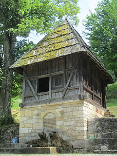
Rimavské Janovce is a village and municipality in the Rimavská Sobota District of the Banská Bystrica Region of southern Slovakia.
Dogonkiria is a village and rural commune in Niger.
Dungass is a village and rural commune in Niger.

Gornja Dobrinja is a village in the municipality of Požega, western Serbia. According to the 2002 census, the village has a population of 505 people.

Gorobilje is a village in the municipality of Požega, western Serbia. According to the 2002 census, the village has a population of 1506 people.There is a Serbian Orthodox Church of Saint John the Baptist in the village square.

Prijanovići is a village in the municipality of Požega, western Serbia. According to the 2002 census, the village has a population of 446 people.

Srednja Dobrinja is a village in the municipality of Požega, western Serbia. According to the 2002 census, the village has a population of 481 people.

Tabanovići is a village in the municipality of Požega, western Serbia. According to the 2002 census, the village has a population of 137 people.

Bagačiće is a village in the municipality of Sjenica, Serbia. According to the 2002 census, the village has a population of 85 people.

Boguti is a village in the municipality of Sjenica, Serbia. According to the 2002 census, the village has a population of 72 people.

Kanjevina is a village in the municipality of Sjenica, Serbia. According to the 2002 census, the village has a population of 65 people.

Vrsjenice is a village in the municipality of Sjenica, Serbia. According to the 2002 census, the village has a population of 200 people.

Baljen is a village in the municipality of Tutin, Serbia. According to the 2002 census, the village has a population of 72 people.

Devreč is a village in the municipality of Tutin, Serbia. According to the 2002 census, the village has a population of 106 people.

Izrok is a village in the municipality of Tutin, Serbia. According to the 2002 census, the village had a population of 107.

Piskopovce is a village in the municipality of Tutin, Serbia. According to the 2002 census, the village has a population of 162 people.

Ruđa is a village in the municipality of Tutin, Serbia. According to the 2002 census, the village has a population of 103 people.

Žirče is a village in the municipality of Tutin, Serbia. According to the 2002 census, the village has a population of 370 people.

Brvenik is a village in the municipality of Raška, Serbia. According to the 2002 census, the village has a population of 67 people.

Žutice is a village in the municipality of Raška, Serbia. According to the 2002 census, the village has a population of 224 people.


