Nanny Goat Hill

Last updated
Nanny Goat Hill
Perkins Street, Ottawa.jpg
Dominican University College atop the escarpment, overlooking Perkins Street.
Highest point
Elevation 81 m (266 ft) [1]
Coordinates 45°24′40″N75°42′30″W / 45.41111°N 75.70833°W / 45.41111; -75.70833
Geography
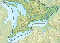
Canada Southern Ontario relief location map.jpg
Red triangle with thick white border.svg
Nanny Goat Hill
CountryCanada
Province Ontario
City Ottawa

Nanny Goat Hill [2] is a hill located on the west side of Downtown Ottawa, Ontario, Canada.

The hill is characterized by an escarpment that forms the north-western side of the hill, overlooking LeBreton Flats. The escarpment runs roughly from the corner of Booth and Spruce Streets in the west to the corner of Bronson Avenue and Slater Street in the north. The highest point on the hill is 81m above sea level, at the corner of Primrose Avenue and Arthur Street, [1] close to Dominican University College which overlooks the escarpment. Much of Ottawa's Chinatown is located on the south side of the hill. Its business association's former name, "Somerset Heights" was an allusion to the hill.

The name "Nanny Goat" is said to have begun to be applied as a nickname for the hill in the 19th century, as its escarpment was so steep that only nanny goats could climb it. [3] [4] Another origin story cites that it was named after goats that pastured there. [5]

The hill's steep limestone escarpment has been cited as a reason why Downtown Ottawa was spared from the 1900 Hull–Ottawa fire, which damaged more of the city to its west. [6]
Related Research Articles

<span class="mw-page-title-main">Parliament Hill</span> Home of the Canadian Parliament in Ottawa

Parliament Hill, colloquially known as The Hill, is an area of Crown land on the southern banks of the Ottawa River in downtown Ottawa, Ontario, Canada. Its Gothic revival suite of buildings, and their architectural elements of national symbolic importance, is the home of the Parliament of Canada. Parliament Hill attracts approximately three million visitors each year. Law enforcement on Parliament Hill and in the parliamentary precinct is the responsibility of the Parliamentary Protective Service (PPS).

<span class="mw-page-title-main">Yonge Street</span> Historic road in Ontario, Canada

Yonge Street is a major arterial route in the Canadian province of Ontario connecting the shores of Lake Ontario in Toronto to Lake Simcoe, a gateway to the Upper Great Lakes.

<span class="mw-page-title-main">Sandy Hill, Ottawa</span> Neighbourhood in Ottawa, Ontario, Canada

Sandy Hill is a neighbourhood in Ottawa, Ontario, located just east of downtown. The neighbourhood is bordered on the west by the Rideau Canal, and on the east by the Rideau River. To the north it stretches to Rideau Street and the Byward Market area while to the south it is bordered by the Queensway highway and Nicholas Street. The area is named for its hilliness, caused by the river, and its sandy soil, which makes it difficult to erect large buildings. It is home to a number of embassies, residences and parks. Le cordon bleu operates its Canadian school there, at the opposite end of Sandy Hill from the University of Ottawa.

<span class="mw-page-title-main">The Glebe</span> Neighbourhood in Ottawa, Ontario, Canada

The Glebe is a neighbourhood in Ottawa, Ontario, Canada. It is located just south of Downtown Ottawa in the Capital Ward. As of 2016, the neighbourhood had a population of 13,055.

<span class="mw-page-title-main">Bank Street (Ottawa)</span> Street in Ottawa, Ontario, Canada

Bank Street is the major commercial north-south street in Ottawa, Ontario, Canada. It runs south from Wellington Street in downtown Ottawa, south through the neighbourhoods of Centretown, The Glebe, Old Ottawa South, Alta Vista, Hunt Club, and then through the villages of Blossom Park, Leitrim, South Gloucester, Greely, Metcalfe, Spring Hill, and Vernon before exiting the city limits at Belmeade Road.

<span class="mw-page-title-main">Laurier Avenue</span>

Laurier Avenue(French: Avenue Laurier) is a central east west street running through Ottawa, Ontario, Canada. Originally known as "Maria Street" and "Theodore Street", it was renamed in honour of Canadian Prime Minister Sir Wilfrid Laurier. Laurier House, the residence of Prime Ministers Laurier and William Lyon Mackenzie King, is located at the corner of Laurier Avenue East and Chapel Street.

<span class="mw-page-title-main">Wellington Street (Ottawa)</span> Major street in Ottawa, Canada

Wellington Street is a major street in Ottawa, Ottawa, Canada. The street is notable for being the main street of the Parliamentary Precinct of the Parliament of Canada. It is one of the first two streets laid out in Bytown in 1826. The street runs from Vimy Place, just west of Booth Street, to the Rideau Canal where it connects with Rideau Street and delimits the northern border of the downtown core. It is named after the Duke of Wellington, in recognition of his role in the creation of the Rideau Canal, and therefore of Ottawa.

<span class="mw-page-title-main">Ottawa Bluesfest</span>

Ottawa Bluesfest is an annual outdoor music festival that takes place each July in downtown Ottawa, Ontario, Canada. While the festival's lineup historically focused on blues music at its inception, it has increasingly showcased mainstream pop, hip hop, reggae, and rock acts in recent years. Bluesfest has become the largest music festival in Canada and the second largest blues festival in North America.

<span class="mw-page-title-main">Spadina Avenue</span> Thoroughfare in Toronto, Ontario

Spadina Avenue is one of the most prominent streets in Toronto, Ontario, Canada. Running through the western section of downtown, the road has a very different character in different neighbourhoods.

<span class="mw-page-title-main">Lincoln M. Alexander Parkway</span> Municipal freeway in Hamilton, Ontario

The Lincoln Alexander Parkway, nicknamed The Linc, is a municipal expressway in the city of Hamilton, Ontario, Canada, which connects Highway 403 with the Red Hill Valley Parkway, which continues north to the Queen Elizabeth Way (QEW). Collectively, the two expressways form a southern and eastern bypass of Hamilton. Located on the Hamilton mountain, atop the Niagara Escarpment, the freeway was named after the former Progressive Conservative MP and first black Lieutenant Governor of Ontario, Lincoln Alexander in July 1997, despite him never holding a driver's license.

<span class="mw-page-title-main">Centretown West</span> Neighbourhood in Ottawa, Ontario, Canada

Centretown West is a neighbourhood in Ottawa, Ontario, Canada. It lies to the west of Bronson Avenue, east of the O-Train Trillium Line, north of Carling Avenue, and south of Nanny Goat Hill, which is an escarpment to the north of Somerset Street West. To the east lies Centretown, to the north lies Lebreton Flats, to the west lies Hintonburg, and to the south lies Dow's Lake. Much of the neighbourhood makes up what is also called Dalhousie.

<span class="mw-page-title-main">LeBreton Flats</span> Neighbourhood in Ottawa, Ontario, Canada

LeBreton Flats known colloquially as The Flats is a neighbourhood in Somerset Ward in central Ottawa, Ontario, Canada. It lies to the west of Centretown neighbourhood, and to the north of Centretown West. The Ottawa River forms the western and northern limit, with the western side being a wider area of the river known as Nepean Bay.

<span class="mw-page-title-main">Sir John A. Macdonald Parkway</span>

The Sir John A. Macdonald Parkway, formerly the Ottawa River Parkway, is a four-lane scenic parkway along the Ottawa River in Ottawa, Ontario, Canada. It runs from Carling Avenue near Connaught Avenue, to Booth Street at the Canadian War Museum and National Holocaust Monument. It is maintained by the National Capital Commission. The speed limit is 60 km/h (37 mph). Bicycles are allowed on the road and on a parallel recreational path along the parkway.

<span class="mw-page-title-main">Confederation Park</span> Historic site in Ontario, Canada

Confederation Park(French: Parc de la Confédération) is a public park and National Historic Site of Canada, located in the downtown core of Ottawa, Ontario, Canada. It is bordered on the south by Laurier Avenue and Ottawa City Hall; on the east by the Rideau Canal and National Defence Headquarters; on the north by the Mackenzie King Bridge, the Rideau Centre and the National Arts Centre; and to the west by Elgin Street and the Lord Elgin Hotel.

<span class="mw-page-title-main">Wellington Street West</span>

Wellington Street West is a 2.3 km road and shopping area west of downtown Ottawa, Ontario. This road was once connected to - and is often confused with - the prominent Wellington Street in downtown Ottawa. But the two Wellingtons were severed in the 1960s with the expropriation of LeBreton Flats and the demolition of the viaduct that connected them over the Canadian Pacific Railway tracks.

<span class="mw-page-title-main">Brockville and Ottawa Railway</span>

The Brockville and Ottawa Railway (B&O) was an early railway in Upper Canada, today's Ontario. It ran north from the town of Brockville on the Saint Lawrence River to Sand Point on the Ottawa River. It was built primarily to serve the timber trade on the Ottawa Valley, shortcutting routes that led into the city of Ottawa, further downstream. The first railway tunnel in Canada, the Brockville Tunnel, was dug in order to allow the B&O to reach the port lands on the south side of the city, which sits on a bluff.

<span class="mw-page-title-main">Pimisi station</span> Ottawa O-Train light rail station

Pimisi is a light rail station on the Ottawa Confederation Line as part of the O-Train network.

The OPL and LAC Joint Facility is an ongoing project whose goal is to bring together the extensive collections of the Ottawa Public Library and Library and Archives Canada into one centre. It includes a series of community and creative spaces that aim to appeal to all residents and visitors of Ottawa.

References

  1. 1 2 "Ontario Base Survey".
  2. "Nanny Goat Hill". Geographical Names Data Base . Natural Resources Canada.
  3. "Would Level Off "Nanny Goat Hill"". Ottawa Journal. February 12, 1920. p. 7. Retrieved 2021-05-16.
  4. "A lost piece of LeBreton Flats: Albert Street West, Nanny Goat Hill and more!". The Kitchissippi Museum. Retrieved 2021-05-16.
  5. "Digging Into Past Era Uncovers Odd Old Names". Ottawa Citizen. July 15, 1958. p. 2. Retrieved 2021-05-16.
  6. "Nanny Goat Hill". Centretown News. Retrieved 2021-05-16.