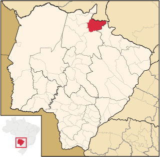
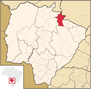
Location
The Nascentes do Rio Taquari State Park is divided between the municipalities of Alcinópolis (82.7%) and Costa Rica (17.3%) in Mato Grosso do Sul. It has an area of 30,619 hectares (75,660 acres). The buffer zone covers 89,744.73 hectares (221,764.1 acres). The park contains parts of the Paraguay and Paraná river basins, and is near the watershed of the Araguaia River. It is between the chapadão and the pré-pantanal regions on the border between Mato Grosso do Sul, Mato Grosso and Goiás, and protects the sources of the Taquari River, considered the most degraded river in the pantanal basin of Mato Grosso do Sul.
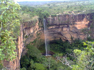
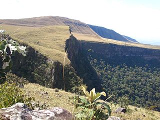
The park contains six large canyons formed over millions of years in the Chapadão de Baús on the western edge of the Brazilian central plateau. The park has archaeological sites that date back 11,000 years, with traces in caves of ancient rock paintings and petroglyphs. The park has great scenic beauty, and high potential for ecotourism, environmental education and research. The management plan, published in June 2009, defined zones of usage for the park. About 50% is defined as having minimal human intervention, with restricted visitation.
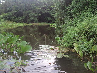
The Nascentes do Rio Taquari State Park is in the Pantanal Biosphere Reserve, which also includes the Pantanal, Chapada dos Guimarães, Emas and Serra da Bodoquena national parks, and the Serra de Santa Bárbara and Pantanal de Rio Negro state parks. It protects an important ecological corridor between the cerrado and the pantanal. Vegetation is in the cerrado biome, and includes seasonal forests and cerradão. Conflicting activities include plowing with intensive use of agrochemicals, mining, roads, transmission lines and homes in the park.
History
The Nascentes do Rio Taquari State Park was created by state decree 9.662 of 9 October 1999 with the objective of preserving the ecosystems, flora and fauna of the area, maintaining the watershed, cultural heritage and landscape, and supporting recreation and tourism in contact with nature. Implementation of the park was made as a compensatory measure by the railway company Ferrovia Norte-Brasil (FERRONORTE) for engaging in work that had an environmental impact in the state. Decree 9.663 of 9 October 1999 provided for expropriation of privately owned lands in the state park, with the expense of compensation to be born by FERRONORTE.
Before the park was created all the land was privately owned. The process of acquiring the properties did not begin until 2007, with indemnification starting in March 2008. As of 2010 only 10% of the area of the park had been formally acquired by the state. The landowners were continuing activities such as cattle raising while negotiations over land value continued.

Mato Grosso is one of the states of Brazil, the third largest by area, located in the Central-West region. The state has 1.66% of the Brazilian population and is responsible for 1.9% of the Brazilian GDP.
The Chapada dos Guimarães National Park is a national park in the state of Mato Grosso, Brazil. It is a region of rugged terrain with dramatic cliffs and waterfalls, and contains the geographical centre of the continent.

The Emas National Park is a national park and a UNESCO World Heritage Site in the states of Goiás and Mato Grosso do Sul in Brazil.
Alcinópolis is a municipality located in the Brazilian state of Mato Grosso do Sul. Its population was 5,417 (2020) and its area is 4,400 km².
Costa Rica is a municipality located in the Brazilian state of Mato Grosso do Sul. Its population was 21,142 (2020) and its area is 5,723 km².
The Pantanal Matogrossense National Park is a national park in the state of Mato Grosso at the border to Mato Grosso do Sul, Brazil.

Serra da Bodoquena National Park is a national park in the state of Mato Grosso do Sul, Brazil.
The Cuiabá River is a Brazilian river in the western state of Mato Grosso that flows in the Río de la Plata Basin. It is a tributary of the São Lourenço River.

The Taquari River is a river in the states of Mato Grosso and Mato Grosso do Sul in Brazil. It is a left tributary of the Paraguay River. The town of Coxim is situated on the Taquari.
Águas do Cuiabá Ecological Station, formerly the Águas do Cuiabá State Park, is an ecological station in the state of Mato Grosso, Brazil, a fully protected conservation unit in the cerrado biome. There was controversy about the acquisition of land to expand the unit's area when it was made an ecological station.
The Águas Quentes State Park is a state park in the state of Mato Grosso, Brazil
The Massairo Okamura State Park is a state park in the city of Cuiabá, capital of Mato Grosso, Brazil. It preserves an area of typical cerrado forest in a densely urbanised area.
The Encontro das Águas State Park is a state park in the state of Mato Grosso, Brazil. It covers an area of the pantanal rich in watercourses.

The Piquirí River is a river of Mato Grosso state in western Brazil. It is a tributary of the São Lourenço River.
The Serra de Santa Bárbara State Park is a state park in the state of Mato Grosso, Brazil. It preserves a unique environment where the Amazon rainforest, pantanal and cerrado meet, and holds many endemic or endangered species.

The Cristalino State Park is a state park in the state of Mato Grosso, Brazil.
The Serra Ricardo Franco State Park is a state park in the state of Mato Grosso, Brazil. It protects the edge of a plateau on the border with Bolivia in the region of transition from cerrado to Amazon rainforest. The park has been poorly protected and is badly degraded in areas by deforestation and conversion to pasturage. It is threatened by illegal squatters, hunting and burning.
The Guirá State Park is a State park in the state of Mato Grosso, Brazil.

The Serra Azul State Park is a state park in the state of Mato Grosso, Brazil. It protects a mountainous area of cerrado forest and contains slopes that are used for paragliding. The park contains the geodetic center of Brazil.
The Dom Osório Stoffel State Park is a state park in the state of Mato Grosso, Brazil. It protects an area of the cerrado biome.
This page is based on this
Wikipedia article Text is available under the
CC BY-SA 4.0 license; additional terms may apply.
Images, videos and audio are available under their respective licenses.
