Related Research Articles

Robertson County is a county in the U.S. state of Texas. As of the 2020 census, its population was 16,757. Its county seat is Franklin. The county was created in 1837 and organized the following year. It is named for Sterling C. Robertson, an early settler who signed the Texas Declaration of Independence.

Milam County is a county located in the U.S. state of Texas. As of the 2020 census, its population was 24,754. The county seat is Cameron. The county was created in 1834 as a municipality in Mexico and organized as a county in 1837. Milam County is named for Benjamin Rush Milam, an early settler and a soldier in the Texas Revolution.
Limestone County is a county in the U.S. state of Texas. As of the 2020 census, its population was 22,146. Its county seat is Groesbeck. The county was created in 1846.

Falls County is a county in the U.S. state of Texas. As of the 2020 census, its population was 16,968. The county seat is Marlin. It is named for the original 10-foot-tall waterfall on the Brazos River, which existed until the river changed course during a storm in 1866. The present falls is two miles northeast of the original falls, at the Falls on the Brazos Park, a camping site only a few miles out of Marlin on Farm to Market Road 712.

Burleson County is a county located in the U.S. state of Texas. As of the 2020 census, the population was 17,642. Its county seat is Caldwell. The county is named for Edward Burleson, a general and statesman of the Texas Revolution.

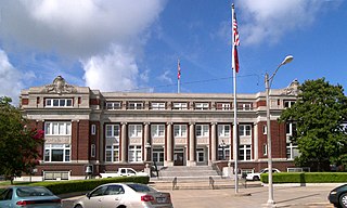
Cameron is a city in Milam County, Texas, United States. Its population was 5,306 at the 2020 census. It is the county seat of Milam County.

Washington-on-the-Brazos is an unincorporated community along the Brazos River in Washington County, Texas, United States. The town is best known for being the site of the Convention of 1836 and the signing of the Texas Declaration of Independence.

George Campbell Childress was a lawyer, politician, and a principal author of the Texas Declaration of Independence.

Area code 979 is a telephone area code in the North American Numbering Plan (NANP) for the U.S. state of Texas. The numbering plan area comprises the region generally following the Brazos River found between the Austin and Houston metro areas and its surrounding communities, stretching from just south of Waco to the Gulf Coast. It was created on February 13, 2000, in a split from area code 409.
The Little River is a river in Central Texas in the Brazos River watershed. It is formed by the confluence of the Leon River and the Lampasas River near Little River, Texas in Bell County. It flows generally southeast for 75 miles (121 km) until it empties into the Brazos River about 5 miles (8.0 km) southwest of Hearne, at a site called Port Sullivan in Milam County. The Little River has a third tributary, the San Gabriel River, which joins the Little about 8 miles (13 km) north of Rockdale and five miles southwest of Cameron. Cameron, the county seat of Milam County and the only city of any significant size on the Little River, was established in 1846.
Fort Bend was a blockhouse built in a large bend of the Brazos River in what is now Fort Bend County, Texas, to provide protection against Indian raids. It was erected in November 1822 by several members of Stephen F. Austin's Old Three Hundred, including William W. Little, Joseph Polley, William Smithers [Smeathers], Charles Beard, Henry Holster and is described as a "little log shanty". The location was reportedly selected by Austin, and a settlement soon grew up around the post. As the site provided one of the more favorable fords of the Brazos River, it became important during the Texas Revolution. The Fort Bend crossing was briefly defended in April 1836 by a rear guard detachment led by Wiley Martin. Where Mexican pickets forced the company of 46 men to retreat across the Ford after a short skirmish. After Martin was maneuvered out of the position, Gen. Antonio López de Santa Anna transported a portion of his Mexican army across the Brazos at the crossing. After Santa Anna's defeat at the battle of San Jacinto the site was used briefly by the Texas army. Troops under Thomas Jefferson Green, who were in pursuit of retreating Mexican forces led by Gen. Vicente Filisola, halted for a short time in mid-May 1836 at Fort Bend. Because Fort Bend had been the center of activity in the area its name was given to the county when it was established in 1837. The next year nearby Richmond, Texas was selected as the county seat and soon absorbed the smaller Fort Bend settlement. In 1936 the Texas Centennial Commission erected a monument to commemorate Fort Bend's role in the Texas Revolution.

Gause is an unincorporated community and census-designated place in Milam County, Texas, United States. According to the Handbook of Texas, the community had an estimated population of 400 in 2000. It was first listed as a CDP in the 2020 census with a population of 275.
Gause Independent School District is a public school district based in the community of Gause, Texas (USA).

The Star of the Republic Museum, in Washington, Texas, United States, is the only museum in the state of Texas created specifically to collect and interpret the culture and history of the Republic of Texas from 1836 to 1846. Within the museum's two floors of exhibits, visitors can learn about the history of the time period through media experiences, as well as informative exhibits. The site of the Star of the Republic Museum was selected at Washington on the Brazos where elected delegates gathered on March 2, 1836, to declare Texas’ independence from Mexico.
Neil McLennan was an early Scottish-American settler of Texas. McLennan County, Texas, was named for him.
Wheelock is an unincorporated community in Robertson County, Texas, United States. It is located 15 miles northeast of Bryan and 11 miles southeast of Franklin. Wheelock is located on Farm to Market Road 46 and Farm to Market Road 391. It is part of the Bryan–College Station Metropolitan Statistical Area.
Valley Junction is a small unincorporated community in Robertson County, Texas, United States. It is located near what was formerly Robertson's Colony, the colony founded by Sterling C. Robertson when he moved from Nashville, Tennessee.
Daniel James Kubiak was an educator and businessman from Rockdale, Texas, who served as a Democratic member of the Texas House of Representatives from 1969 to 1983 and again from 1991 until his death in 1998. During his tenure in the House, he represented three different districts in Central Texas and was particularly known for his support of public education.

Robertson's Colony was an empresario colonization effort during the Mexican Texas period. It is named after Sterling C. Robertson, but had previously been known by other names. It has also been referred to as the Nashville Colony, after the Tennessee city where the effort originated, the Texas Association, the Upper Colony, and Leftwich's Grant, named after early colonizer Robert Leftwich. The eventual contract spread over an area that includes all or part of thirty present-day counties in Texas.
Sarahville de Viesca or Fort Milam or Bucksnort is a ghost town in Falls County, Texas, United States. The settlement was established in 1834 by Sterling C. Robertson and named for his mother Mrs. Sarah Robertson and Agustín Viesca, the Mexican governor of Coahuila y Tejas. The site was located at the falls of the Brazos River, where the river formerly dropped 10 feet (3 m) and where a well-used ford was located. The town was temporarily deserted in 1836 during the Runaway Scrape and permanently abandoned soon afterward because of native American raids. Fort Milam was built on the west-bank site but abandoned a few years later in favor of the town of Bucksnort, which occupied the east bank. Bucksnort vanished when the nearby town of Marlin was founded. There is a county park and historical marker located where Farm to Market Road 712 crosses the Brazos, south of Marlin.
References
- 1 2 "Nashville-on-the-Brazos, Texas". The Handbook of Texas online. Retrieved 2009-05-29.
- 1 2 "Site of the Town of Nashville and DAR Centennial Park". Milam County Historical Commission. Retrieved 2009-05-29.
- ↑ "History of Gause and Nashville-on-the-Brazos". Leonard Kubiak's Online Texas History Webpages. Leonard Kubiak. Retrieved 2009-06-06.
- 1 2 "Nashville, Texas". Texas Escapes Online Magazine. Retrieved 2009-05-29.
