Kulgam, known as Kolgom in Kashmiri, is a town, an administrative division and capital of the Kulgam district in the Indian union territory of Jammu and Kashmir. It is located at a distance of 67 km (42 mi) from the summer state capital of Jammu and Kashmir, Srinagar. The city is divided into 16 electoral wards that has a population of 23,584, of which 12,605 are males while 10,979 are females.
Nasirabad is a cantonment town in Ajmer district in the Indian state of Rajasthan.

Kulgam district is an administrative district of Indian-administered Jammu and Kashmir in the disputed Kashmir region. It is in the Kashmir division and is located at a distance of 18 kilometres (11 mi) towards south-west of Anantnag. The district comprises block, tehsil and town of Kulgam.
Qaimoh is a block, a town and a notified area committee in Kulgam District in the union territory of Jammu and Kashmir, India. It is four miles to the west of Anantnag and six miles to the north of Kulgam District. It is 55 km to the south of Srinagar city. Qaimoh is one of the largest blocks in Jammu and Kashmir.

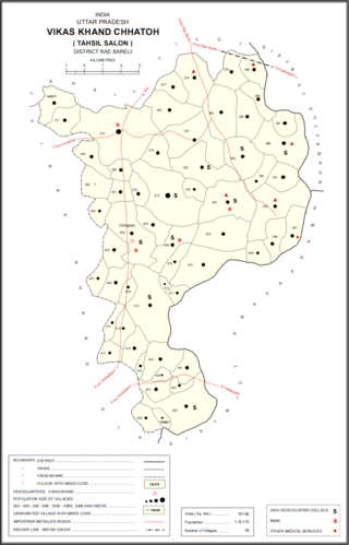
Nasirabad is a Nagar panchayat and a Gram Sabha in Chhatoh Block, Raebareli district in the state of Uttar Pradesh, India. It was declared a Nagar Panchayat in 2017. Located southeast of Jais on the road to Salon, Nasirabad is an old town partly built on an elevated area that covers the ruins of an ancient fort. It is one of the main Muslim centres in the district. Muslims make up about half the town's population, and the Shia and Sunni communities are both prominent. As of 2011, Nasirabad's population is 13,648, in 2,243 households. It is located 37 km from Raebareli the district headquarters. It is the headquarters of a nyaya panchayat that also includes 6 other villages.
Nasirabad is a village in Kakasharaf Rural District, in the Central District of Khorramabad County, Lorestan Province, Iran. At the 2006 census, its population was 14, in 4 families.
Nasirabad is a village in Khandan Rural District, Tarom Sofla District, Qazvin County, Qazvin Province, Iran. At the 2006 census, its population was 19, in 10 families.
Nasirabad is a village in Binalud Rural District, in the Central District of Nishapur County, Razavi Khorasan Province, Iran. At the 2006 census, its population was 195, in 49 families.
Nasirabad is a village in Shurab-e Tangazi Rural District, in the Central District of Kuhrang County, Chaharmahal and Bakhtiari Province, Iran. At the 2006 census, its population was 28, in 6 families. The village is populated by Lurs.
Nasirabad is a village in Qanibeyglu Rural District, Zanjanrud District, Zanjan County, Zanjan Province, Iran. At the 2006 census, its population was 698, in 164 families.
Nasirabad is a village in Miyan Deh Rural District of Shibkaveh District, Fasa County, Fars province, Iran.
Tazeh Kand-e Nasirabad is a village in Dikleh Rural District, Hurand District, Ahar County, East Azerbaijan Province, Iran. At the 2006 census, its population was 49, in 13 families.
Nasirabad-e Olya is a village in Charuymaq-e Shomalesharqi Rural District, in the Central District of Hashtrud County, East Azerbaijan Province, Iran. At the 2006 census, its population was 184, in 30 families.
Nasirabad-e Sofla is a village in, and the capital of, Charuymaq-e Shomalesharqi Rural District of the Central District of Hashtrud County, East Azerbaijan province, Iran.
Nasirabad is a village in Dul Rural District, in the Central District of Urmia County, West Azerbaijan Province, Iran. At the 2006 census, its population was 416, in 76 families.
Nasirabad is a village in Rudpey-ye Shomali Rural District, in the Central District of Sari County, Mazandaran Province, Iran. At the 2006 census, its population was 100 in 24 families.
Nasirabad is a village in Forg Rural District, Forg District, Darab County, Fars Province, Iran. At the 2006 census, its population was 836, in 181 families.
Nasirabad is a village in, and the capital of, Rostaq Rural District of the Central District of Neyriz County, Fars province, Iran.
Frisal is a tehsil and CD block in the district of Kulgam, Jammu and Kashmir, India. It is 14kms far from District Headquarter Kulgam and 6 kms away from NH44 Bijbehara, situated on Bijbehara, Arwani-Frisal-Kulgam road. Its boundaries connect three districts of South Kashmir. Frisal is 2nd largest town as per population in district Kulgam. The main source of income of this tehsil is agriculture, horticulture, business, and government jobs. There are many springs in town Frisal and is known as town of springs in district Kulgam. Frisal town is economically average and educationally well. Presently there are offices like Tehsil office, Block office, JK Bank, Punjab National Bank, social welfare office, Model Hospital, Govt. Degree college, one higher secondary, 5 high schools and several lower educational institutions.

Mau is a large village in Dih block of Rae Bareli district, Uttar Pradesh, India. It is located on the road from Fursatganj to the Gukana ghat on the Ganges, 4 miles west of Nasirabad and 8 miles from Jais. A road branches off at Mau and connects to Nasirabad. To the northwest of the village is a large lake called the Bara Tal.


