
Thottiyam is a panchayat town in Tiruchirappalli district in the Indian state of Tamil Nadu. Thamilselvi Thirugnanam is the current President of Thottiyam. It is situated 60 km north-west of Tiruchirapalli on Tiruchy-Namakkal State Highway (SH-25) and further it connects Namakkal-Salem-Bangalore National Highway. It is located near the Kaveri River, about 12 km north-west of Musiri. Koranganatha Temple located in the outskirts of the town is a historic temple built during the Chola period in the 10th century.

Rayavaram is a village Panchayat in Pudukkottai district in Tamil Nadu, India.
Alangudi is a municipality in the Pudukkottai district of the Indian state of Tamil Nadu, that serves as the headquarters for Alangudi taluk, one of the 11 taluks in Pudukkottai district. The town has been ruled, at different times, by the Cholas, Mutharaiyars, Early Pandyas, Thondaimans, and the British. It is situated about 395 kilometres (245 mi) southwest of Chennai and about 75 kilometres (47 mi) southeast of Tiruchirappalli. Tamil Nadu's first women Asiad Santhi Soundarajan is from Alangudi municipality.
Balakrishnampatti is a panchayat town in Tiruchirappalli District in the state of Tamil Nadu, India.
Elumalai is a Panchayat town in the district of Madurai, in the Indian state of Tamil Nadu. Originally named Aezhumalai, the town is located near Usilampatti (18 km), Madurai (58 km), Theni (56 km), Peraiyur (24 km) and Tirumangalam (40 km) in the Western ghats.
Kallakudi is a panchayat town in Tiruchirappalli district in the Indian state of Tamil Nadu.
Koothappar is a panchayat town in Tiruchirappalli district in the Indian state of Tamil Nadu. It is located 16 km from Tiruchirappalli.
Krishnasamudram is a census town in Tiruchirappalli district in the Indian state of Tamil Nadu.
Manachanallur is a Town in Tiruchirappalli district in the Indian state of Tamil Nadu. Manachanallur is famous for an ancient temple, Sri Boominathar Temple of Lord Shiva.
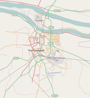
Musiri is a municipality in the Tiruchirappalli district in the Indian state of Tamil Nadu. It has an average elevation of 82 metres (269 feet).
Palaganangudy is a panchayat town in Tiruchirappalli district in the Indian state of Tamil Nadu.
Pappakurichi is a census town in Tiruchirappalli district in the Indian state of Tamil Nadu. It was merged with the Tiruchirappalli Corporation in 2011.
Ponnampatti is a panchayat town in Tiruchirappalli district in the Indian state of Tamil Nadu.
Poovalur is a panchayat town in Tiruchirappalli district in the Indian state of Tamil Nadu. Poovalur is just 3 km from its taluk headquarters Lalgudi. It lies on the Tiruchirappalli–Chidambaram national highway NH 227. Generally the livelihood of this town's people is agriculture. Banana, paddy, and sugarcane are the notable crops grown in this area.
South Kannanur is a panchayat town in Tiruchirappalli district in the Indian state of Tamil Nadu.
Sirugamani is a panchayat town in Tiruchirappalli district in the Indian state of Tamil Nadu. It's situated on the banks of river cauvery, just a few miles away from Trichy on the way towards Karur. To be specific, it is in between Perugamani and Kaavalkara Palayam near Pettavaaithalai.
Thathaiyangarpet is a panchayat town in Tiruchirappalli district in the Indian state of Tamil Nadu.
Thiruverumbur is a neighbourhood in the city of Tiruchirapalli in the Indian state of Tamil Nadu. It was merged with the Tiruchirappalli Corporation in 2011.
Uppiliapuram is a panchayat town in Tiruchirappalli district in the Indian state of Tamil Nadu.

Kerur is a City in Bagalkot district in Karnataka, which located on NH 218. It has an average elevation of 617 meters (2024 feet). It's a birthplace of Jagadish Shettar, a former Chief Minister of Karnataka. Kerur is a Town Panchayat city in district of Bagalkot, Karnataka. The Kerur city is divided into 16 wards for which elections are held every five years. The Kerur Town Panchayat has population of 19,731 of which 9,929 are males while 9,802 are females as per report released by Census India 2011.
