Nebraska Highway 31 is a highway in Nebraska. The southern terminus is near Louisville at an intersection with Nebraska Highway 50. The northern terminus is near Kennard at an intersection with U.S. Highway 30. The highway serves as a main north–south highway in the western portion of the Omaha Metro Area.

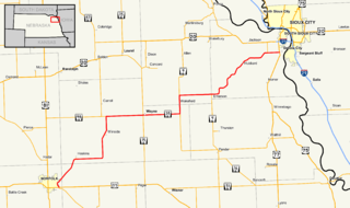
Nebraska Highway 13 is a highway in the northeastern part of the U.S. state of Nebraska that runs predominantly northwest-southeast with a south terminus east of Hadar at an intersection with U.S. Highway 81 and a north terminus two miles (3 km) south of Center, Nebraska at an intersection with Nebraska Highway 84.

Nebraska Highway 133 is a highway in eastern Nebraska. Its southern terminus is at an intersection with U.S. Highway 6 in Omaha. Its northern terminus is at an intersection with U.S. Highway 30 in Blair.

Nebraska Highway 9 is a highway in northeastern Nebraska. The southern terminus is located just north of West Point at an intersection with U.S. Highway 275. Its northern terminus is at an intersection with Nebraska Highway 12 just south of Ponca.

Nebraska Highway 109 is a highway in eastern Nebraska. Its southern terminus is at U.S. Highway 77 and Nebraska Highway 92 at Wahoo, Nebraska. Its northern terminus is at U.S. Highway 77 near Fremont, Nebraska.

Nebraska Highway 12 is a highway in northern and northeastern Nebraska. It has a western terminus at U.S. Highway 83 in Valentine and an eastern terminus at U.S. Highway 20 west of Jackson. The highway largely lies within 10 miles (16 km) of the South Dakota border its entire length. The highway has been designated the Outlaw Trail Scenic Byway.

Nebraska Highway 99 is a highway in southeastern Nebraska. It has a southern terminus at the Kansas border south of Burchard and just north of Summerfield, Kansas. Its northern terminus is north of Burchard at an intersection with Nebraska Highway 4. It lies entirely in Pawnee County. It is a part of a three-state "Highway 99" which includes K-99 in Kansas and Oklahoma State Highway 99.

Nebraska Highway 128 (N-128) is a highway in southeastern Nebraska. It has a western terminus at Nebraska Highway 50 south of Syracuse and an eastern terminus at U.S. Highway 75 south of Nebraska City.

Nebraska Highway 27 is a highway in Nebraska. It is divided into three segments. The southernmost segment begins at the Kansas border and goes north to Haigler. The middle segment begins at Interstate 80 near Chappell and goes north to Oshkosh. The northernmost segment begins at Ellsworth and goes north to the South Dakota border.

Nebraska Highway 39 is a highway in central Nebraska. It runs for a length of 42.05 miles (67.67 km). It has a southern terminus west of Osceola at an intersection with Nebraska Highway 92. Its northern terminus is at an intersection with Nebraska Highway 14 southeast of Albion.

Nebraska Highway 61 is a highway in western Nebraska. It is a north–south highway with a length of 234.82 miles (377.91 km). The southern terminus of Nebraska Highway 61 is at the Kansas border south of Benkelman, where the highway continues south as K-161. The northern terminus is at the South Dakota border north of Merriman, where the highway continues north as South Dakota Highway 73.

Nebraska Highway 87 is a highway in northwestern Nebraska. It has a southern terminus at Nebraska Highway 2 in Alliance. Its northern terminus is at the South Dakota border where it continues in northward as South Dakota Highway 407.
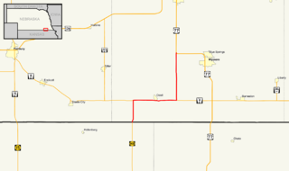
Nebraska Highway 112 is a highway in southeastern Nebraska. Its western terminus is at the Kansas border where it continues as K-148 southwest of Odell. Its eastern terminus is at U.S. Highway 77 west of Blue Springs.

Nebraska Highway 95 is a highway in northeastern Nebraska. It has a western terminus at an intersection with Nebraska Highway 11 west of Chambers. Its eastern terminus is at U.S. Highway 281 to the east of Chambers.
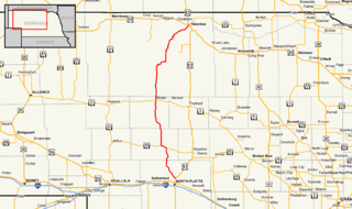
Nebraska Highway 97 is a highway in western Nebraska. It has a southern terminus north of North Platte at an intersection with U.S. Highway 83. The northern terminus is at U.S. Highway 20 in Valentine.
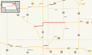
Nebraska Highway 98 is a highway in the northeastern part of the U.S. state of Nebraska. Its western terminus is at an intersection with Nebraska Highway 13 in Pierce. Its eastern terminus is at an intersection with Nebraska Highway 35 west of Wayne.
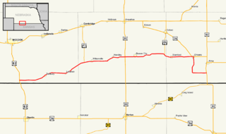
Nebraska Highway 89 is a highway in southern Nebraska. Its western terminus is at U.S. Highway 83 west of Danbury. Its eastern terminus is at an intersection with U.S. Highway 183 south of Alma.

Nebraska Highway 137 is a highway in northern Nebraska. Its southern terminus is at U.S. Highway 20 in Newport. Its northern terminus is at the South Dakota border where it continues as South Dakota Highway 47.
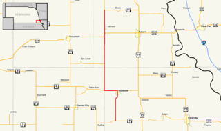
Nebraska Highway 105 is a highway in southeastern Nebraska. Its southern terminus is at an intersection with Nebraska Highway 8 south of Humboldt. Its northern terminus is at an intersection with Nebraska Highway 67 west of Brock.
