Nevada State Route 118

Last updated

Nevada 118.svg

State Route 118

Wildes Road
Nevada 118 map.svg
State Route 118 highlighted in red.
Route information
Maintained by NDOT
Length3.475 mi [1]  (5.592 km)
Existed1976–present
HistorySR 62 by 1948; Became SR 118 in 1976
Major junctions
West endNevada 115.svg SR 115 in Fallon
East endWildes Road north of NAS Fallon
Location
Country United States
State Nevada
Counties Churchill
Highway system
  • Nevada State Highway System
Nevada 117.svg SR 117 Nevada 119.svg SR 119

State Route 118 (SR 118) is a state highway in Churchill County, Nevada. It serves the southeast portion of Fallon near northern edge of Naval Air Station Fallon. Prior to 1976, the route was designated as State Route 62.

Contents

Route description

View from the west end of SR 118 looking eastbound 2015-04-29 14 56 41 View east from the west end of Nevada State Route 118 (Wildes Road) in Churchill County, Nevada.jpg
View from the west end of SR 118 looking eastbound

State Route 118 has its western terminus at the intersection of Harrigan Road and Wildes Road, near the southeastern city limits of Fallon. From there, the route heads east along Wildes Road, through predominantly agricultural areas. The route curves southeastward, and turns east again after its intersection with Pasture Road. At this point, the highway follows the northern perimeter of Naval Air Station Fallon. SR 118 reaches it eastern terminus about 1.4 miles (2.3 km) east of the Pasture Road intersection, although Wildes Road continues eastward to a junction with U.S. Route 50 (US 50). [1] [2]

History

Wildes Road appears on maps dating back to at least 1937. [3] State Route 62 first appeared on state highway maps in 1948, [4] and was defined in state law (as of 1951) as "Beginning...approximately one mile south of Fallon, thence easterly one mile; thence southeasterly approximately two miles." [5] SR 62 was shown following Wildes Road as the current route does today by 1957. [6]

In the mid 1970s, Nevada began renumbering their state highway system. Old SR 62 became State Route 118 on July 1, 1976. [7] The route has remained relatively unchanged since.

At one point, the route may have been part of an alignment of US 50. [1]

Major intersections

The entire route is in Churchill County.

LocationmikmDestinationsNotes
Fallon Nevada 115.svg SR 115 (Harrigan Road)Western terminus
Wildes RoadContinuation beyond eastern terminus
1.000 mi = 1.609 km; 1.000 km = 0.621 mi

See also

Related Research Articles

<span class="mw-page-title-main">U.S. Route 466</span> Former Numbered Highway in the United States

U.S. Route 466 was an east–west United States highway. Though it reached a length of around 500 miles (805 km), the route was co-signed with other US routes for much of its length. When California deleted most of its U.S. Highways in the mid-1960s, including US 466 in 1964, there was no longer a need for the designation.

<span class="mw-page-title-main">Nevada State Route 28</span> State highway in Nevada, United States

State Route 28 (SR 28) is a 16.3-mile (26.2 km) state highway in Douglas County, Carson City, and Washoe County in western Nevada, United States, that runs along the northeastern shore of Lake Tahoe. SR 28 connects U.S. Route 50 (US 50) in Douglas County with California State Route 28 at Crystal Bay. SR 28 has been part of the Nevada scenic byway system since June 1994 and the National Scenic Byway system since September 1996.

<span class="mw-page-title-main">Ohio State Route 7</span> State highway in Ohio, US

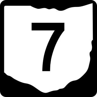
State Route 7 (SR 7), formerly known as Inter-county Highway 7 until 1921 and State Highway 7 in 1922, is a north–south state highway in the southern and eastern portions of the U.S. state of Ohio. At about 336 miles (541 km) in length, it is the longest state route in Ohio. Its southern terminus is an interchange with U.S. Route 52 (US 52) just west of Chesapeake. Its northern terminus also serves as the eastern terminus of SR 531 in Conneaut. The path of SR 7 stays within five miles (8.0 km) of the Ohio River for the southern portion, with the river being visible from much of the route. The road also remains within 10 miles (16 km) of the Pennsylvania state line for the northern portion.

<span class="mw-page-title-main">Nevada State Route 115</span> Highway in Nevada

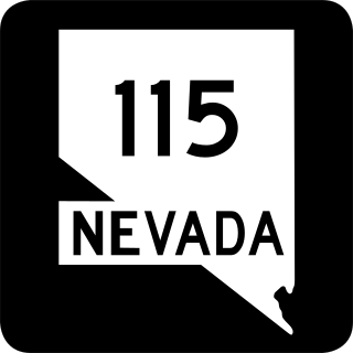
State Route 115 is a state highway outside the city of Fallon, Nevada in the United States. Known as Harrigan Road, SR 115 starts at an intersection with SR 119 and runs north to an intersection with Stillwater Avenue, paralleling U.S. Route 95.

<span class="mw-page-title-main">Nevada State Route 116</span> State highway in Nevada, United States

State Route 116 is a state highway in Churchill County, Nevada, United States. Known as Stillwater Road, it connects the small town of Stillwater to U.S. Route 50 east of Fallon. The road was established by 1940 as SR 42, and was renumbered to SR 116 in 1976.

<span class="mw-page-title-main">Nevada State Route 117</span> State highway in Nevada, United States

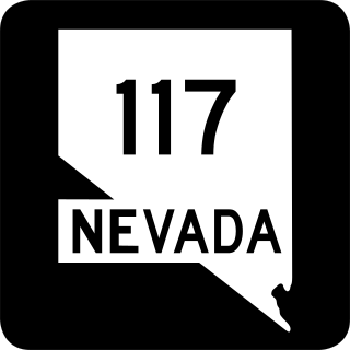
State Route 117 is a state highway in Churchill County, Nevada. The route serves farm areas around the southwest side of the city of Fallon.

<span class="mw-page-title-main">Nevada State Route 120</span> State highway in Nevada, United States

State Route 120 is a state highway in Churchill County, Nevada. It connects U.S. Route 95 to State Route 119 just outside Naval Air Station Fallon.

<span class="mw-page-title-main">Nevada State Route 121</span> Former state highway in Nevada, United States

State Route 121 was a state highway in Churchill County, Nevada. It spurred from U.S. Route 50, east of Fallon, north 27.05 miles (43.53 km) to a local road, Settlement Road in Dixie Valley, with the moniker of Dixie Valley Road. SR 121 was assigned in 1976 and removed from the primary state highway system in 2021, with the entire length of the route being redesignated as Frontage Road FRCH08.

<span class="mw-page-title-main">Nevada State Route 160</span> Highway in Nevada

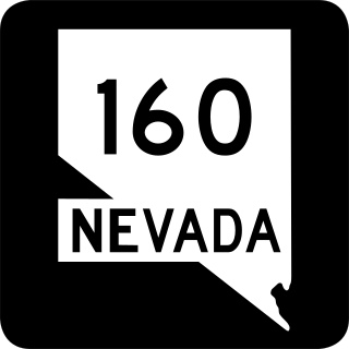
State Route 160 is a state highway in southern Nevada, United States. It connects the southern Las Vegas Valley to U.S. Route 95 northwest of the city via the Pahrump Valley. The southern part of the route sees heavy traffic, mostly due to Pahrump's continued growth as a Las Vegas bedroom community.

<span class="mw-page-title-main">Nevada State Route 231</span> State highway in Nevada, United States

State Route 231 is an unsigned state highway in Elko County, Nevada, United States. Known as Angel Lake Road, the highway connects Angel Lake to the town of Wells. SR 231 is a Nevada Scenic Byway.

<span class="mw-page-title-main">Nevada State Route 292</span> State highway in Nevada, United States

State Route 292 is a short state highway on the northern edge of Humboldt County, Nevada, United States, that serves the community of Denio.

<span class="mw-page-title-main">U.S. Route 95 Alternate (Schurz–Fernley, Nevada)</span> U.S. Highway between Schurz and Fernley, Nevada, United States

In the U.S. state of Nevada, U.S. Route 95 Alternate is an alternate route of U.S. Route 95 located in the western part of the state. It connects Schurz to Interstate 80 via the cities of Yerington and Fernley.

<span class="mw-page-title-main">Nevada State Route 726</span> State highway in Nevada, United States

State Route 726 is a 1.866-mile-long (3.003 km) state highway in Churchill County, Nevada running through a rural area north of Fallon.

<span class="mw-page-title-main">U.S. Route 93 in Nevada</span> Section of U.S. Numbered Highway in Nevada, United States

In the U.S. state of Nevada, U.S. Route 93 is a major United States Numbered Highway traversing the eastern edge of the state. The highway connects the Las Vegas area to the Great Basin National Park, and provides further connections to Ely and Wells. US 93 also provides the majority of the most direct connection from the major metropolitan areas of Las Vegas and Phoenix to the Boise, Idaho metropolitan area.

<span class="mw-page-title-main">Nevada State Route 795</span> State highway in Nevada, United States

State Route 795 is a short state highway in southern Humboldt County, Nevada, United States. One of Nevada's newest state routes, SR 795 primarily serves as a connector road north of Winnemucca.

<span class="mw-page-title-main">Nevada State Route 794</span> State highway in Nevada, United States

State Route 794 (SR 794) is a 2.439-mile (3.925 km)state highway in Humboldt County, Nevada, United States. The highway primarily serves as a connector road east of Winnemucca and, for all but the very east end of the route, SR 794 is concurrent with Interstate 80 Business as it runs along East Winnemucca Boulevard.

<span class="mw-page-title-main">Nevada State Route 723</span> State highway in Nevada, United States

State Route 723 is a 2-mile (3.2 km) state highway in Churchill County, Nevada, running through a rural area northwest of Fallon.

<span class="mw-page-title-main">Nevada State Route 720</span> State highway in Nevada, United States

State Route 720 is a 3.248-mile-long (5.227 km) state highway in Churchill County, Nevada, south of Fallon. It serves Naval Air Station Fallon.

References

Template:Attached KML/Nevada State Route 118
KML is from Wikidata
  1. 1 2 3 Nevada Department of Transportation (January 2017). "State Maintained Highways of Nevada: Descriptions and Maps" . Retrieved 7 May 2017.
  2. Google (February 21, 2016). "Overview of SR 118" (Map). Google Maps . Google. Retrieved February 21, 2016.
  3. General Highway Map: Churchill County, Nevada (PDF) (Map). Nevada Department of Highways. 1937. Retrieved February 21, 2016.
  4. Official Highway Map of Nevada (Map). Nevada Department of Highways. 1948. § D2. Retrieved February 21, 2016.
  5. H.D. Mills (1951). State of Nevada Laws Relating to Highways and State Parks. Carson City, Nevada: State Printing Office. p. 15.
  6. General Highway Map: Churchill County (PDF) (Map). Nevada Department of Highways. 1957. Retrieved February 21, 2016.
  7. Nevada's State Maintained Highways: Descriptions, Index and Maps. Nevada Department of Transportation. January 2001.