Nevada State Route 513

Last updated

Nevada 513.svg

State Route 513
E. Fifth Street
Nevada State Route 513
SR 513 highlighted in red
Route information
Length2.185 mi [1] (3.516 km)
Existed1976–2011
HistorySR 65 by 1973
Major junctions
West endNo image.svgBusiness plate.svgNo image.svg
US 395.svg US 395 Bus. in Carson City
East endFairview Drive in Carson City
Highway system
  • Highways in Nevada
Nevada 512.svg SR 512 I515 I-515.svg

State Route 513 (SR 513) was a short state highway in Carson City, Nevada. The route was originally part of State Route 65, a longer highway that served the eastern outskirts of the city. SR 513 was turned over to Carson City in phases, and completely removed from the state highway system in 2011.

Contents

Route description

State Route 513 began at the intersection of Fifth Street and South Carson Street (U.S. Route 395 Business/State Route 529) in downtown Carson City. At the northeast corner of this intersection is south end of the Nevada capitol complex. SR 513 headed east along East Fifth Street, passing by the Nevada Legislature building and other state facilities. Crossing Roop Street, the route entered a more residential area of the central city. After about a mile (1.6 km), SR 513 became a two-lane road through more open areas. Fifth Street then rises over the Carson City Freeway (U.S. Routes 50 and 395) and touches down next to Nevada State Prison. In 2011, the state highway ended at a roundabout intersection with Fairview Drive just past the prison facility. [2] [3]

Another segment of SR 513 existed separately from the main route on Fifth Street. This short section consisted of a 0.043-mile (0.069 km) bridge over the Carson River on Deer Run Road. [4] This segment was removed from SR 513 in 2010. [1]

History

SR 513 was previously designated as State Route 65. Nevada 65.svg
SR 513 was previously designated as State Route 65.

SR 513 had been a part of Nevada's state highway system since at least 1951. By this time, the route had been defined in state laws as heading east from State Route 3 (Carson Street) to the Nevada State Prison, then turning south and east to the Carson River. [5] That general route had been established as a road by 1937, [6] and was shown on Nevada's official highway maps as State Route 65 by 1973. [7] The route appears to have followed what is now Fifth Street and Carson River Road. [3]

The SR 65 designation stayed in place until Nevada officials began renumbering the state's highways on July 1, 1976. On that date, State Route 513 was the new number assigned to the highway. [8] This change was seen on the state highway map in 1982. [9]

After becoming SR 513, the route remained unchanged for many years. The road was realigned west of the state prison in 2008-09, as the new bridge over US 50/395 was constructed.

A transfer of ownership of several state highways to Carson City's control was proposed by 2007, in order to reduce the amount of money the city was supposed to pay to the Nevada Department of Transportation for the construction of the Carson City Freeway (future Interstate 580). [10] Under this plan, the portion of State Route 513 on Carson River Road and on Fifth Street east of the Fairview Drive roundabout was removed from the state highway system on May 28, 2009. [4] The remainder of East Fifth Street was turned over to Carson City control on July 11, 2011, eliminating SR 513 from the state highway system. [11]

Related Research Articles

Interstate 580 (I-580) is a 35.187-mile (56.628 km) Interstate Highway in Western Nevada. It runs concurrently with U.S. Route 395 (US 395) from an intersection with US 50 near the southern boundary of Carson City to the Reno Spaghetti Bowl interchange with I-80 in Reno. The freeway provides a high-speed direct route between Lake Tahoe and Carson City to Reno and I-80.

Nevada State Route 207 highway in Nevada

State Route 207 (SR 207) is a 11.082-mile (17.835 km) state highway in western Douglas County, Nevada, United States. Commonly known as the Kingsbury Grade, it is one of three Nevada highways that connects the western edge of the state to the Lake Tahoe region through the Carson Range. The route was part of State Route 19 prior to 1976.

Nevada State Route 206 highway in Nevada

State Route 206 is a state highway in Douglas County, Nevada, United States. It runs northwest from State Route 88 near the California state line along Foothill Road to Genoa, and then turns east on Genoa Lane to end at U.S. Route 395.

State Route 341 is a state highway in western Nevada connecting US 50 near Dayton to Reno via Virginia City. Commonly known as the Virginia City Highway, or Geiger Grade north of Virginia City, the route has origins dating back to the 1860s.

State Route 756 is a state highway in Douglas County, Nevada. It connects Centerville to the town of Gardnerville. The route previously existed as State Route 56.

State Route 667 is a state highway in the Reno-Sparks metropolitan area of Washoe County, Nevada. It follows a portion of Kietzke Lane, a major north–south arterial in the area.

State Route 663 was an east–west state highway in Washoe County, Nevada serving the Reno-Sparks area. The route was turned over to local control in 2010.

State Route 653 is an east–west state highway in Washoe County, Nevada, serving the city of Reno.

State Route 705 is a short 0.928-mile-long (1.493 km) state highway in Douglas County, Nevada. The route follows a portion of Clear Creek Road just south of Carson City. The route was once part of the Lincoln Highway, forming a major travel link between Carson City and Lake Tahoe. SR 705 was designated in 2000, and was only truncated once.

State Route 759 is a short state highway in Douglas County, Nevada serving the county's airport facility.

State Route 757 is a state highway in Douglas County, Nevada. Formerly a part of State Route 19, the route connects the Genoa area to the Johnson Lane area.

State Route 511 was a short state highway that followed West Washington Street in Carson City, Nevada. It was turned over to local control in 2010.

State Route 512 was a state highway in Carson City, Nevada. It connected Kings Canyon west of Carson City to the state capitol using various city streets. The route dates to the mid-19th century, as part of a wagon trail linking Lake Tahoe and Carson City that was later incorporated into the Lincoln Highway. SR 512 was turned over to local control in 2010.

State Route 516 was a state highway following Ormsby Boulevard and Winnie Lane in Carson City, Nevada. The route was turned over to local control in 2010.

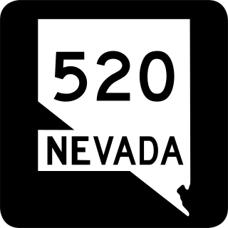
State Route 520 was a short state highway in Carson City, Nevada. The route served the central portion of the city, providing access to several government buildings in the capitol district. It was turned over to local control in 2010.

State Route 530 was a 1.464-mile-long (2.356 km) state highway in Carson City, Nevada. It followed a portion of William Street and was formerly signed as part of U.S. Route 50. The route was turned over to local control in 2010.

State Route 531 was a state highway in Carson City, Nevada. It followed a portion of College Parkway in the northern part of the city. Created by 1995, the highway was turned over to city control in 2011.

U.S. Route 395 Business is a business route of US 395 in Carson City, Nevada. The route provides access to downtown Carson City from Interstate 580 (I-580). The route was originally part of mainline US 395 before it was realigned around Carson City along I-580. Although still signed as US 395 Business, the route is no longer part maintained by the Nevada Department of Transportation (NDOT) and the ownership has been transferred to Carson City.

U.S. Route 395 in Nevada Section of U.S. Highway in Douglas County, Carson City, and Washoe County in western Nevada, United States

U.S. Route 395 (US 395) is an 85-mile-long (137 km) United States Numbered Highway near Lake Tahoe in the state of Nevada. It traverses the state after entering from California in Topaz Lake and crosses back into California near Hallelujah Junction. US 395 serves the cities of Gardnerville, Minden, Carson City and Reno. All of US 395 north of Carson City is a freeway and is built up to Interstate Highway standards. Part of the freeway section is also designated as Interstate 580 (I-580).

State Route 429 was a rural state highway located in southern Washoe County, Nevada. It followed Bowers Mansion Road, a former alignment of U.S. Route 395. The SR 429 designation was retired in 2012, and the route has since become part of U.S. Route 395 Alternate.

References

Route map:

KML file (edithelp)
    KML is not from Wikidata
    1. 1 2 "State Maintained Highways of Nevada: Descriptions and Maps Quarter 2 Update". Nevada Department of Transportation. July 2011. Archived from the original on 12 January 2012. Retrieved 12 Oct 2011.
    2. Google (12 March 2010). "Overview of SR 513" (Map). Google Maps . Google. Retrieved 12 March 2010.
    3. 1 2 Official Highway Map of Nevada (Map) (2007–08 ed.). Nevada Department of Transportation. 2007. Carson City Region inset.
    4. 1 2 "State Maintained Highways of Nevada: Descriptions and Maps". Nevada Department of Transportation. January 2010. Archived from the original on 23 September 2010. Retrieved 12 March 2010.
    5. State of Nevada: Laws Relating to Highways and State Parks. Carson City, Nevada: State Printing Office. 1951.
    6. Base Map - Ormsby County, Nevada (PDF) (Map). Nevada Department of Highways. 1937. Retrieved 13 March 2010.
    7. Official Highway Map of Nevada (Map). Nevada State Highway Department. 1973. Lake Tahoe Region inset. Retrieved 13 March 2010.
    8. Nevada State Maintained Highways: Descriptions, Index and Maps. Nevada Department of Transportation. January 2001. p. 96.
    9. Official Highway Map of Nevada (Map). Nevada Department of Transportation. 1982. Lake Tahoe Region inset. Retrieved 13 March 2010.
    10. Harber, Terri (7 August 2007). "City could take over several state-controlled streets". Nevada Appeal . Swift Communications . Retrieved 13 March 2010.
    11. "State Maintained Highways of Nevada: Descriptions and Maps Quarter 3 Update". Nevada Department of Transportation. October 2011. Archived from the original on 12 January 2012. Retrieved 12 Oct 2011.