
State Route 401 is a state highway in Pershing County, Nevada. The route, known as Rye Patch Road, serves the Rye Patch State Recreation Area.

State Route 28 (SR 28) is a 16.3-mile (26.2 km) state highway in Douglas County, Carson City, and Washoe County in western Nevada, United States, that runs along the northeastern shore of Lake Tahoe. SR 28 connects U.S. Route 50 (US 50) in Douglas County with California State Route 28 at Crystal Bay. SR 28 has been part of the Nevada scenic byway system since June 1994 and the National Scenic Byway system since September 1996.

State Route 231 is an unsigned state highway in Elko County, Nevada, United States. Known as Angel Lake Road, the highway connects Angel Lake to the town of Wells. SR 231 is a Nevada Scenic Byway.

State Route 447 is a state highway in the U.S. state of Nevada. The highway is almost entirely within Washoe County but does for a brief time enter Pershing County, Nevada. The highway connects the town of Gerlach to the remainder of the state via Wadsworth. Though passing through extremely remote and desolate areas of Nevada, the highway has recently gained fame as the primary route to access the Black Rock Desert, the site of the annual Burning Man festival. The state maintained portion ends at Gerlach; however the highway continues as Washoe County Route 447 from Gerlach north to the California state line near Cedarville.

State Route 490 is a state highway in White Pine County, Nevada. The route serves a state prison north of Ely.
State Route 877 is a state highway in rural Washoe County, Nevada. It runs along Franktown Road in the western reaches of the Washoe Valley.
State Route 671 is a state highway in Washoe County, Nevada. It runs along Holcomb Lane and portions of Lakeside Drive and Huffaker Lane in an agricultural area of southern Reno.
State Route 663 was an east–west state highway in Washoe County, Nevada serving the Reno-Sparks area. The route was turned over to local control in 2010.
State Route 648 runs from Kietzke Lane east along E. Second Street in Reno and Glendale Avenue in Sparks to S. McCarran Boulevard.

State Route 767 is a short state highway in the Ruby Valley region of Elko County, Nevada. It follows a portion of Ruby Valley Road.
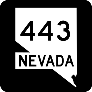
State Route 443 is a state highway in the Reno-Sparks metropolitan area of Washoe County, Nevada. It is the main connection between the city of Reno and the community of Sun Valley to the north. SR 443 is known as Clear Acre Lane in Reno and Sun Valley Drive within Sun Valley.

State Route 431, commonly known as the Mount Rose Highway, is a 24.413-mile-long (39.289 km) highway in Washoe County, Nevada, that connects Incline Village at Lake Tahoe with Reno. The highway, a Nevada Scenic Byway, takes its name from Mount Rose, which lies just off the highway. Prior to 1976, the highway existed as State Route 27.

State Route 425 is a 3.437-mile-long (5.531 km) state highway that serves the town of Verdi in Washoe County, Nevada. Interstate 80 Business is routed along the highway and extends beyond the terminus of the state route. SR 425 was formerly a part of SR 1 and U.S. Route 40.

U.S. Route 395 (US 395) is an 85-mile-long (137 km) United States Numbered Highway near Lake Tahoe in the state of Nevada. It traverses the state after entering from California in Topaz Lake and crosses back into California near Hallelujah Junction. US 395 serves the cities of Gardnerville, Minden, Carson City and Reno. All of US 395 north of Carson City is a freeway and is built up to Interstate Highway standards. Part of the freeway section is also designated as Interstate 580 (I-580). US 395 is an important regional highway, serving the communities of Western Nevada, connecting them to other major communities via California, and it is the only major north–south arterial for the geographically isolated region.

State Route 446 is a 13.156-mile-long (21.173 km) state highway serving Washoe County, Nevada. The route runs from SR 445 to SR 447 at the town of Nixon.

State Route 429 was a rural state highway located in southern Washoe County, Nevada. It followed Bowers Mansion Road, a former alignment of U.S. Route 395. The SR 429 designation was retired in 2012, and the route has since become part of U.S. Route 395 Alternate.
U.S. Route 395 Alternate is a 20.082-mile-long (32.319 km) alternate route of U.S. Route 395 in Washoe County, Nevada.

State Route 723 is a 2-mile (3.2 km) state highway in Churchill County, Nevada, running through a rural area northwest of Fallon.


