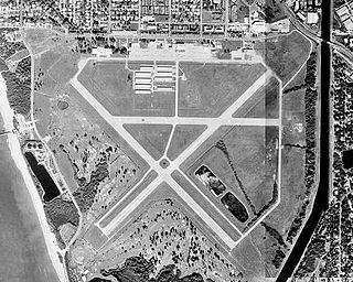
Will Rogers World Airport, also known as Will Rogers Airport or simply Will Rogers, is a passenger airport located in Oklahoma City, Oklahoma, United States, about 6 miles (10 km) southwest of the city's downtown area. It is a civil-military airport on 8,081 acres of land. Although the official IATA and ICAO airport codes for Will Rogers World Airport are OKC and KOKC, it is common practice to refer to it as "WRWA" or "Will Rogers".

Allegheny County Airport is in West Mifflin, Pennsylvania, United States, 7 miles (11 km) southeast of Pittsburgh. It is the fifth-busiest airport in Pennsylvania following Philadelphia, Pittsburgh, Allentown, and Harrisburg. The airport is owned by the Allegheny County Airport Authority and is the primary FAA-designated reliever airport for Pittsburgh International Airport. Allegheny County Airport was dedicated on September 11, 1931.

Merrill Field is a public-use general aviation airport located one mile (1.6 km) east of downtown Anchorage in the U.S. state of Alaska. The airport is owned by Municipality of Anchorage. It opened in 1930 as Anchorage Aviation Field and was renamed in honor of Alaska aviation pioneer Russel Merrill.
Lawrence Municipal Airport is two miles east of Lawrence, in Essex County, Massachusetts, United States. It is owned by the City of Lawrence, though it is in North Andover.
Iowa City Municipal Airport, is two miles southwest of downtown Iowa City, in Johnson County, Iowa. It is the oldest civil airport west of the Mississippi River still in its original location.

Ocean City Municipal Airport is a public facility serving Ocean City, a town in Worcester County, Maryland, United States. It is located 3 statute miles (5 km) southwest of town, off Route 611 in West Ocean City. The airport opened in October 1960.
West Bend Municipal Airport is a city-owned public-use airport located three nautical miles (6 km) east of the central business district of West Bend, a city in Washington County, Wisconsin, United States. It is included in the Federal Aviation Administration (FAA) National Plan of Integrated Airport Systems for 2023–2027, in which it is categorized as a regional reliever airport facility.

Chicago/Aurora Municipal Airport is a public airport opened in April 1966, located in the village of Sugar Grove, Illinois, United States, 8 miles (13 km) west of the city of Aurora, both in Kane County. The airport is owned and operated by the City of Aurora. It is 50 miles (80 km) west of Chicago and is designated as a reliever airport for Chicago's O'Hare and Midway airports.
Venice Municipal Airport is a city managed public-use airport located two miles (3.2 km) south of the central business district of Venice, a city in Sarasota County, Florida, United States.
New Ulm Municipal Airport is a public airport located two statute miles (3 km) west of the central business district (CBD) of New Ulm, a city in Brown County, Minnesota, United States. This general aviation airport covers 195 acres (79 ha) and has two runways. Operational since September 1945, scheduled airline service was once available on Midwest Aviation, also known as Lake State Airways, though today only charter flights are offered by the city's New Ulm Flight Service, founded in the 1960s.
Plant City Airport is a public-use airport located two nautical miles (4 km) southwest of the central business district of Plant City in Hillsborough County, Florida, United States. The airport is publicly owned by the Hillsborough County Aviation Authority, which also operates Tampa International Airport. It was formerly known as Plant City Municipal Airport. It supports a 400-acre (1.6 km2) industrial park located about one mile (1.6 km) east of the airport.
Kathrinstadt Airport is a private-use airport located eight miles (11 km) southeast of the central business district of Hastings, a town in St. Johns County, Florida, United States. It is approximately 25 miles southwest of St. Augustine.
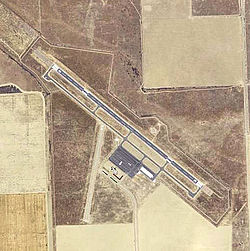
Ada Municipal Airport is two miles north of Ada, in Pontotoc County, Oklahoma. It is owned by the City of Ada, which is 88 miles (142 km) southeast of Oklahoma City.

Shishmaref Airport is a state-owned public-use airport located one nautical mile (1.85 km) south of the central business district of Shishmaref, a village in the Nome Census Area of the U.S. state of Alaska. It has one asphalt paved runway designated 5/23 and measuring 5,000 x 70 ft.. Shishmaref is located on Sarichef Island in the Chukchi Sea, just north of the Bering Strait and five miles from the mainland.
Cando Municipal Airport is a public airport located one mile (1.6 km) west of the central business district of Cando, North Dakota, in Towner County, North Dakota, United States. It is owned by the Cando Airport Authority.

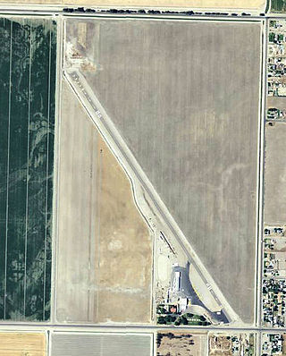
Porterville Municipal Airport is a city-owned public-use airport located three nautical miles southwest of the central business district of Porterville, a city in Tulare County, California, United States. According to the FAA's National Plan of Integrated Airport Systems for 2009–2013, it is categorized as a general aviation facility.
Corcoran Airport was a public use airport located two nautical miles (3.7 km) west of the central business district of Corcoran, a town in Kings County, California, United States. It is privately owned by Lakeland Dusters, Inc. The airport has been permanently closed.

Coalinga Municipal Airport (Old) is a closed airport located 1 mile north of Coalinga, California. The airport was closed approximately in the year 2000; all aviation use was moved to the New Coalinga Municipal Airport.

Helm Field also called Lemoore Auxiliary Army Airfield A-7 is a former US Army Airfield use for training during World War II. Helm Field was location in the town of Coalinga, California, 70 miles south of Fresno. Helm Field had two 3,000 foot runways, one oriented east/west and one oriented northwest/southeast. The Airfield was on a 773 acres site of form farm land. The US Army purchased the land on January 11, 1943 for training pilots. The Airfield was used by the Lemoore Basic Flying School, based at the Lemoore Army Air Field. Helm Field was 15 miles northwest of Lemoore Army Air Field. The Army built at Helm Field to support training stage house, control tower, motor pool building, crash truck shelter and latrines. Helm Field was used by Air Corps Basic Flying School, the AAF Basic Flying School, the AAF Pilot School, the 88th Air Base Squadron, the 3023rd Army Air Force Pilot School and the 461st Army Air Force Base Unit. The army closed Helm Field on October 15, 1844 and the Airfield was sold by the War Assets Administration. Helm Field was used as a farm labor camp in the 1950s. The east/west runway was returned to farmland. The northwest/southeast runway was still intact and was used as a civilian airfield till 1971.
Lago Vista, Texas, Rusty Allen Airport is a publicly owned, municipal airport located in unincorporated Travis County, Texas, United States. It is 2 miles (3.2 km) northeast of the central business district of Lago Vista and is northwest of Austin.