New Germantown | |
|---|---|
 | |
| Country | United States |
| State | Pennsylvania |
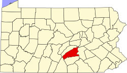
| County | Perry |
| Township | Toboyne |
| Elevation | 745 ft (227 m) |
| Time zone | UTC-5 (EST) |
| • Summer (DST) | UTC-4 (Eastern Daylight Time) |
| ZIP code | 17071 [1] |
| Area code | 717 |

New Germantown is an unincorporated community in Toboyne Township, Perry County, Pennsylvania, United States. [2]
The center of New Germantown is at the intersection of Germantown Road and Big Spring Road. Its ZIP code is 17006.