Odessa is a village in Schuyler County, New York, United States.

Southampton is a village in Suffolk County, New York, United States. The village is named after the Earl of Southampton. The Village of Southampton is in the southeast part of the county in the Town of Southampton, and is colloquially known as Southampton, despite being part of the Town of Southampton. The population was 3,109 at the 2010 census.
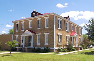
Tilden is a Census-designated place (CDP) and county seat of McMullen County, Texas, United States.

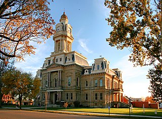
Penfield, Georgia, United States was established shortly after 1829 in Greene County, and named in honor of Josiah Penfield, a Savannah merchant and silversmith, who bequeathed $2,500.00 and a financial challenge to the Georgia Baptist Convention to match his gift for educational purposes. The Convention organized a manual labor school which opened in 1833 as Mercer Institute, in honor of Rev. Jesse Mercer of Greene County, a major contributor to the matching gift request.
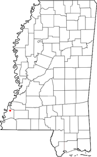
Washington is an unincorporated community in Adams County, Mississippi, United States. The community is close to Natchez. Located along the lower Mississippi River, it was the second and longest-serving capital of the Mississippi Territory.
Brooklin is a community in the town of Whitby, Ontario, Canada. It is located north of the urban area of Whitby, at the south junction of Ontario Highways 12 and 7.
Zorra is a township in Oxford County, situated in south-western Ontario, Canada. A predominantly rural municipality, Zorra was formed in 1975 through the amalgamation of East Nissouri, West Zorra and North Oxford townships. It is best known for the Highland Games weekend held each summer in Embro, celebrating the heritage of the Scottish pioneer families which grew from the 1830s to form nearly a quarter of the county's population.

Blandford-Blenheim is a township in the Canadian province of Ontario, located in Oxford County. The township had a population of 7,359 in the Canada 2011 Census.
New York State Route 311 (NY 311) is a state highway located entirely within Putnam County, New York, in the United States. The highway begins at NY 52 in Lake Carmel, and intersects Interstate 84 (I-84) shortly thereafter. It crosses NY 164 and NY 292 as it heads into the northeastern part of the county, finally curving east to reach its northern terminus at NY 22 just south of the Dutchess County line. The route passes several historical sites.

Granville was a town located in Milwaukee County, Wisconsin, United States. One portion was incorporated as the village of Brown Deer in 1955; the remainder consolidated with the City of Milwaukee in 1956, and became a neighborhood of Milwaukee.
Prairie Village is a neighborhood of Louisville, Kentucky, composed of a series of subdivisions and farms centered on the intersection of Third Street Road, Valley Station Road, and Stonestreet Road.
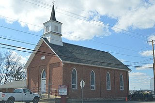
Cashel, Ontario is a small hamlet situated in Unionville, Ontario located at the intersection of Elgin Mills Road and York Regional Road 67. Originally it was called Crosby Corners after John Crosby, the village's first store owner, who came originally from New York State. The name was changed to Cashel in 1851 with the opening of its first post office. It was likely named after Cashel in Ireland. In 1851 the community had a sawmill, cobbler shop, blacksmith shop, wagon shop, inn and tavern, Masonic Lodge, and Presbyterian church. In 1890 Peaches United Church was built on land from farmer Thomas Peach at 10762 McCowan Road. The church is a historic site and not operating since the 1960s to 1970s, but cemetery remains in active use.

Deputy is an unincorporated community and census-designated place (CDP) in Graham Township, Jefferson County, Indiana, United States. By road it is approximately 18 miles (29 km) northwest of Madison, the county seat. As of the 2010 census it had a population of 86.

Volga is an unincorporated community in Smyrna Township, Jefferson County, Indiana. The name's origin is not known with certainty, but is believed to have been adopted from Volga in Russia. There were no Russian settlers in the area so the reason is not known.

Grant Township is a township in Douglas County, Kansas, USA. As of the 2000 census, its population was 442.

Hugglescote is a village on the River Sence in North West Leicestershire, England. The village is about 1 mile (1.6 km) south of the centre of Coalville, and its built-up area is now contiguous with the town.
Lilly Chapel is an unincorporated community in Fairfield Township, Madison County, Ohio, United States. It is located at 39°53′20″N83°16′54″W, at the intersection of W. Jefferson Kiousville Road and Lilly Chapel Georgesville Road, approximately three miles west of Georgesville.
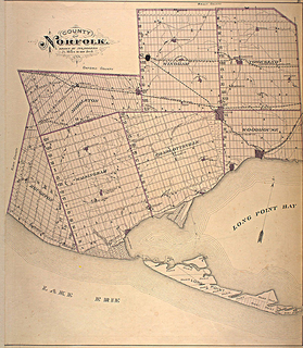
Norfolk County in the Canadian province of Ontario consists of a long list of communities. Its four designated population centres are Simcoe, Port Dover, Delhi, and Waterford.
Brutus is an unincorporated community in Pittsylvania County, in the U.S. state of Virginia.
Briggsdale is a neighborhood of Franklin County in the city of Columbus, Ohio. The neighborhood is on the west/southwest side of the city within the Hilltop area. The area was first settled and founded by the family of Joseph M. Briggs, after whom the neighborhood was named. Joseph Briggs was an active figure in the early years of the township and county operations. The Briggsdale Methodist church was founded with his help, and it now exists as the New Horizons Methodist Church. The present day Briggsdale neighborhood is located near the historical Green Lawn Cemetery to the north as well as Briggs High School to the west.