Plumwood, Ohio

Last updated

Plumwood, Ohio
Monroe Township hall at Plumwood.jpg
Monroe Township hall
OHMap-doton-Plumwood.png
Location in Ohio
Coordinates: 40°00′32″N83°24′53″W / 40.00889°N 83.41472°W / 40.00889; -83.41472
Country United States
State Ohio
County Madison
Township Monroe
Area
[1]
  Total
0.62 sq mi (1.61 km2)
  Land0.62 sq mi (1.61 km2)
  Water0.00 sq mi (0.00 km2)
Elevation
[2]
1,007 ft (307 m)
Population
 (2020) [3]
  Total
257
  Density413.18/sq mi (159.61/km2)
Time zone UTC-5 (Eastern (EST))
  Summer (DST) UTC-4 (EDT)
ZIP Code
43140 (London)
FIPS code 39-63758
GNIS feature ID2628953 [2]

Plumwood is an unincorporated community and census-designated place in central Monroe Township, Madison County, Ohio, United States. [4] As of the 2020 census, the population was 257. [3]

Contents

History

Plumwood was originally laid out on December 23, 1895, by Charles F. Sanford. The community was originally named Sanford, but the name was later changed. [5] As of 1915, the community was one of the largest trade posts in the county, with three large general stores, a blacksmith, six threshing outfits, three hay baling outfits, and the population was 200. [5]

Historical population
CensusPop.Note
2010 319
2020 257−19.4%
U.S. Decennial Census [6]

Geography

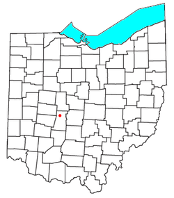
Plumwood is in northern Madison County, sitting at the intersection of State Route 38 with Arthur Bradley Road, 9 miles (14 km) north of London, the Madison county seat, and 17 miles (27 km) south of Marysville. Columbus, the state capital, is 24 miles (39 km) to the east.

According to the U.S. Census Bureau, the Plumwood CDP has an area of 0.62 square miles (1.61 km2), all land. [1] The Spring Fork of Little Darby Creek flows past the community to its south and west, [7] part of the Scioto River watershed.

Education

Plumwood is in the Jonathan Alder School District, [8] which operates Jonathan Alder High School.

References

  1. 1 2 "2024 U.S. Gazetteer Files: Ohio". United States Census Bureau. Retrieved April 10, 2025.
  2. 1 2 U.S. Geological Survey Geographic Names Information System: Plumwood, Ohio
  3. 1 2 "P1. Race – Plumwood CDP, Ohio: 2020 DEC Redistricting Data (PL 94-171)". U.S. Census Bureau. Retrieved April 10, 2025.
  4. U.S. Geological Survey Geographic Names Information System: Plumwood, Ohio
  5. 1 2 Bryan, Chester E., History of Madison County, Ohio , B.F. Bowen & Company, Inc., Indianapolis, Indiana, 1915, Pg. 181.
  6. "Census of Population and Housing". Census.gov. Retrieved June 4, 2016.
  7. DeLorme. Ohio Atlas & Gazetteer. 7th ed. Yarmouth: DeLorme, 2004, pp. 57, 67. ISBN   0-89933-281-1.
  8. "2020 CENSUS - SCHOOL DISTRICT REFERENCE MAP: Madison County, OH" (PDF). U.S. Census Bureau . Retrieved September 18, 2024. - Text list