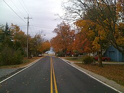
Rosedale, Ohio

Last updated

Rosedale, Ohio
Rosedale, Ohio in Fall.jpg
Rosedale, Ohio in Fall
OHMap-doton-Rosedale.png
Location of Rosedale, Ohio
Coordinates: 40°04′41″N83°27′18″W / 40.07806°N 83.45500°W / 40.07806; -83.45500
Country United States
State Ohio
County Madison
Township Pike
Elevation
[1]
1,011 ft (308 m)
Population
 (2010) [2]
  Total580
Time zone UTC-5 (Eastern (EST))
  Summer (DST) UTC-4 (EDT)
ZIP codes
43029
Area code 740
GNIS feature ID1065246 [1]

Rosedale is an unincorporated community in central Pike Township, Madison County, Ohio, United States, and roughly thirty miles (48 kilometers) west of the city of Columbus.

Contents

History

The Rosedale Post Office was established on June 3, 1830, [3] with Captain Andrews as the first postmaster. [4] In 1832, he purchased 1,300 acres (530 ha) of land, named the place "Rosedale Farms" after the post office, and opened a store at the intersection of Rosedale Road and Rosedale-Milford Center Road. [4] Later, Darius Burnham laid out the community of Liverpool on land he owned near Rosedale, and the plat was recorded on May 18, 1836, in London. [4] From 1837 to 1838, Foster Griffin became the postmaster and moved the post office from the rural country into Liverpool. [4] Soon after, the community changed its name to match the post office. The Rosedale Post Office was discontinued on October 14, 1867, re-established on January 17, 1870, then discontinued again on September 30, 1901. [3] The mail service was then sent through the Mechanicsburg branch. In 1905, the Pike township high school was built in the community, at a cost of $12,000. [4] As of 1915, the community contained one general store, one blacksmith, and a population of 60. [4]

In 1964 Conservative Mennonite Bible School, a Bible college owned by the Conservative Mennonite Conference (now known as the Rosedale Network of Churches), purchased the former high school building and moved to Rosedale from Berlin, Ohio. The school was later renamed Rosedale Bible College. [5] Also in the mid-1960s Conservative Mennonite Conference (now the Rosedale Network of Churches) moved its headquarters to the community. [6]

Geography and topography

The community is located between the Spring Fork and main channel of the Little Darby Creek to the northwest of their confluence. This puts the community on the western edge of the Scioto Watershed. [7] The area was originally a wetland of prairie grass and moisture tolerant trees, and now boasts rich and productive farmland of primarily soy beans, corn and wheat.[ citation needed ]

Economy

The town is the home of several denomination-wide agencies of the Rosedale Network of Churches, including Rosedale Bible College, Choice Books Great Lakes-Rosedale, and the administrative offices of the Conservative Mennonite Conference. The Conference's mission agency, Rosedale Mennonite Missions, was headquartered in Rosedale for several decades but relocated to Columbus, Ohio in 2015 and was subsequently renamed Rosedale International. [8] Rosedale has one church, the Rosedale Free Will Baptist Church.

Related Research Articles

<span class="mw-page-title-main">Mount Sterling, Ohio</span> Village in Ohio, United States

Mount Sterling is a village in Madison County, Ohio, United States. The population was 1,945 at the 2020 census. It is a part of the Columbus, Ohio Metropolitan Statistical Area.

The Rosedale Network of Churches is a Christian body of Mennonite churches in the Anabaptist tradition. Rosedale Network of Churches was originally formed in 1910 by a group of Amish Mennonites to promote unity while preserving autonomy of the local congregation.

<span class="mw-page-title-main">West Middletown, Ohio</span> Unincorporated community in Ohio, U.S.

West Middletown is an unincorporated community in eastern Madison Township, Butler County, Ohio, United States. It is located on the west shore of the Great Miami River about one mile from Middletown. It had about 200 people in 1905 and was formerly a station on the Cincinnati, Hamilton, and Dayton Railroad. Founded as Madison City, it received the name Heno when it was awarded a post office in 1882. Since there was already another Madison City in Ohio, the postmaster general demanded a name change. According to legend, as old-timers were discussing the new name around the cracker barrel in the general store, a can of Heno tea caught their attention. So the town was named for the tea. But in 1907, the postmaster general decreed the village was within the shadow of Middletown, and only a few postal workers had ever heard of Heno, making it difficult to sort and forward mail to the place. The government ordered the village to accept the name of West Middletown. In 1963 the postmaster general in another decree closed the West Middletown post office, transferring its business to Middletown.

<span class="mw-page-title-main">Chuckery, Ohio</span> Unincorporated community in Ohio, United States

Chuckery is an unincorporated community located in far southwestern Darby Township, Union County, Ohio, United States. It is located at 40°06′42″N83°23′26″W, at the intersection of State Routes 38 and 161.

Amish Mennonites came into existence through reform movements among North American Amish mainly between 1862 and 1878. These Amish moved away from the old Amish traditions and drew near to the Mennonites, becoming Mennonites of Amish origin. Over the decades, most Amish Mennonites groups removed the word "Amish" from the name of their congregations or merged with Mennonite groups.

<span class="mw-page-title-main">General Conference Mennonite Church</span> Mennonite church association (1860–2002)

The General Conference Mennonite Church (GCMC) was a mainline association of Mennonite congregations based in North America from 1860 to 2002. The conference was formed in 1860 when congregations in Iowa invited North American Mennonites to join together in order to pursue common goals such as higher education and mission work. The conference was especially attractive to recent Mennonite and Amish immigrants to North America and expanded considerably when thousands of Russian Mennonites arrived in North America starting in the 1870s. Conference offices were located in Winnipeg, Manitoba and North Newton, Kansas. The conference supported a seminary and several colleges. In the 1990s the conference had 64,431 members in 410 congregations in Canada, the United States and South America. After decades of cooperation with the Mennonite Church, the two groups reorganized into Mennonite Church Canada in 2000 and Mennonite Church USA in 2002.

<span class="mw-page-title-main">Rosedale Bible College</span> Private Anabaptist college in Ohio

Rosedale Bible College (RBC) is a private evangelical Anabaptist junior Bible college in Rosedale, Ohio. RBC offers an Associate in Biblical Studies accredited by the Commission on Accreditation of the Association for Biblical Higher Education. The college is owned by the Rosedale Network of Churches, a coalition of roughly 120 widely scattered churches within the Mennonite family of faith, and united by a evangelical-Anabaptist theology.

Amity is an unincorporated community in north-eastern Canaan Township, Madison County, Ohio, United States. It is located at the intersection of Plain City-Georgesville Road and Amity Pike Road, between Plain City and West Jefferson.

Chenoweth is an unincorporated community in Range Township, Madison County, Ohio, United States. It is located along Ohio State Route 323 between McClimansville and Range.

<span class="mw-page-title-main">Lafayette, Madison County, Ohio</span> CDP in Ohio, United States

Lafayette is a census-designated place in the center of Deer Creek Township, Madison County, Ohio, United States. It is located along U.S. Route 40, just west of its intersection with U.S. Route 42. The population of Lafayette was 206 at the 2020 census.

<span class="mw-page-title-main">Lilly Chapel, Ohio</span> Unincorporated community in Ohio, United States

Lilly Chapel is an unincorporated community in Fairfield Township, Madison County, Ohio, United States. It is located at the intersection of W. Jefferson Kiousville Road and Lilly Chapel Georgesville Road, approximately three miles west of Georgesville.

Rupert is an unincorporated community in Union Township, Madison County, Ohio, United States. It is located at the intersection of Ohio State Route 665 and Glade Run Road, approximately four miles east of London.

Newport is an unincorporated community in Paint Township, Madison County, Ohio, United States. It is located along Ohio State Route 38 between London and Midway.

Kiousville is an unincorporated community in southern Fairfield Township, Madison County, Ohio, United States. It is located at the intersection of Kiousville-Georgesville Road and McKendree Road.

<span class="mw-page-title-main">Big Plain, Ohio</span> Unincorporated community in Ohio, United States

Big Plain is an unincorporated community in Fairfield Township, Madison County, Ohio, United States. It is located at the intersection of West Jefferson-Kiousville Road and Big Plain-Circleville Road, approximately four miles north of Kiousville.

Conservative Mennonites include numerous Conservative Anabaptist groups that identify with the theologically conservative element among Mennonite Anabaptist Christian fellowships, but who are not Old Order groups or mainline denominations.

Chrisman is an unincorporated community in Oak Run Township, Madison County, Ohio, United States. It is located at the intersection of London-Circleville Road and Gregg Mill Road, about four miles southeast of London.

Owens is an unincorporated community in Marion County, in the U.S. state of Ohio.

<span class="mw-page-title-main">Briggsdale (Columbus, Ohio)</span>

Briggsdale is a neighborhood of Franklin County in the city of Columbus, Ohio. The neighborhood is on the west/southwest side of the city within the Hilltop area. The area was first settled and founded by the family of Joseph M. Briggs, after whom the neighborhood was named. Joseph Briggs was an active figure in the early years of the township and county operations. The Briggsdale Methodist church was founded with his help, and it now exists as the New Horizons Methodist Church. The present-day Briggsdale neighborhood is located near the historical Green Lawn Cemetery to the north as well as Briggs High School to the west.

Mabee Corner is an unincorporated community in Hamilton Township, Jackson County, Ohio, United States. It is located west of Oak Hill at the intersection of Bucklick Creek Road and Ohio State Route 139, at 38°54′10″N82°43′16″W.

References

  1. 1 2 U.S. Geological Survey Geographic Names Information System: Rosedale, Ohio
  2. United States Census 2010, 2010 Demographic Profile Data
  3. 1 2 U.S. Geological Survey Geographic Names Information System: Rosedale Post Office
  4. 1 2 3 4 5 6 Bryan, Chester E., History of Madison County, Ohio , B.F. Bowen & Company, Inc., Indianapolis, Indiana, 1915, Pg. 182.
  5. Yoder & Showalter, We Beheld His Glory: Rosedale Bible Institute the First Forty Years, 1992
  6. CMC Website History section, http://cmcrosedale.org/about/history.shtml, retrieved 10 August 2010
  7. Waterways info from ODNR Division of Soil and Water Resources
  8. Rosedale International website History section, https://rosedaleinternational.org/history/, retrieved 10 August 2021