New California is a census-designated place in central Jerome Township, Union County, Ohio, United States. It is located at the intersection of U.S. Route 42 and Industrial Parkway, just south of 42's intersection with U.S. Route 33. The population was 2,225 at the 2020 census.

Chuckery is an unincorporated community located in far southwestern Darby Township, Union County, Ohio, United States. It is located at the intersection of State Routes 38 and 161.
Fryburg is an unincorporated community located in central Pusheta Township, Auglaize County, Ohio, United States.

Roundhead is an unincorporated community in southeastern Roundhead Township, Hardin County, Ohio, United States. It has a post office with the ZIP code 43346.

Haydenville is an unincorporated community and census-designated place (CDP) in southern Green Township, Hocking County, Ohio, United States. As of the 2020 census the population of the CDP was 337.

Coal Run is an unincorporated community in northeastern Waterford Township, Washington County, Ohio, United States. It has a post office with the ZIP code 45721. It is located along State Route 60 between the villages of Beverly and Lowell. The Muskingum River flows past the community.

Kansas is a census-designated place in northwestern Liberty Township, Seneca County, Ohio, United States. It has a post office with the ZIP code 44841. It is located along State Route 635. The population was 175 at the 2020 census.

Lafayette is a census-designated place in the center of Deer Creek Township, Madison County, Ohio, United States. It is located along U.S. Route 40, just west of its intersection with U.S. Route 42. The population of Lafayette was 206 at the 2020 census.
Pharisburg is an unincorporated community in Leesburg Township, Union County, Ohio, United States. It is located at the intersection of Ohio State Routes 4 and 347, about two miles west of Magnetic Springs.

New Dover is an unincorporated community in Dover Township, Union County, Ohio, United States. It is located along U.S. Route 36, about three miles east of Marysville.
Watkins is an unincorporated community in Mill Creek Township, Union County, Ohio, United States. It is located along Watkins Road, between U.S. Route 33 and U.S. Route 42, about five miles east of Marysville.
Jerome is an unincorporated community in Jerome Township, Union County, Ohio, United States. It is located at the intersection of Jerome Road and Scioto Road, about 2 miles east of New California.

Arnold is an unincorporated community in Jerome Township, Union County, Ohio, United States. It is located along U.S. Route 42, between New California and Plain City.

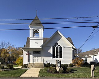
Montra is an unincorporated community in Jackson Township, Shelby County, Ohio, United States. Established in the middle of the nineteenth century, the small community is prominent because of a landmark church, Emanuel Lutheran Church of Montra.

Frenchtown is an unincorporated community in Wayne Township, Darke County, Ohio, United States. The community lies at the intersection of State Route 185 with Burns and Mangen Roads, approximately 2 miles (3.2 km) northwest of the village of Versailles.
St. Patrick is an unincorporated community in northwestern Turtle Creek Township, Shelby County, Ohio, United States. It lies at the intersection of Hoying and Wright-Puthoff Roads, northwest of the city of Sidney, the county seat of Shelby County. Its elevation is 971 feet (296 m) and it is located at 40°22′15″N84°17′15″W.

Cassella is an unincorporated community in Marion Township, Mercer County, Ohio, United States. Located at 40°24′22″N84°33′8″W, it lies at an elevation of 955 feet (291 m). Situated at the intersection of State Route 119 and Cassella-Montezuma Road in western Marion Township, it lies in the headwaters of Beaver Creek to the south of the city of Celina, the county seat of Mercer County. Other nearby communities include Maria Stein, 3 miles (4.8 km) to the east, Carthagena, 2 miles (3.2 km) to the north, and St. Henry, 4 miles (6.4 km) to the west.
Unionville is an unincorporated community on the line between northwestern Harpersfield Township in Ashtabula County and eastern Madison Township in Lake County in the U.S. state of Ohio. It has a post office with the ZIP code 44088. It lies along State Route 84.
Celina is an unincorporated community in Oil Township, Perry County, in the U.S. state of Indiana.
Keystone is an unincorporated community in Bloomfield Township, Jackson County, Ohio, United States. It is located south of the city of Jackson, at the intersection of Franklin Valley Road and Keystone Station Road, at 38°59′17″N82°36′33″W.