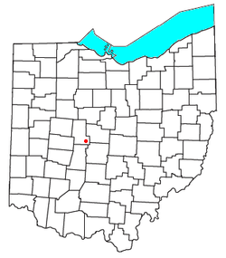
New California, Ohio

Last updated
New California, Ohio
New California, Ohio, Sign.JPG
OHMap-doton-New California.png
Location of New California, Ohio
Coordinates: 40°09′06″N83°14′42″W / 40.15167°N 83.24500°W / 40.15167; -83.24500
Country United States
State Ohio
Counties Union
Area
[1]
  Total2.09 sq mi (5.41 km2)
  Land2.06 sq mi (5.33 km2)
  Water0.03 sq mi (0.08 km2)
Elevation
[2]
978 ft (298 m)
Population
 (2020)
  Total2,225
  Density1,081.15/sq mi (417.42/km2)
Time zone UTC-5 (Eastern (EST))
  Summer (DST) UTC-4 (EDT)
ZIP code
43064
Area code 614
GNIS feature ID2628939 [2]

New California is a census-designated place in central Jerome Township, Union County, Ohio, United States. [3] It is located at the intersection of U.S. Route 42 and Industrial Parkway, just south of 42's intersection with U.S. Route 33. [4] The population was 2,225 at the 2020 census.

Contents

History

New California was platted in 1853. [5] According to tradition, news of a man passing through the settlement to California caused the name to be selected. [6] The New California Post office was established on January 7, 1850, but was discontinued on May 14, 1904. The mail service is now sent through the Plain City branch.

On September 19, 2009, a new Ohio historical marker was dedicated in New California. The marker symbolizes the fact that 367 men from Jerome Township joined the Union cause, giving it one of the highest per capita rates for service in the nation during the American Civil War, and also the fact that seventeen of those veterans are buried in the community's small cemetery. [7]

Demographics

Historical population
CensusPop.Note
2020 2,225
U.S. Decennial Census [8]

Related Research Articles

<span class="mw-page-title-main">Plain City, Ohio</span> Village in Ohio, United States

Plain City is a village in Madison and Union counties in the U.S. state of Ohio, along Big Darby Creek. The population was 4,065 at the 2020 census.

<span class="mw-page-title-main">Chuckery, Ohio</span> Unincorporated community in Ohio, United States

Chuckery is an unincorporated community located in far southwestern Darby Township, Union County, Ohio, United States. It is located at 40°06′42″N83°23′26″W, at the intersection of State Routes 38 and 161.

<span class="mw-page-title-main">Bascom, Ohio</span> Census-designated place in Ohio, United States

Bascom is a census-designated place in western Hopewell Township, Seneca County, Ohio. It has a post office with the ZIP code 44809 and hosts Hopewell-Loudon High School. The community is located at the intersection of State Routes 18 and 635 east of Fostoria. The population was 397 at the 2020 census.

<span class="mw-page-title-main">Pettisville, Ohio</span> Census-designated place in Ohio, United States

Pettisville is an unincorporated community and census-designated place (CDP) in Clinton and German townships, Fulton County, Ohio, United States. Located at the intersection of County Road 19 and Country Road D, its elevation is 755 feet (230 m). As of the 2020 census the population was 469.

<span class="mw-page-title-main">Jerome Township, Union County, Ohio</span> Township in Ohio, United States

Jerome Township is one of the fourteen townships of Union County, Ohio, United States. The 2020 census found 9,504 people in the township.

Jacksontown is a census-designated place (CDP) in central Licking Township, Licking County, Ohio, United States. It has a post office with the ZIP code 43030. It lies at the intersection of U.S. Route 40 with State Route 13.

<span class="mw-page-title-main">Brownsville, Ohio</span> Census-designated place in Ohio, United States

Brownsville is an unincorporated community and census-designated place (CDP) in northeastern Bowling Green Township, Licking County, Ohio, United States. As of the 2020 census, it had a population of 214. It lies at the intersection of U.S. Route 40 with State Route 668.

<span class="mw-page-title-main">Buford, Ohio</span> Census-designated place in Ohio, United States

Buford is an unincorporated community and census-designated place in central Clay Township, Highland County, Ohio, United States. The population was 306 at the 2020 census. It once had a post office, with the ZIP code 45110. The current ZIP code 45171 is for nearby Sardinia.

<span class="mw-page-title-main">Parkman, Ohio</span> Census-designated place in Ohio, United States

Parkman is a census-designated place in southern Parkman Township, Geauga County, Ohio, United States. It lies along U.S. Route 422 at its intersection with State Routes 88, 168, and 528.

<span class="mw-page-title-main">Damascus, Ohio</span> Census-designated place in Ohio, United States

Damascus is an unincorporated community and census-designated place in southern Mahoning and northern Columbiana counties in the U.S. state of Ohio. As of the 2020 census, it had a population of 418. The community lies at the intersection of U.S. Route 62 and State Routes 173 and 534.

<span class="mw-page-title-main">Austinburg, Ohio</span> Census-designated place in Ohio, United States

Austinburg is a census-designated place in northern Austinburg Township, Ashtabula County, Ohio, United States. It lies at the intersection of State Routes 45 and 307. As of the 2020 census it had a population of 505, out of a total population of 2,197 in Austinburg Township. Austinburg was laid out ca. 1800 by Judge Eliphalet Austin, and named for him.

<span class="mw-page-title-main">Kinsman, Ohio</span> Census-designated place in Ohio, United States

Kinsman is an unincorporated community and census-designated place in Kinsman Township, Trumbull County, Ohio, United States. The population was 574 at the 2020 census. It is part of the Youngstown–Warren metropolitan area. It lies at the intersection of State Route 5 and State Route 7 between Williamsfield and Burghill. Kinsman has a post office with the ZIP code 44428; as well as a library, the Kinsman Free Public Library.

<span class="mw-page-title-main">Good Hope, Ohio</span> Census-designated place in Ohio, United States

Good Hope is an unincorporated community and census-designated place (CDP) in central Wayne Township, Fayette County, Ohio, United States. The population was 202 at the 2020 census.

<span class="mw-page-title-main">Etna, Licking County, Ohio</span> Census-designated place in Ohio, United States

Etna is an unincorporated community and census-designated place (CDP) in Licking County, Ohio, United States. As of the 2020 census it had a population of 1,209. It lies at an elevation of 1,069 feet (326 m) at the intersection of U.S. Route 40 and State Route 310. It was listed as a census-designated place in 2010.

<span class="mw-page-title-main">Lafayette, Madison County, Ohio</span> CDP in Ohio, United States

Lafayette is a census-designated place in the center of Deer Creek Township, Madison County, Ohio, United States. It is located along U.S. Route 40, just west of its intersection with U.S. Route 42. The population of Lafayette was 206 at the 2020 census.

<span class="mw-page-title-main">Big Plain, Ohio</span> Unincorporated community in Ohio, United States

Big Plain is an unincorporated community in Fairfield Township, Madison County, Ohio, United States. It is located at the intersection of West Jefferson-Kiousville Road and Big Plain-Circleville Road, approximately four miles north of Kiousville.

Essex is an unincorporated community on the east side of Rush Creek in the central part of Jackson Township, Union County, Ohio, United States. It is at 40°28′57″N83°18′57″W, at the intersection of State Routes 37 and 739.

Pharisburg is an unincorporated community in Leesburg Township, Union County, Ohio, United States. It is located at 40°20′43″N83°18′13″W, at the intersection of Ohio State Routes 4 and 347, about two miles west of Magnetic Springs.

<span class="mw-page-title-main">Jerome, Ohio</span> Unincorporated community in Ohio, United States

Jerome is an unincorporated community in Jerome Township, Union County, Ohio, United States. It is located at 40°09′59″N83°10′33″W, at the intersection of Jerome Road and Scioto Road, about 2 miles east of New California.

<span class="mw-page-title-main">Arnold, Ohio</span> Unincorporated community in Ohio, United States

Arnold is an unincorporated community in Jerome Township, Union County, Ohio, United States. It is located along U.S. Route 42, between New California and Plain City.

References

  1. "ArcGIS REST Services Directory". United States Census Bureau. Retrieved September 20, 2022.
  2. 1 2 U.S. Geological Survey Geographic Names Information System: New California, Ohio
  3. U.S. Geological Survey Geographic Names Information System: New California, Ohio
  4. Rand McNally, The Road Atlas '06, Chicago, 2006, p. 78.
  5. Curry, William Leontes (1913). History of Jerome Township, Union County, Ohio. Press of the Edward T. Miller Company. p. 48.
  6. Overman, William Daniel (1958). Ohio Town Names. Akron, OH: Atlantic Press. p. 96.
  7. Plain City Advocate, A historic occasion, October 6, 2009
  8. "Census of Population and Housing". Census.gov. Retrieved June 4, 2016.