
Union County is a county located in the U.S. state of Ohio. As of the 2020 census, the population was 62,784. Its county seat is Marysville. Its name is reflective of its origins, it being the union of portions of Franklin, Delaware, Madison, and Logan counties.
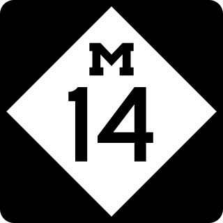
M-14 is an east–west state trunkline highway in the southeastern portion of the US state of Michigan. Entirely freeway, it runs for 22.250 miles (35.808 km) to connect Ann Arbor with Detroit by way of a connection with Interstate 96 (I-96). The western terminus is at a partial interchange with I-94 west of Ann Arbor. From there, the freeway curves around the north side of Ann Arbor and runs concurrently with US Highway 23 (US 23). East of that section, M-14 passes through woodlands and fields in Washtenaw County. In Wayne County, the freeway returns to a suburban area of mixed residential neighborhoods and light industrial areas. It crosses two different rivers and a pair of rail lines as it approaches Detroit's inner suburbs, where it terminates at an interchange between I-96 and I-275.

U.S. Route 36 (US 36) is an east–west United States highway that travels approximately 1,414 miles (2,276 km) from Rocky Mountain National Park, Colorado to Uhrichsville, Ohio. The highway's western terminus is at Deer Ridge Junction, an intersection in Rocky Mountain National Park, Colorado, where it meets US 34. Its eastern terminus is at US 250 in Uhrichsville, Ohio.

Sylvania Township is one of the eleven townships of Lucas County, Ohio, United States. As of 2020, the total population was 50,679, making it the second most populous municipality of Lucas County, Northwest Ohio, and the 419 / 567 area codes.
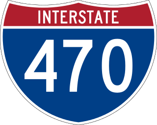
Interstate 470 (I-470) is a 10.63-mile-long (17.11 km) auxiliary Interstate Highway of I-70 that bypasses the city of Wheeling, West Virginia, United States. I-470 is one of 13 auxiliary Interstate Highways in Ohio and the only auxiliary Interstate Highway in West Virginia. The western terminus of I-470 is an interchange with I-70 in Richland Township, Ohio. Traveling southeast through rural Belmont County, I-470 approaches the Vietnam Veterans Memorial Bridge, which spans the Ohio River. After crossing the river into Ohio County, West Virginia, the highway continues east toward the Wheeling communities of Bethlehem and Elm Grove and its eastern terminus at I-70 near Elm Grove. The portion of the highway in West Virginia is named the USS West Virginia Memorial Highway by proclamation of then-Governor Cecil H. Underwood on the 59th anniversary of the attack on Pearl Harbor.

Irwin is an unincorporated community in southwestern Union Township, Union County, Ohio, United States. It is located at the intersection of Ohio State Route 4 and 161. Irwin has a post office which serves the surrounding area, including the community of Rosedale.

Pennsylvania Route 68 is a 90.036-mile-long (144.899 km) east–west state highway located in western Pennsylvania in the United States. The western terminus of the route is at the Ohio state line west of Glasgow, where PA 68 continues into Ohio as State Route 39. The eastern terminus is at U.S. Route 322 in Clarion. The route runs southwest-northeast across Beaver, Butler, Armstrong, and Clarion counties. PA 68 follows the Ohio River between the Ohio border and Beaver, where it crosses the Beaver River into Rochester and heads northeast away from the Ohio River. The route runs through rural areas to Butler County, where it intersects Interstate 79 (I-79) in Zelienople before serving Evans City and Butler. PA 68 passes through a section of Armstrong County before crossing the Allegheny River into Clarion County. Here, the route passes through Rimersburg and Sligo before it has an interchange with I-80 and continues to its terminus in Clarion.

Pennsylvania Route 168 is a highway in Western Pennsylvania that runs for 55 miles (89 km) from PA 18 in Frankfort Springs to PA 208 in Volant. PA 168 intersects or runs concurrently with PA 18 at several points, including in New Castle.

U.S. Route 30 (US 30) is a United States Numbered Highway that runs from Astoria, Oregon, to Atlantic City, New Jersey. In the state of Ohio, it is a major, 245-mile-long (394 km), east–west highway that runs through the northern section of the state. Overall, the highway runs through rural areas dominated by farm fields or woodlands; some segments are urban in character in the Mansfield and Canton areas.

York Center is an unincorporated community in York Township, Union County, Ohio, United States. It is located at the intersection of State Routes 47 and 739.
Claibourne is an unincorporated community in Claibourne Township, Union County, Ohio, United States. It is located at the intersection of Claibourne Road and Bethlehem-Claibourn Road.
Pharisburg is an unincorporated community in Leesburg Township, Union County, Ohio, United States. It is located at the intersection of Ohio State Routes 4 and 347, about two miles west of Magnetic Springs.

New Dover is an unincorporated community in Dover Township, Union County, Ohio, United States. It is located along U.S. Route 36, about three miles east of Marysville.
Watkins is an unincorporated community in Mill Creek Township, Union County, Ohio, United States. It is located along Watkins Road, between U.S. Route 33 and U.S. Route 42, about five miles east of Marysville.
Jerome is an unincorporated community in Jerome Township, Union County, Ohio, United States. It is located at the intersection of Jerome Road and Scioto Road, about 2 miles east of New California.
Lunda is an unincorporated community in Liberty Township, Union County, Ohio, United States. It is located at the intersection of Lunda Road and Perkins Road, about three miles southeast of West Mansfield.

State Route 347 (SR 347) is an east–west state highway in central portion of the U.S. state of Ohio. The western terminus of SR 347 is at SR 287 near Middleburg, adjacent to the U.S. Route 33 freeway. Its eastern terminus is at a T-intersection with SR 37 just one-quarter mile (0.40 km) south of the village of Magnetic Springs. The route runs through rural areas of Logan and Union counties passing through no incorporated villages.
Buena Vista is an unincorporated community in Green Township, Fayette County, Ohio, United States. It is located at the intersection of Greenfield-Sabina Road and Stafford Road, about 5 miles south of Washington Court House. Rattlesnake Creek flows near the town site.
Manara is an unincorporated community in Marion Township, Fayette County, Ohio, United States. It is located at the intersection of Washington-Waterloo Road and Bloomingburg-New Holland Road.
Union–Miles Park is a neighborhood on the Southeast side of Cleveland, Ohio, in the United States. The neighborhood draws its name from Union Avenue, and Miles Park in its far southwest corner.

