Newport is an unincorporated community in Monroe County in the U.S. state of Michigan. The community is located within Berlin Charter Township. As an unincorporated community, Newport has no legally defined boundaries or population statistics of its own but does have its own post office with the 48166 ZIP Code.

New California is a census-designated place in central Jerome Township, Union County, Ohio, United States. It is located at the intersection of U.S. Route 42 and Industrial Parkway, just south of 42's intersection with U.S. Route 33. The population was 2,225 at the 2020 census.

Petersburg is a small unincorporated community and census-designated place in southeastern Springfield Township, Mahoning County, Ohio, United States. The population was 405 at the 2020 census. It is part of the Youngstown–Warren metropolitan area.
Owens is a small unincorporated crossroads community at the intersection of Dahlgren Road, Windsor Drive, and Owens Drive in King George County, Virginia, United States. State Routes 206 and 218 meet at this intersection, with 206 going east towards U.S. Route 301 and Dahlgren, 218 going south towards US 301 and Colonial Beach and 206 and 218 joined together going west towards Arnolds Corner and Fredericksburg. The eastern part of the community is within the Dahlgren census-designated place.

Rosedale is an unincorporated community in central Pike Township, Madison County, Ohio, United States, and roughly thirty miles west of the city of Columbus.

Middleburg is an unincorporated community in northern Zane Township, Logan County, Ohio, United States. It has a post office with the ZIP code 43336. It is located at the intersection of State Route 287 with County Road 153, near the headwaters of the Big Darby Creek and a short distance southwest of U.S. Route 33.
Plumwood is a census-designated place in central Monroe Township, Madison County, Ohio, United States. It lies at the intersection of State Route 38 with Arthur Bradley Road, 8½ miles north of the city of London, the county seat of Madison County. The Spring Fork of the Little Darby Creek flows past the community.

Footville is an unincorporated community in southwestern Trumbull Township, Ashtabula County, Ohio, United States. It lies at the intersection of State Route 166 with Trask Road, 1+1⁄2 miles (2.4 km) east of the Geauga County line and 11+1⁄4 miles (18.1 km) southeast of the village of Jefferson, the county seat of Ashtabula County. Spring and Trumbull Creeks, which are both tributaries of the Grand River, pass near Footville.
Amity is an unincorporated community in north-eastern Canaan Township, Madison County, Ohio, United States. It is located at the intersection of Plain City-Georgesville Road and Amity Pike Road, between Plain City and West Jefferson.
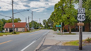
Summerford is an unincorporated community in Somerford Township, Madison County, Ohio, United States. It is located at the intersection of U.S. Route 40 and State Route 56.

Big Plain is an unincorporated community in Fairfield Township, Madison County, Ohio, United States. It is located at the intersection of West Jefferson-Kiousville Road and Big Plain-Circleville Road, approximately four miles north of Kiousville.
Jerome is an unincorporated community in Jerome Township, Union County, Ohio, United States. It is located at the intersection of Jerome Road and Scioto Road, about 2 miles east of New California.
Chrisman is an unincorporated community in Oak Run Township, Madison County, Ohio, United States. It is located at the intersection of London-Circleville Road and Gregg Mill Road, about four miles southeast of London.
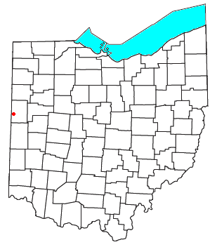
Padua is an unincorporated community in western Washington Township, Mercer County, Ohio, United States. It lies at the intersection of State Route 49 and St. Anthony Road, west of the city of Celina, the county seat of Mercer County. Its elevation is 899 feet (274 m), and it is located at 40°30′30″N84°47′2″W.

Montra is an unincorporated community in Jackson Township, Shelby County, Ohio, United States. Established in the middle of the nineteenth century, the small community is prominent because of a landmark church, Emanuel Lutheran Church of Montra.
St. Patrick is an unincorporated community in northwestern Turtle Creek Township, Shelby County, Ohio, United States. It lies at the intersection of Hoying and Wright-Puthoff Roads, northwest of the city of Sidney, the county seat of Shelby County. Its elevation is 971 feet (296 m) and it is located at 40°22′15″N84°17′15″W.
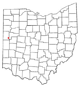
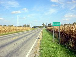
Sebastian is an unincorporated community in northern Marion Township, Mercer County, Ohio, United States. Its elevation is 932 feet (284 m), and it is located at 40°26′39″N84°31′0″W. Located at the intersection of Sebastian Road and County Road 716-A, the community lies south of the city of Celina, the county seat of Mercer County, and nearly 2 miles (3.2 km) northwest of the village of Chickasaw.
Little York is an unincorporated community in Butler Township, Montgomery County, Ohio, United States. It is located on the east bank of the Stillwater River, at the intersection of Little York Road and Meeker Road, not far from the intersection of I-70 and Ohio State Route 48.
Glade is an unincorporated community in Scioto Township, Jackson County, Ohio, United States. It is located southeast of Beaver at the intersection of the James A. Rhodes Appalachian Highway and Glade Road, at 39°00′48″N82°46′58″W.
Parlett is an unincorporated community in Wayne Township, Jefferson County, Ohio, United States. It is located southeast of Hopedale and just east of Cherry Valley at the intersection of Ohio State Route 151 and Township Road 142A.