Cumberland County is a coastal county located on the Delaware Bay in the U.S. state of New Jersey. As of the 2020 U.S. census, the county's population was 154,152, making it the 16th-largest of the state's 21 counties. Its county seat is Bridgeton. Cumberland County is named for Prince William, Duke of Cumberland. The county was formally created from portions of Salem County on January 19, 1748.

Route 29 is a state highway in the U.S. state of New Jersey. It runs 34.76 mi (55.94 km) from an interchange with Interstate 295 (I-295) in Hamilton Township in Mercer County, where it continues as I-195, to Route 12 in Frenchtown, Hunterdon County. Between the southern terminus and I-295 in Ewing Township, the route is a mix of freeway and four-lane divided highway that runs along the Delaware River through Trenton. This section includes a truck-restricted tunnel that was built along the river near historic houses and Riverview Cemetery. North of I-295, Route 29 turns into a scenic and mostly two-lane highway. North of the South Trenton Tunnel, it is designated the Delaware River Scenic Byway, a New Jersey Scenic Byway and National Scenic Byway, that follows the Delaware River in mostly rural sections of Mercer County and Hunterdon County. The obsolete Delaware & Raritan Canal usually stands between the river and the highway. Most sections of this portion of Route 29 are completely shaded due to the tree canopy. Route 29 also has a spur, Route 129, which connects Route 29 to U.S. Route 1 (US 1) in Trenton.

Route 42 is a state highway in the U.S. state of New Jersey within the Camden area. It runs 14.28 mi (22.98 km) from an intersection with U.S. Route 322 and County Route 536 Spur in Monroe Township, Gloucester County to an intersection with Interstate 76 and Interstate 295 in Bellmawr, Camden County. The route is a mix of freeway and divided four-lane arterial road. The southern portion of Route 42 is a local arterial route and one of several highways comprising the Black Horse Pike, a road that runs from Camden to Atlantic City. The northern portion is part of a six- to eight-lane freeway referred to locally as the North–South Freeway that connects the Atlantic City Expressway to the Benjamin Franklin Bridge. Major intersections along the route include the Atlantic City Expressway and the southern terminus of Route 168 in Turnersville, another intersection with Route 168 in Blackwood, and Route 41 and Route 55 in Deptford Township.

Route 47 is a state highway in the southern part of New Jersey. It runs 75.20 mi (121.02 km) from Atlantic Avenue in Wildwood, Cape May County north to U.S. Route 130 in Brooklawn, Camden County. It is also referred to as Delsea Drive, as it connects the Delaware River near Brooklawn to the Atlantic Ocean in Wildwood. This name was assigned by the New Jersey Legislature in 1933. The route runs through rural areas of Cape May and southern Cumberland counties as a two-lane road. Traffic jams along this portion of Route 47 are commonplace in the summer vacation season and can stretch for miles due to the missing southern section of Route 55, where all Jersey Shore-bound traffic enters the small two-lane road. North of here, the route runs through the cities of Millville and Vineland before entering Gloucester County, where it passes through more rural areas as well as Clayton and Glassboro. Past Glassboro, it heads through suburban areas in Washington and Deptford townships before running through Westville and Brooklawn. Route 47 is the longest signed state route in New Jersey.

Route 49 is a state highway in the southern part of the U.S. state of New Jersey. It runs 53.80 mi (86.58 km) from an interchange with the New Jersey Turnpike, Interstate 295 (I-295), and U.S. Route 40 (US 40) in Deepwater, Salem County, southeast to Route 50 and County Route 557 in Tuckahoe, Cape May County. The route serves Salem, Cumberland, Atlantic, and Cape May Counties, passing through rural areas and the communities of Salem, Bridgeton, and Millville along the way. It is a two-lane, undivided road for most of its length.

Route 54 is a state highway located in Atlantic County in New Jersey, United States. It is considered to be a southern extension of U.S. Route 206, running 11.86 mi (19.09 km) from an intersection with US 206 and US 30 in Hammonton to an intersection with US 40 in Buena Vista Township. The road passes through the center of Hammonton before running into rural areas. It intersects US 322 and Route 73 in Folsom and the Atlantic City Expressway in Hammonton.

Route 55 is a state highway in the southern part of the U.S. state of New Jersey that is built to freeway standards. Also known as the Veterans Memorial Highway, it runs 40.54 miles (65.24 km) from an intersection with Route 47 in Port Elizabeth north to an interchange with Route 42 in Gloucester County. The Route 55 freeway serves as a main road through Cumberland and Gloucester counties, serving Millville, Vineland, and Glassboro. It is used as a commuter route north to Philadelphia and, along with Route 47, as a route from the Delaware Valley to the Jersey Shore resorts in Cape May County. Route 55 has a posted speed limit of 65 miles per hour (105 km/h) for most of its length.

Route 56 is a state highway in the southern part of the U.S. state of New Jersey. Also known as Landis Avenue, it runs 9.19 mi (14.79 km) from an intersection with Route 77 and County Route 622 (CR 622) in Upper Deerfield Township, Cumberland County, to an intersection with Route 47 in Vineland, Cumberland County. The route serves as a connector between Bridgeton and Vineland. West of the interchange with Route 55 in Vineland, Route 56 is a two-lane undivided road that passes through rural areas of Cumberland County, also entering a corner of Salem County. East of Route 55, the route is a four-lane locally maintained road that runs through commercial areas of Vineland.
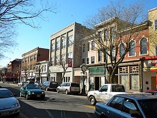
Bridgeton is a city in Cumberland County, in the U.S. state of New Jersey. It is the county seat of Cumberland County and is located on the Cohansey River near Delaware Bay in the South Jersey region of the state.

Millville is a city in Cumberland County, in the U.S. state of New Jersey. As of the 2010 U.S. census, the city's population was 28,400, reflecting an increase of 1,553 (+5.8%) from the 26,847 counted in the 2000 census.

Vineland is a city in Cumberland County, in the U.S. state of New Jersey. As of the 2020 U.S. census, the city had a total population of 60,780. The Census Bureau's Population Estimates Program calculated that the city's population was 61,156 in 2021, ranking the city the 630th-most-populous in the country. Bridgeton and Vineland are the two principal cities of the Vineland-Bridgeton metropolitan statistical area, which encompasses those cities and all of Cumberland County for statistical purposes and which constitutes a part of the Delaware Valley. The MSA had a population of 156,898 as of the 2010 census. The 2020 population was an increase of 54 (+0.1%) from the 2010 census count of 60,724, reflecting an increase of 4,453 (+7.9%) from the 56,271 counted in the 2000 census.

Route 72 is a state highway in the U.S. state of New Jersey. It runs 28.74 mi (46.25 km) from the Four Mile Circle with Route 70 in Woodland Township in Burlington County to County Route 607 in Ship Bottom on Long Beach Island in Ocean County. Route 72 travels through the Pine Barrens as a two-lane undivided road. After an interchange with the Garden State Parkway, the route becomes a four- to six-lane divided highway through built-up areas of Manhawkin and crosses the Manahawkin Bay via the Manahawkin Bay Bridge onto Long Beach Island.

U.S. Route 206 is a 130.23-mile-long (209.58 km) north–south United States highway in New Jersey and Pennsylvania, United States. Only about a half a mile of its length is in Pennsylvania; the Milford–Montague Toll Bridge carries it over the Delaware River into New Jersey, where the remainder of the route is. Its southern terminus is at an intersection with US 30 and Route 54 in Hammonton, New Jersey. The highway's northern terminus is at an intersection with US 209 near Milford, Pennsylvania; some sources and signs show an overlap with US 209 to end at its parent route US 6. For much of its length, US 206 is a rural two-lane undivided road that passes through the Pine Barrens, agricultural areas, and the Appalachian Mountains of northwestern New Jersey, with some urban and suburban areas. The route connects several cities and towns, including Bordentown, Trenton, Princeton, Somerville, Roxbury, Netcong, and Newton. The road is known as the Disabled American Veterans Highway for much of its length.
Route 90 is a 3.22-mile (5.18 km) state highway in New Jersey in the United States (U.S.). The western terminus is at the Betsy Ross Bridge over the Delaware River in Pennsauken Township, Camden County, where the road continues into Philadelphia, Pennsylvania, as an unnumbered road that provides access to Interstate 95. The eastern terminus is an interchange with Route 73 in Cinnaminson Township, Burlington County. It is a four-to six-lane freeway its entire length, interchanging with U.S. Route 130 and Camden County Route 644.

The Delaware Valley is a metropolitan region on the East Coast of the United States that comprises and surrounds Philadelphia, the sixth most populous city in the nation and 68th largest city in the world as of 2020.

Interstate 295 (I-295) in Delaware, New Jersey, and Pennsylvania is an auxiliary Interstate Highway, designated as a bypass around Philadelphia and a partial beltway of Trenton, New Jersey.

Interstate 676 (I-676) is an Interstate Highway that serves as a major thoroughfare through Center City Philadelphia, where it is known as the Vine Street Expressway, and Camden, New Jersey, where it is known as the northern segment of the North–South Freeway, as well as the Martin Luther King Jr. Memorial Highway in honor of civil rights leader Martin Luther King Jr. Its western terminus is at I-76 in Philadelphia near the Philadelphia Museum of Art and Fairmount Park. From there, it heads east and is then routed on surface streets near Franklin Square and Independence National Historical Park, home of the Liberty Bell, before crossing the Delaware River on the Benjamin Franklin Bridge. On the New Jersey side of the bridge, the highway heads south to its southern terminus at I-76 in Gloucester City near the Walt Whitman Bridge. Between the western terminus and downtown Camden, I-676 is concurrent with U.S. Route 30 (US 30).
County Route 552 is a county highway in the U.S. state of New Jersey. The highway extends 27.48 miles (44.22 km) from Laurel Street in Bridgeton to Harding Highway in Hamilton Township.

U.S. Route 322 is a spur of U.S. Route 22, running from Cleveland, Ohio, east to Atlantic City, New Jersey. The easternmost segment of the route in New Jersey runs 62.64 miles (100.81 km) from the Commodore Barry Bridge over the Delaware River in Logan Township, Gloucester County, where it continues southeast to Atlantic Avenue and Pacific Avenue in Atlantic City, Atlantic County. The portion of the route between the Commodore Barry Bridge and Route 42 in Williamstown is mostly a two-lane undivided road that is concurrently signed with County Route 536 (CR 536), passing through Mullica Hill and Glassboro. From Williamstown, US 322 follows the Black Horse Pike, a four-lane road, southeast to Atlantic City. In Hamilton Township, Atlantic County, US 322 forms a concurrency with U.S. Route 40, continuing with that route all the way to Atlantic City. US 322 intersects several major roads including U.S. Route 130 and Interstate 295 (I-295) in Logan Township, the New Jersey Turnpike in Woolwich Township, Route 55 in Harrison Township, Route 42 in Williamstown, Route 50 and U.S. Route 40 in Hamilton Township, the Garden State Parkway in Egg Harbor Township, and U.S. Route 9 in Pleasantville.

U.S. Route 40 is a U.S. highway running from Silver Summit, Utah east to Atlantic City, New Jersey. The easternmost segment of the route runs 64.32 miles (103.51 km) through the southern part of New Jersey between the Delaware Memorial Bridge over the Delaware River in Pennsville Township, Salem County, where it continues into Delaware along with Interstate 295 (I-295), east to Atlantic Avenue and Pacific Avenue in Atlantic City, Atlantic County. The route passes through Salem, Gloucester, and Atlantic counties as well as the boroughs of Woodstown, Elmer, Newfield, and Buena. The route encounters a mix of rural, suburban, and urban environs throughout its journey across South Jersey.
