
Route 18 is a 42.8-mile-long (68.9 km) expressway in the central part of the US state of New Jersey. It begins at an intersection with Route 138 in Wall Township, Monmouth County and ends at Interstate 287 (I-287) in Piscataway Township, Middlesex County. Route 18 is a major route through central New Jersey that connects the Jersey Shore to the Raritan Valley region, connecting the county seats of Monmouth (Freehold) and Middlesex respectively. The route runs through Ocean Township, Marlboro Township, and East Brunswick, as for much of the route is a freeway. The remainder of the route is an expressway with traffic lights in the East Brunswick and Old Bridge areas. Route 18 was designated in 1939 as a proposed freeway from Old Bridge to Eatontown. The section west of Old Bridge was formerly designated as part Route S28, a prefixed spur of State Highway Route 28 from Middlesex to Matawan. The designation, assigned in the 1927 renumbering, remained until a second renumbering in 1953. At that point, Route S28 was redesignated as Route 18, though the section from Old Bridge to Matawan was signed as TEMP 18, as this section would be decommissioned when the Route 18 freeway was built.
Route 138 is an expressway located entirely in Monmouth County, New Jersey that extends for 3.52 miles (5.66 km). The route's western terminus is at the eastern end of Interstate 195 (I-195) at the interchange with Route 34 in Wall Township. Route 138's eastern terminus is at Route 35 in Wall Township. The highway is also meant to be an evacuation route in case of a disaster, where the eastbound lanes would be reversed all the way to the New Jersey Turnpike.

Route 34 is a state highway in the central part of the U.S. state of New Jersey. The route runs 26.79 mi (43.11 km) from an intersection with Route 35 and Route 70 in Wall Township, Monmouth County, north to an intersection with U.S. Route 9 in Old Bridge Township, Middlesex County. The route is a four-lane divided highway between its southern terminus and the north end of the Route 33 concurrency in Howell Township; along this stretch, the route intersects the Garden State Parkway and Interstate 195 (I-195)/Route 138 within a short distance of each other. North of Route 33, Route 34 is an undivided two- to four-lane road that intersects Route 18 in Colts Neck Township and Route 79 in Matawan. Route 34 passes through mostly suburban areas along its route.

Route 35 is a state highway in the U.S. state of New Jersey, primarily traveling through the easternmost parts of Middlesex, Monmouth, and Ocean counties. It runs 58.11 mi (93.52 km) from the entrance to Island Beach State Park in Berkeley Township, Ocean County to an intersection with Route 27 in Rahway, Union County. Between Seaside Park and Mantoloking, Route 35 follows the right-of-way of the former Pennsylvania Railroad along the Jersey Shore. The route heads through Point Pleasant Beach and crosses the Manasquan River on the Brielle Bridge, meeting Route 34 and Route 70 at the former Brielle Circle in Wall Township. From there, Route 35 heads north and intersects Route 138, an extension of Interstate 195, continuing north through Monmouth County before crossing the Victory Bridge over the Raritan River into Perth Amboy, has where the route continues north to Rahway.

Route 38 is a state highway in the southern part of the U.S. state of New Jersey serving the Philadelphia metropolitan area. It extends 19.19 mi (30.88 km) from the Airport Circle, where it intersects U.S. Route 30 and US 130, in Pennsauken Township, Camden County, east to an intersection with US 206 and CR 530 in Southampton Township, Burlington County. The entire route is closely parallel to CR 537 located to the north, being only one block away at places. The route is a multilane divided highway for most of its length and passes through commercial development, residential development, and some farmland.

Route 4 is a state highway in Bergen County and Passaic County, New Jersey, United States. The highway stretches 10.83 mi (17.43 km) from Route 20 in Paterson east to an interchange with Interstate 95 (I-95), U.S. Route 1/9 (US 1/9), US 46, and US 9W at the George Washington Bridge approach in Fort Lee.

Route 26 is a state highway in New Jersey, United States, running 2.54 miles (4.09 km) along Livingston Avenue from U.S. Route 1 (US 1) in North Brunswick Township northeast to Nassau Street at the border of New Brunswick. Prior to the 1953 renumbering, the route continued southwest along US 1 to Trenton. Livingston Avenue inside New Brunswick, southwest of Suydam Street, is the 1.08-mile (1.74 km) County Route 691 (CR 691). The 0.39 miles (0.63 km) from Suydam Street to its end at George Street is part of State Route 171, also maintained by Middlesex County.

Route 32 is an arterial state highway in Middlesex County, New Jersey, United States. The route is a 1.18-mile-long (1.90 km) highway along Forsgate Drive that connects U.S. Route 130 (US 130) in South Brunswick Township and the New Jersey Turnpike at exit 8A in Monroe Township. Despite the short length, it is an important artery that connects not only traffic between the Turnpike and US 130, but traffic to County Route 535 (CR 535). The right-of-way on Forsgate continues eastward as Middlesex County Route 612. Route 32 was first designated in 1964 along Forsgate Drive and was proposed to become part of New Jersey Route 92 along its entire alignment.

Route 33 is a state highway in the central part of the US state of New Jersey. The highway extends 42.03 miles (67.64 km), from an interchange with U.S. Route 1 (US 1) in Trenton, Mercer County, east to an intersection with Route 71 in Neptune, Monmouth County. Route 33 is a major route through central New Jersey, as it runs from the greater state capital area in the Delaware Valley region, through a mixture of farmland, housing, and commercial developments in the lower Raritan Valley region, en route to the greater Asbury Park area on the Jersey Shore. The route traverses through historic towns such as Hightstown, Monroe, Manalapan, Freehold, and Tinton Falls. There are several intersections on Route 33 with future developments.
Route 79 is a state highway located in Monmouth County in the U.S. state of New Jersey. It runs 12.13 mi (19.52 km) from an intersection with U.S. Route 9 in Freehold Township north to an intersection with Route 34 and County Route 516 Spur in Matawan. The route is a mostly two-lane undivided road that passes through a mixture of suburban residential, urban commercial, and open rural areas. The route intersects Route 33 in Freehold Township, Route 33 Business and CR 537 in Freehold Borough, Route 18 and CR 520 in Marlboro Township, and CR 516 in Matawan.

U.S. Route 130 is a U.S. Highway that is a spur route of US 30, located completely within the state of New Jersey. It is signed with north and south cardinal directions, following a general northeast–southwest diagonal path, with north corresponding to the general eastward direction and vice versa. The route runs 83.46 mi (134.32 km) from Interstate 295 (I-295) and US 40 at Deepwater in Pennsville Township, Salem County, where the road continues south as Route 49, north to US 1 in North Brunswick Township, Middlesex County, where Route 171 continues north into New Brunswick. The route briefly runs concurrent with US 30 near Camden, about one-third of the way to New Brunswick. The road runs within a close distance of I-295 south of Bordentown and a few miles from the New Jersey Turnpike for its entire length, serving as a major four- to six-lane divided local road for most of its length. US 130 passes through many towns including Penns Grove, Bridgeport, Westville, Camden, Pennsauken, Burlington, Bordentown, Hightstown, and North Brunswick.

Route 133 is a short state freeway located entirely in East Windsor Township, Mercer County, New Jersey in the United States. The route runs as a 4.42-mile-long (7.11 km) four-lane bypass of Hightstown from County Route 571 (CR 571) at Windsor Center Drive to the New Jersey Turnpike / Interstate 95 (I-95) at exit 8. Originally, Route 133 did not have any direct connections to any other limited access roads until a new Turnpike interchange opened in January 2013.

The Atlantic City Expressway, officially numbered, but unsigned, as Route 446 and abbreviated A.C. Expressway, ACE, or ACX, and known locally as the Expressway, is a 44.19-mile (71.12 km) long toll road in the U.S. state of New Jersey, managed and operated by the South Jersey Transportation Authority (SJTA). A controlled-access highway, it serves as an extension of the freeway part of Route 42 from Turnersville southeast to Atlantic City. The Atlantic City Expressway is signed as east-west, though the mileage and exits decrease as if you are travelling north-south. It connects Philadelphia and the surrounding Delaware Valley metropolitan area with Atlantic City and other Jersey Shore resorts, and also serves other South Jersey communities, including Hammonton and Mays Landing. The expressway intersects many major roads, including Route 73 in Winslow Township, Route 54 in Hammonton, Route 50 in Hamilton Township, the Garden State Parkway in Egg Harbor Township, U.S. Route 9 (US 9) in Pleasantville, and the Atlantic City–Brigantine Connector near the eastern terminus in Atlantic City.
Route 440 is an expressway in New Jersey, United States. It comprises two segments, a 5.15-mile (8.29 km) freeway in Middlesex County linking Interstate 287 (I-287) and the New Jersey Turnpike (I-95), in Edison to the Outerbridge Crossing in Perth Amboy and a 8.18-mile (13.16 km) four-lane expressway in Hudson County running from the Bayonne Bridge in Bayonne to U.S. Route 1/9 Truck in Jersey City. These two segments are connected by New York State Route 440 (NY 440), which runs across Staten Island. The freeway portion in Middlesex County is six lanes wide and interchanges with the Garden State Parkway and US 9 in Woodbridge.
Interstate 287 (I-287) is an auxiliary Interstate Highway in the US states of New Jersey and New York. It is a partial beltway around New York City, serving northern New Jersey and the counties of Rockland and Westchester in New York. I-287, which is signed north–south in New Jersey and east–west in New York, follows a roughly horseshoe-shaped route from the New Jersey Turnpike (I-95) in Edison, New Jersey, clockwise to the New England Thruway (I-95) in Rye, New York, for 98.72 miles (158.87 km). Through New Jersey, I-287 runs west from its southern terminus in Edison through suburban areas. In Bridgewater Township, the freeway takes a more northeasterly course, paralleled by US Route 202 (US 202). The northernmost part of I-287 in New Jersey passes through mountainous surroundings. After crossing into New York at Suffern, I-287 turns east on the New York State Thruway (I-87) and runs through Rockland County. After crossing the Hudson River on the Tappan Zee Bridge, I-287 splits from I-87 near Tarrytown and continues east through Westchester County on the Cross-Westchester Expressway until it reaches the New England Thruway. Within New Jersey, I-287 is maintained by the New Jersey Department of Transportation (NJDOT), and, within New York, it is maintained by the New York State Thruway Authority (NYSTA).
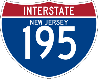
Interstate 195 (I-195) is an auxiliary route of the Interstate Highway System located in the US state of New Jersey. Its western end is at I-295 and Route 29 just south of Trenton in Hamilton Township, Mercer County, while its eastern end is at the Garden State Parkway, Route 138, and Route 34 in Wall Township, Monmouth County. I-195 is 34.17 miles (54.99 km) in length. The route is mostly a four-lane highway that mainly runs through agrarian and wooded areas in Central Jersey. It has an interchange with the New Jersey Turnpike (I-95) in Robbinsville Township and serves as a main access road to New Jersey's state capital of Trenton, the Horse Park of New Jersey, the Six Flags Great Adventure amusement park, and the Jersey Shore. I-195 is occasionally referred to as the Central Jersey Expressway. On April 6, 1988, President Ronald Reagan signed H.R. 4263 naming I-195 in New Jersey the James J. Howard Interstate Highway, in honor of the late James J. Howard.

Route 92 was a 6.7-mile (10.8 km) proposed branch of the New Jersey Turnpike that would have run from west to east, beginning at U.S. Route 1 just north of Ridge Road in South Brunswick Township, east along Route 32, to Exit 8A in Monroe Township. Route 92 was also assigned in the 1953 renumbering and by the late 1950s it was named the Princeton–Hightstown Bypass, a freeway planned to connect the Somerset Freeway in Montgomery Township, with Route 33 in East Windsor Township. In 1987, the planned Route 92 was truncated to only run east from U.S. Route 1 near Kingston. New plans were announced in 1994, this time running to US 1 near Princeton. After public hearings found opposition was still strong, the planned route was truncated to a much shorter bypass of Hightstown only and numbered Route 133. Construction on the road, the first project awarded under New Jersey's modified Design-build program, began on September 20, 1996 and was opened November 30, 1999.

U.S. Route 9 (US 9) is a United States Numbered Highway in the Northeastern U.S., running from Laurel, Delaware, north to Champlain, New York. In New Jersey, the route runs 166.80 miles (268.44 km) from the Cape May–Lewes Ferry terminal in North Cape May, Cape May County, where the ferry carries US 9 across the Delaware Bay to Lewes, Delaware, north to the George Washington Bridge in Fort Lee, Bergen County, where the route along with Interstate 95 (I-95) and US 1 continue into New York City. US 9 is the longest U.S. Highway in the state. From North Cape May north to Toms River in Ocean County, US 9 is mostly a two-lane undivided road that closely parallels the Garden State Parkway and runs near the Jersey Shore. Along this stretch, it passes through the communities of Rio Grande, Cape May Court House, Somers Point, Pleasantville, Absecon, Tuckerton, Manahawkin, Beachwood, and Berkeley Township. In the Toms River area, US 9 runs along the Garden State Parkway for a short distance before heading northwest away from it and the Jersey Shore into Lakewood Township. Upon entering Monmouth County, the route transitions into a multilane suburban divided highway and continues through Howell Township, Freehold Township, Manalapan Township, Marlboro Township, Old Bridge Township, Sayreville, and South Amboy. In Woodbridge Township, US 9 merges with US 1 and the two routes continue through northern New Jersey as US 1/9 to the George Washington Bridge.

County Route 522 is a county highway in the U.S. state of New Jersey. The highway extends 21 miles (34 km) from Route 27 in South Brunswick Township to Main Street in Freehold Borough.

U.S. Route 1 (US 1) is a U.S. Route which parallels the East Coast of the United States, running from Key West, Florida, in the south to Fort Kent, Maine, at the Canadian border in the north. Of the entire length of the route, 66.06 miles (106.31 km) of it runs through New Jersey. It enters the state from Pennsylvania on the Trenton–Morrisville Toll Bridge over the Delaware River in the state capital of Trenton, running through the city on the Trenton Freeway. From here, US 1 continues northeast as a surface divided highway through suburban areas, heading into Middlesex County and passing through New Brunswick and Edison. US 1 merges with US 9 in Woodbridge, and the two routes continue through northern New Jersey as US 1/9 to the George Washington Bridge over the Hudson River in Fort Lee. At this point, the road continues into New York City along with I-95.

