Woodstown, New Jersey

Last updated

Woodstown, New Jersey
Woodstown NJ Friends.JPG
Woodstown Friends Meetinghouse
Salem County New Jersey Incorporated and Unincorporated areas Woodstown Highlighted.svg
Woodstown highlighted in Salem County. Inset map: Salem County highlighted in the State of New Jersey.
Census Bureau map of Woodstown, New Jersey.png
Census Bureau map of Woodstown, New Jersey
Location map of Salem County, New Jersey.svg
Red pog.svg
Woodstown
Location in Salem County
USA New Jersey relief location map.svg
Red pog.svg
Woodstown
Location in New Jersey
Usa edcp relief location map.png
Red pog.svg
Woodstown
Location in the United States
Coordinates: 39°39′01″N75°19′34″W / 39.650178°N 75.326232°W / 39.650178; -75.326232 [1] [2]
Country Flag of the United States.svg  United States
State Flag of New Jersey.svg  New Jersey
County Flag placeholder.svg Salem
Incorporated July 26, 1882
Government
[3]
  Type Borough
  BodyBorough Council
   Mayor Donald Dietrich (R, term ends December 31, 2023) [4] [5]
   Municipal clerk Cynthia Dalessio [6]
Area
[7]
  Total1.61 sq mi (4.18 km2)
  Land1.57 sq mi (4.08 km2)
  Water0.04 sq mi (0.10 km2)  2.47%
  Rank437th of 565 in state
13th of 15 in county [1]
Elevation
[8]
49 ft (15 m)
Population
 (2020) [9]
  Total3,678
  Estimate 
(2022) [10]
3,701
  Rank423rd of 565 in state
7th of 15 in county [11]
  Density2,335.4/sq mi (901.7/km2)
   Rank265th of 565 in state
2nd of 15 in county [11]
Time zone UTC−05:00 (Eastern (EST))
  Summer (DST) UTC−04:00 (Eastern (EDT))
ZIP Code
08098 [12] [13]
Area code 856 exchange: 769 [14]
FIPS code 3403382720 [1] [15] [16]
GNIS feature ID0885452 [1] [17]
Website www.historicwoodstown.org

Woodstown is a borough in Salem County, in the U.S. state of New Jersey. As of the 2020 United States census, the borough's population was 3,678, [9] an increase of 173 (+4.9%) from the 2010 census count of 3,505, [18] [19] which in turn reflected an increase of 369 (+11.8%) from the 3,136 counted in the 2000 census. [20]

Contents

Woodstown was established on July 26, 1882, from portions of Pilesgrove Township based on the results of a referendum held that same day. The borough's incorporation was confirmed on March 3, 1925. [21] The borough was named for early settler Jackanias (or Jaconias) Wood. [22] [23] [24] [25]

Geography

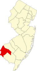
According to the United States Census Bureau, the borough had a total area of 1.62 square miles (4.18 km2), including 1.58 square miles (4.08 km2) of land and 0.04 square miles (0.10 km2) of water (2.47%). [1] [2]

The Borough of Woodstown is an independent municipality completely surrounded by Pilesgrove Township, [26] [27] making it part of 21 pairs of "doughnut towns" in the state, where one municipality entirely surrounds another. [28] Woodstown serves as the more densely settled commercial core of the paired communities, while Pilesgrove is more agricultural. [29]

Demographics

Historical population
CensusPop.Note
1880 490
1890 1,516209.4%
1900 1,371−9.6%
1910 1,61317.7%
1920 1,589−1.5%
1930 1,83215.3%
1940 2,02710.6%
1950 2,34515.7%
1960 2,94225.5%
1970 3,1376.6%
1980 3,2503.6%
1990 3,154−3.0%
2000 3,136−0.6%
2010 3,50511.8%
2020 3,6784.9%
2022 (est.)3,701 [10] 0.6%
Population sources: 1880–1890 [30]
1890–2000 [31] 1890–1920 [32]
1890–1910 [33] 1910–1930 [34]
1900–1990 [35] 2000 [36] [37]
2010 [18] [19] 2020 [9]

2010 census

The 2010 United States census counted 3,505 people, 1,444 households, and 939 families in the borough. The population density was 2,211.8 inhabitants per square mile (854.0/km2). There were 1,529 housing units at an average density of 964.9 per square mile (372.5/km2). The racial makeup was 82.25% (2,883) White, 11.44% (401) Black or African American, 0.51% (18) Native American, 1.17% (41) Asian, 0.03% (1) Pacific Islander, 1.28% (45) from other races, and 3.31% (116) from two or more races. Hispanic or Latino of any race were 5.56% (195) of the population. [18]

Of the 1,444 households, 31.6% had children under the age of 18; 45.7% were married couples living together; 15.0% had a female householder with no husband present and 35.0% were non-families. Of all households, 29.2% were made up of individuals and 12.3% had someone living alone who was 65 years of age or older. The average household size was 2.41 and the average family size was 2.99. [18]

25.2% of the population were under the age of 18, 7.2% from 18 to 24, 25.4% from 25 to 44, 27.8% from 45 to 64, and 14.5% who were 65 years of age or older. The median age was 39.0 years. For every 100 females, the population had 90.2 males. For every 100 females ages 18 and older there were 85.5 males. [18]

The Census Bureau's 2006–2010 American Community Survey showed that (in 2010 inflation-adjusted dollars) median household income was $62,958 (with a margin of error of +/− $8,239) and the median family income was $74,479 (+/− $7,727). Males had a median income of $64,688 (+/− $16,960) versus $40,781 (+/− $8,241) for females. The per capita income for the borough was $31,074 (+/− $3,576). About 3.4% of families and 8.7% of the population were below the poverty line, including 6.0% of those under age 18 and 8.5% of those age 65 or over. [38]

2000 census

As of the 2000 United States census [15] there were 3,136 people, 1,304 households, and 839 families residing in the borough. The population density was 1,975.6 inhabitants per square mile (762.8/km2). There were 1,389 housing units at an average density of 875.0 per square mile (337.8/km2). The racial makeup of the borough was 85.04% White, 12.91% African American, 0.19% Native American, 0.73% Asian, 0.26% from other races, and 0.86% from two or more races. Hispanic or Latino of any race were 1.56% of the population. [36] [37]

There were 1,304 households, out of which 30.1% had children under the age of 18 living with them, 49.5% were married couples living together, 11.5% had a female householder with no husband present, and 35.6% were non-families. 30.8% of all households were made up of individuals, and 14.5% had someone living alone who was 65 years of age or older. The average household size was 2.38 and the average family size was 3.00. [36] [37]

In the borough the population was spread out, with 24.7% under the age of 18, 6.9% from 18 to 24, 29.6% from 25 to 44, 22.3% from 45 to 64, and 16.5% who were 65 years of age or older. The median age was 38 years. For every 100 females, there were 87.0 males. For every 100 females age 18 and over, there were 83.8 males. [36] [37]

The median income for a household in the borough was $44,533, and the median income for a family was $56,328. Males had a median income of $42,175 versus $31,169 for females. The per capita income for the borough was $24,182. About 3.5% of families and 5.5% of the population were below the poverty line, including 9.0% of those under age 18 and 4.3% of those age 65 or over. [36] [37]

Government

First National Bank Woodstown NJ 1st National Bank.jpg
First National Bank
Businesses on South Main Street Woodstown NJ South Main Street.jpg
Businesses on South Main Street

Local government

Borough hall WoodstownNJboroughhall.jpg
Borough hall

Woodstown is governed under the borough form of New Jersey municipal government, which is used in 218 municipalities (of the 564) statewide, making it the most common form of government in New Jersey. [39] The governing body is comprised of the mayor and the borough council, with all positions elected at-large on a partisan basis as part of the November general election. The mayor is elected directly by the voters to a four-year term of office. The borough council is comprised of six members elected to serve three-year terms on a staggered basis, with two seats coming up for election each year in a three-year cycle. [3] The borough form of government used by Woodstown is a "weak mayor / strong council" government in which council members act as the legislative body with the mayor presiding at meetings and voting only in the event of a tie. The mayor can veto ordinances subject to an override by a two-thirds majority vote of the council. The mayor makes committee and liaison assignments for council members, and most appointments are made by the mayor with the advice and consent of the council. [40] [41]

As of 2022, the mayor of the Borough of Woodstown is Republican Don Dietrich, whose term of office ends December 31, 2023. Members of the Woodstown Borough Council are Council President Glenn Merkle (R, 2024), Heather Bobbitt (R, 2023), Jim Hackett (R, 2023), Joe Hiles (D, 2022), Bertha Hyman (D, 2022) and Kristin Nixon (R, 2024). [4] [42] [43] [44] [45]

In March 2015, the borough council selected Debbie Tierno from among three candidates nominated by the Republican municipal committee to fill the vacant seat of Fran Grenier who had resigned the previous month. [46]

Matt Perry was selected by the borough council in December 2013 from among three candidates offered by the Republican municipal committee to fill the vacant seat of Veronica Soultz who resigned from office the previous month after moving out of the borough. [47] [48]

Federal, state and county representation

Woodstown is located in the 2nd Congressional District [49] and is part of New Jersey's 3rd state legislative district. [50] [51] [52]

For the 118th United States Congress , New Jersey's 2nd congressional district is represented by Jeff Van Drew ( R , Dennis Township ). [53] New Jersey is represented in the United States Senate by Democrats Cory Booker ( Newark , term ends 2027) [54] and Bob Menendez ( Englewood Cliffs , term ends 2025). [55] [56]

For the 2024-2025 session , the 3rd Legislative District of the New Jersey Legislature is represented in the State Senate by John Burzichelli ( D , Paulsboro ) and in the General Assembly by David Bailey (D, Woodstown ) and Heather Simmons (D, Glassboro ). [57]

Salem County is governed by a five-member Board of County Commissioners who are elected at-large to serve three-year terms of office on a staggered basis, with either one or two seats coming up for election each year. At an annual reorganization meeting held in the beginning of January, the board selects a Director and a Deputy Director from among its members. [58] As of 2024, Salem County's Commissioners (with party, residence, and term-end year listed in parentheses) are:

Director Benjamin H. Laury (R, Elmer, 2024), Deputy Director Gordon J. "Mickey" Ostrum Jr. (R, Pilesgrove Township, 2024), Cordy Taylor (R, Oldmans Township, 2025), Ed Ramsey (R, Pittsgrove Township, 2026) and Daniel Timmerman (R, Elmer, 2025). [58] [59]

Constitutional officers elected on a countywide basis are: Clerk Dale A. Cross (R, Pennsville Township, 2024), [60] [61] Sheriff Charles M. Miller (R, Salem, 2024) [62] [63] and Surrogate Nicki A. Burke (D, Woodstown, 2025). [64] [65]

Politics

As of March 2011, there were a total of 2,340 registered voters in Woodstown, of which 664 (28.4% vs. 30.6% countywide) were registered as Democrats, 573 (24.5% vs. 21.0%) were registered as Republicans and 1,099 (47.0% vs. 48.4%) were registered as Unaffiliated. There were 4 voters registered as Libertarians or Greens. [66] Among the borough's 2010 Census population, 66.8% (vs. 64.6% in Salem County) were registered to vote, including 89.2% of those ages 18 and over (vs. 84.4% countywide). [66] [67]

In the 2012 presidential election, Democrat Barack Obama received 51.7% of the vote (886 cast), ahead of Republican Mitt Romney with 46.2% (792 votes), and other candidates with 2.1% (36 votes), among the 1,728 ballots cast by the borough's 2,497 registered voters (14 ballots were spoiled), for a turnout of 69.2%. [68] [69] In the 2008 presidential election, Democrat Barack Obama received 936 votes (52.3% vs. 50.4% countywide), ahead of Republican John McCain with 821 votes (45.8% vs. 46.6%) and other candidates with 19 votes (1.1% vs. 1.6%), among the 1,791 ballots cast by the borough's 2,340 registered voters, for a turnout of 76.5% (vs. 71.8% in Salem County). [70] In the 2004 presidential election, Republican George W. Bush received 818 votes (50.8% vs. 52.5% countywide), ahead of Democrat John Kerry with 766 votes (47.5% vs. 45.9%) and other candidates with 11 votes (0.7% vs. 1.0%), among the 1,611 ballots cast by the borough's 2,241 registered voters, for a turnout of 71.9% (vs. 71.0% in the whole county). [71]

In the 2013 gubernatorial election, Republican Chris Christie received 62.9% of the vote (704 cast), ahead of Democrat Barbara Buono with 34.6% (387 votes), and other candidates with 2.5% (28 votes), among the 1,132 ballots cast by the borough's 2,472 registered voters (13 ballots were spoiled), for a turnout of 45.8%. [72] [73] In the 2009 gubernatorial election, Republican Chris Christie received 522 votes (45.4% vs. 46.1% countywide), ahead of Democrat Jon Corzine with 489 votes (42.5% vs. 39.9%), Independent Chris Daggett with 108 votes (9.4% vs. 9.7%) and other candidates with 19 votes (1.7% vs. 2.0%), among the 1,150 ballots cast by the borough's 2,361 registered voters, yielding a 48.7% turnout (vs. 47.3% in the county). [74]

Education

Woodstown High School WoodstownNJHighSchool.jpg
Woodstown High School

The Woodstown-Pilesgrove Regional School District serves public school students in pre-kindergarten through twelfth grade from Woodstown and Pilesgrove Township. [75] As of the 2020–21 school year, the district, comprised of four schools, had an enrollment of 1,425 students and 126.5 classroom teachers (on an FTE basis), for a student–teacher ratio of 11.3:1. [76] Schools in the district (with 2020–21 enrollment data from the National Center for Education Statistics [77] ) are William Roper Early Childhood Learning Center [78] with 83 students in grades PreK-K, Mary S. Shoemaker Elementary School [79] with 470 students in grades 1-5, Woodstown Middle School [80] with 278 students in grades 6-8 and Woodstown High School [81] with 579 students in grades 9-12. [82] [83] [84] Students from neighboring Alloway Township, Oldmans Township and Upper Pittsgrove Township attend the high school as part of sending/receiving relationships. [85] [86] A majority of public school students in grades 9–12 from Oldmans Township attend Penns Grove High School as part of a sending/receiving relationship with the Penns Grove-Carneys Point Regional School District, with the balance attending Woodstown High School. [87]

Transportation

U.S. Route 40 and Route 45 serve Woodstown 2018-08-15 15 51 21 View east along U.S. Route 40 and north along New Jersey State Route 45 (West Street) at Spring Garden Street in Woodstown, Salem County, New Jersey.jpg
U.S. Route 40 and Route 45 serve Woodstown

Roads and highways

As of May 2010, the borough had a total of 18.28 miles (29.42 km) of roadways, of which 11.51 miles (18.52 km) were maintained by the municipality, 4.66 miles (7.50 km) by Salem County, and 2.11 miles (3.40 km) by the New Jersey Department of Transportation. [88]

U.S. Route 40 traverses the borough roughly east to west [89] and Route 45 roughly south to north. [90]

Public transportation

NJ Transit provides bus service between Salem and Philadelphia on the 401 route, with local service offered on the 468 route operating between Penns Grove and Woodstown. [91] [92]

The 18.6 miles (29.9 km) southern portion of the freight rail Salem Branch operated under contract by Southern Railroad of New Jersey runs through the borough.[ citation needed ]

Notable people

People who were born in, residents of, or otherwise closely associated with Woodstown include:

Related Research Articles

<span class="mw-page-title-main">South Harrison Township, New Jersey</span> Township in Gloucester County, New Jersey, United States

South Harrison Township is a township in Gloucester County, in the U.S. state of New Jersey. As of the 2020 United States census, the township's population was 3,395, an increase of 233 (+7.4%) from the 2010 census count of 3,162, which in turn reflected an increase of 745 (+30.8%) from the 2,417 counted in the 2000 census.

<span class="mw-page-title-main">Alloway Township, New Jersey</span> Township in Salem County, New Jersey, United States

Alloway Township is a township in Salem County, in the U.S. state of New Jersey. As of the 2020 United States census, the township's population was 3,283, a decrease of 184 (−5.3%) from the 2010 census count of 3,467, which in turn reflected an increase of 693 (+25.0%) from the 2,774 counted in the 2000 census.

<span class="mw-page-title-main">Carneys Point Township, New Jersey</span> Township in Salem County, New Jersey, United States

Carneys Point Township is a township in Salem County, in the U.S. state of New Jersey. As of the 2020 United States census, the township's population was 8,637, an increase of 588 (+7.3%) from the 2010 census count of 8,049, which in turn reflected an increase of 365 (+4.8%) from the 7,684 counted in the 2000 census.

<span class="mw-page-title-main">Elmer, New Jersey</span> Borough in Salem County, New Jersey, United States

Elmer is a borough in Salem County in the U.S. state of New Jersey. As of the 2020 United States census, the borough's population was 1,347, a decrease of 48 (−3.4%) from the 2010 census count of 1,395, which in turn reflected an increase of 11 (+0.8%) from the 1,384 counted in the 2000 census. It is the home of the annual Appel Farm Arts and Music Festival, which celebrated its 23rd year in 2012.

<span class="mw-page-title-main">Elsinboro Township, New Jersey</span> Township in Salem County, New Jersey, United States

Elsinboro Township is a township in Salem County, in the U.S. state of New Jersey. As of the 2020 United States census, the township's population was 1,001, a decrease of 35 (−3.4%) from the 2010 census count of 1,036, which in turn reflected a decline of 56 (−5.1%) from the 1,092 counted in the 2000 census.

<span class="mw-page-title-main">Lower Alloways Creek Township, New Jersey</span> Township in Salem County, New Jersey, United States

Lower Alloways Creek Township is a township in Salem County, in the U.S. state of New Jersey. As of the 2020 United States census, the township's population was 1,717, a decrease of 53 (−3.0%) from the 2010 census count of 1,770, which in turn reflected a decline of 81 (−4.4%) from the 1,851 counted in the 2000 census.

<span class="mw-page-title-main">Mannington Township, New Jersey</span> Township in Salem County, New Jersey, United States

Mannington Township is a township in Salem County, in the U.S. state of New Jersey. As of the 2020 United States census, the township's population was 1,475, a decrease of 331 (−18.3%) from the 2010 census count of 1,806, which in turn reflected an increase of 247 (+15.8%) from the 1,559 counted in the 2000 census.

<span class="mw-page-title-main">Oldmans Township, New Jersey</span> Township in Salem County, New Jersey, United States

Oldmans Township is a township in Salem County, in the U.S. state of New Jersey. As of the 2020 United States census, the township's population was 1,910, an increase of 137 (+7.7%) from the 2010 census count of 1,773, which in turn reflected a decline of 25 (−1.4%) from the 1,798 counted in the 2000 census.

<span class="mw-page-title-main">Penns Grove, New Jersey</span> Borough in Salem County, New Jersey, United States

Penns Grove is a borough in Salem County, in the U.S. state of New Jersey. As of the 2020 United States census, the borough's population was 4,837, a decrease of 310 (−6.0%) from the 2010 census count of 5,147, which in turn reflected an increase of 261 (+5.3%) from the 4,886 counted in the 2000 census.

<span class="mw-page-title-main">Pennsville Township, New Jersey</span> Township in Salem County, New Jersey, United States

Pennsville Township is a township in Salem County, in the U.S. state of New Jersey. The township is named for William Penn. The township includes the state's westernmost point. As of the 2020 United States census, the township's population was 12,684, a decrease of 725 (−5.4%) from the 2010 census count of 13,409, which in turn reflected an increase of 215 (+1.6%) from the 13,194 counted in the 2000 census.

<span class="mw-page-title-main">Pilesgrove Township, New Jersey</span> Township in Salem County, New Jersey, United States

Pilesgrove Township is a township in Salem County, in the U.S. state of New Jersey. As of the 2020 United States census, the township's population was 4,183, an increase of 167 (+4.2%) from the 2010 census count of 4,016, which in turn reflected an increase of 93 (+2.4%) from the 3,923 counted in the 2000 census.

<span class="mw-page-title-main">Pittsgrove Township, New Jersey</span> Township in Salem County, New Jersey, United States

Pittsgrove Township is a township in Salem County, in the U.S. state of New Jersey. As of the 2020 United States census, the township's population was 8,777, a decrease of 616 (−6.6%) from the 2010 census count of 9,393, which in turn reflected an increase of 500 (+5.6%) from the 8,893 counted in the 2000 census.

<span class="mw-page-title-main">Quinton Township, New Jersey</span> Township in Salem County, New Jersey, United States

Quinton Township is a township in Salem County, in the U.S. state of New Jersey. As of the 2020 United States census, the township's population was 2,580, a decrease of 86 (−3.2%) from the 2010 census count of 2,666, which in turn reflected a decline of 120 (−4.3%) from the 2,786 counted in the 2000 census.

<span class="mw-page-title-main">Salem, New Jersey</span> City in Salem County, New Jersey, United States

Salem is a city in Salem County, in the U.S. state of New Jersey. It is the county seat of Salem County, the state's most rural county. The name Salem, for both the city and county, is derived from the Hebrew word shalom, meaning peace. As of the 2020 United States census, the city's population was 5,296, an increase of 150 (+2.9%) from the 2010 census count of 5,146, which in turn reflected a decrease of 711 (−12.1%) from the 5,857 counted in the 2000 census. Salem is part of the Delaware Valley or Philadelphia greater metropolitan area.

<span class="mw-page-title-main">Upper Pittsgrove Township, New Jersey</span> Township in Salem County, New Jersey, United States

Upper Pittsgrove Township is a township in Salem County, in the U.S. state of New Jersey. As of the 2020 United States census, the township's population was 3,432, a decrease of 73 (−2.1%) from the 2010 census count of 3,505, which in turn reflected an increase of 37 (+1.1%) from the 3,468 counted in the 2000 census.

The Woodstown-Pilesgrove Regional School District is a comprehensive regional public school district serving students in pre-kindergarten through twelfth grade form five communities in Salem County, New Jersey, United States. The district serves students from Woodstown and Pilesgrove Township for K-12, along with students from neighboring Alloway Township, Oldmans Township and Upper Pittsgrove Township who attend the district's high school as part of sending/receiving relationships. A majority of public school students in grades 9-12 from Oldmans Township attend Penns Grove High School as part of a sending/receiving relationship with the Penns Grove-Carneys Point Regional School District, with the balance attending Woodstown High School.

<span class="mw-page-title-main">Woodstown High School</span> High school in Salem County, New Jersey, United States

Woodstown High School is a comprehensive community public high school that serves students in ninth through twelfth grade from Woodstown and Pilesgrove Township, in Salem County, in the U.S. state of New Jersey, operating as the lone secondary school of the Woodstown-Pilesgrove Regional School District.

The Alloway Township School District is a public school district that serves students in pre-kindergarten through eighth grade from Alloway Township in Salem County, in the U.S. state of New Jersey.

The Oldmans Township School District is a community public school district that serves students in kindergarten through eighth grade from Oldmans Township in Salem County, New Jersey, United States.

The Upper Pittsgrove School District is a community public school district that serves students in pre-kindergarten through eighth grade from Upper Pittsgrove Township, in Salem County, in the U.S. state of New Jersey.

References

  1. 1 2 3 4 5 2019 Census Gazetteer Files: New Jersey Places, United States Census Bureau. Accessed July 1, 2020.
  2. 1 2 US Gazetteer files: 2010, 2000, and 1990, United States Census Bureau. Accessed September 4, 2014.
  3. 1 2 2012 New Jersey Legislative District Data Book, Rutgers University Edward J. Bloustein School of Planning and Public Policy, March 2013, p. 19.
  4. 1 2 Mayor and Council Members, Woodstown Borough. Accessed April 24, 2022.
  5. 2023 New Jersey Mayors Directory, New Jersey Department of Community Affairs, updated February 8, 2023. Accessed February 10, 2023.
  6. Borough Clerk, Borough of Woodstown. Accessed April 24, 2022.
  7. "ArcGIS REST Services Directory". United States Census Bureau. Retrieved October 11, 2022.
  8. U.S. Geological Survey Geographic Names Information System: Borough of Woodstown, Geographic Names Information System. Accessed March 14, 2013.
  9. 1 2 3 Total Population: Census 2010 - Census 2020 New Jersey Municipalities, New Jersey Department of Labor and Workforce Development. Accessed December 1, 2022.
  10. 1 2 Annual Estimates of the Resident Population for Minor Civil Divisions in New Jersey: April 1, 2020 to July 1, 2022, United States Census Bureau, released May 2023. Accessed May 18, 2023.
  11. 1 2 Population Density by County and Municipality: New Jersey, 2020 and 2021, New Jersey Department of Labor and Workforce Development. Accessed March 1, 2023.
  12. Look Up a ZIP Code for Woodstown, NJ, United States Postal Service. Accessed June 30, 2012.
  13. Zip Codes, State of New Jersey. Accessed September 1, 2013.
  14. Area Code Lookup - NPA NXX for Woodstown, NJ, Area-Codes.com. Accessed September 1, 2013.
  15. 1 2 U.S. Census website, United States Census Bureau. Accessed September 4, 2014.
  16. Geographic Codes Lookup for New Jersey, Missouri Census Data Center. Accessed April 1, 2022.
  17. US Board on Geographic Names, United States Geological Survey. Accessed September 4, 2014.
  18. 1 2 3 4 5 DP-1 - Profile of General Population and Housing Characteristics: 2010 Demographic Profile Data for Woodstown borough, Salem County, New Jersey Archived February 12, 2020, at archive.today , United States Census Bureau. Accessed May 17, 2012.
  19. 1 2 Table DP-1. Profile of General Demographic Characteristics: 2010 for Woodstown borough Archived July 30, 2013, at the Wayback Machine , New Jersey Department of Labor and Workforce Development. Accessed May 17, 2012.
  20. Table 7. Population for the Counties and Municipalities in New Jersey: 1990, 2000 and 2010, New Jersey Department of Labor and Workforce Development, February 2011. Accessed May 1, 2023.
  21. Snyder, John P. The Story of New Jersey's Civil Boundaries: 1606–1968, Bureau of Geology and Topography; Trenton, New Jersey; 1969. p. 218. Accessed May 17, 2012.
  22. Hutchinson, Viola L. The Origin of New Jersey Place Names, New Jersey Public Library Commission, May 1945. Accessed November 8, 2015.
  23. Gannett, Henry. The Origin of Certain Place Names in the United States, p. 330. United States Government Printing Office, 1905. Accessed November 8, 2015.
  24. Raum, John O. The History of New Jersey: From Its Earliest Settlement to the Present Time, Volume 1, p. 255, J. E. Potter and company, 1877. Accessed November 8, 2015. "Woodstown was early settled by Jackanias Wood, from whom its name is derived."
  25. Town and County Names, Visit Salem County. Accessed November 8, 2015. "Woodstown: Pilesgrove Township In 1797 called Woodsboro. The town was named, it is said, for Jaconias Wood, who built the first house there."
  26. Salem County Map, Coalition for a Healthy NJ. Accessed March 5, 2020.
  27. New Jersey Municipal Boundaries, New Jersey Department of Transportation. Accessed November 15, 2019.
  28. DeMarco, Megan. "Voters to decide whether to merge two Princetons into one", The Star-Ledger , November 3, 2011. Accessed January 8, 2017. "There are 22 sets of 'doughnut towns' in New Jersey, those where one town wraps around the other town". Note that following voter approval of the Princeton merger, 21 pairs of "doughnut towns" remain.
  29. Environmental Resource Inventory for the Borough of Woodstown and the Township of Pilesgrove, Salem County, New Jersey, Delaware Valley Regional Planning Commission, September 2005. Accessed November 8, 2015. "Woodstown is representative of a 19th century commercial center, which supported its agricultural hinterlands and linked to other commercial centers of varying size from Salem City in the south to Camden City in the north.... Since Woodstown is surrounded by Pilesgrove and is considerably denser, the borough's population has remained stable over the last decade."
  30. Report on Population of the United States at the Eleventh Census: 1890. Part I, p. 239. United States Census Bureau, 1895. Accessed October 20, 2016.
  31. Barnett, Bob. Population Data for Salem County Municipalities, 1810 - 2000, WestJersey.org, January 6, 2011. Accessed February 9, 2013.
  32. Compendium of censuses 1726–1905: together with the tabulated returns of 1905, New Jersey Department of State, 1906. Accessed September 1, 2013.
  33. Thirteenth Census of the United States, 1910: Population by Counties and Minor Civil Divisions, 1910, 1900, 1890, United States Census Bureau, p. 338. Accessed February 9, 2013.
  34. Fifteenth Census of the United States : 1930 - Population Volume I, United States Census Bureau, p. 718. Accessed February 9, 2013.
  35. Table 6: New Jersey Resident Population by Municipality: 1940 - 2000, Workforce New Jersey Public Information Network, August 2001. Accessed May 1, 2023.
  36. 1 2 3 4 5 Census 2000 Profiles of Demographic / Social / Economic / Housing Characteristics for Woodstown borough, New Jersey Archived January 12, 2016, at the Wayback Machine , United States Census Bureau. Accessed December 2, 2012.
  37. 1 2 3 4 5 DP-1: Profile of General Demographic Characteristics: 2000 - Census 2000 Summary File 1 (SF 1) 100-Percent Data for Woodstown borough, Salem County, New Jersey Archived February 12, 2020, at archive.today , United States Census Bureau. Accessed December 2, 2012.
  38. DP03: Selected Economic Characteristics from the 2006–2010 American Community Survey 5-Year Estimates for Woodstown borough, Salem County, New Jersey Archived February 12, 2020, at archive.today , United States Census Bureau. Accessed May 17, 2012.
  39. Inventory of Municipal Forms of Government in New Jersey, Rutgers University Center for Government Studies, July 1, 2011. Accessed June 1, 2023.
  40. Cerra, Michael F. "Forms of Government: Everything You've Always Wanted to Know, But Were Afraid to Ask" Archived September 24, 2014, at the Wayback Machine , New Jersey State League of Municipalities. Accessed November 30, 2014.
  41. "Forms of Municipal Government in New Jersey", p. 6. Rutgers University Center for Government Studies. Accessed June 1, 2023.
  42. 2022 Municipal Data Sheet, Woodstown Borough. Accessed August 14, 2022.
  43. Election Summary Report General Election Salem County November 2, 2021 Official Results Report, Salem County, New Jersey, updated November 15, 2021. Accessed January 1, 2022.
  44. Election Summary Report Salem County NJ General Election November 3, 2020 Official Report, Salem County, New Jersey, updated November 25, 2020. Accessed January 1, 2021.
  45. November 5, 2019 Summary Report Salem County, NJ Official Results, Salem County, New Jersey Clerk, updated November 18, 2019. Accessed January 1, 2020.
  46. Wehner, Brittany M. "Woodstown officials appoint new councilwoman to fill vacant seat", NJ.com, March 11, 2015. Accessed June 20, 2015. "Woodstown Borough Council unanimously approved a new council member Tuesday night to fill the recently vacated seat.Republican Debbie Tierno was appointed councilwoman to take over a vacant seat after Councilman Fran Grenier resigned last month."
  47. Staff. "Councilman Matt Perry sworn in to fill the remainder of former councilwoman's term", Jersey Tribune, December 2, 2013. Accessed September 21, 2014. "Following the resignation of councilwoman Veronica Soultz, borough officials swore in the new councilman at the recent meeting. Matt Perry was sworn in last Tuesday to finish Soultz's term."
  48. Wehner, Brittany M. "Woodstown Councilwoman resigns, officials approve replacement", South Jersey Times , November 19, 2013. Accessed September 21, 2014. "Republican Veronica Soultz, formerly of Woodstown, stepped down at the last council meeting for personal reasons, she said.... Three potential Republican replacement candidates were named including John Hathaway, Matt Perry, and former councilman and mayor Rick Pfeffer. Borough council unanimously approved Matt Perry to fill the vacancy, with the exception of Soultz, who abstained from the vote."
  49. Plan Components Report, New Jersey Redistricting Commission, December 23, 2011. Accessed February 1, 2020.
  50. Municipalities Sorted by 2011-2020 Legislative District, New Jersey Department of State. Accessed February 1, 2020.
  51. 2019 New Jersey Citizen's Guide to Government, New Jersey League of Women Voters. Accessed October 30, 2019.
  52. Districts by Number for 2011–2020, New Jersey Legislature. Accessed January 6, 2013.
  53. Directory of Representatives: New Jersey, United States House of Representatives. Accessed January 3, 2019.
  54. U.S. Sen. Cory Booker cruises past Republican challenger Rik Mehta in New Jersey, PhillyVoice. Accessed April 30, 2021. "He now owns a home and lives in Newark's Central Ward community."
  55. Biography of Bob Menendez, United States Senate, January 26, 2015. "Menendez, who started his political career in Union City, moved in September from Paramus to one of Harrison's new apartment buildings near the town's PATH station.."
  56. Home, sweet home: Bob Menendez back in Hudson County. nj.com. Accessed April 30, 2021. "Booker, Cory A. - (D - NJ) Class II; Menendez, Robert - (D - NJ) Class I"
  57. Legislative Roster for District 3, New Jersey Legislature. Accessed January 9, 2024.
  58. 1 2 County Commissioners, Salem County, New Jersey. Accessed May 1, 2022.
  59. 2021 County Data Sheet, Salem County, New Jersey. Accessed May 1, 2022.
  60. About, Salem County Clerk's Office. Accessed May 1, 2022.
  61. Clerks, Constitutional Officers Association of New Jersey. Accessed June 20, 2022.
  62. Home Page, Salem County Sheriff's Office. Accessed May 1, 2022.
  63. Sheriffs, Constitutional Officers Association of New Jersey. Accessed June 20, 2022.
  64. Surrogate's Court, Salem County, New Jersey. Accessed May 1, 2022.
  65. Surrogates, Constitutional Officers Association of New Jersey. Accessed June 20, 2022.
  66. 1 2 Voter Registration Summary - Salem, New Jersey Department of State Division of Elections, March 23, 2011. Accessed February 8, 2013.
  67. GCT-P7: Selected Age Groups: 2010 - State -- County Subdivision; 2010 Census Summary File 1 for New Jersey Archived February 12, 2020, at archive.today , United States Census Bureau. Accessed February 8, 2013.
  68. "Presidential General Election Results - November 6, 2012 - Salem County" (PDF). New Jersey Department of Elections. March 15, 2013. Retrieved December 24, 2014.
  69. "Number of Registered Voters and Ballots Cast - November 6, 2012 - General Election Results - Salem County" (PDF). New Jersey Department of Elections. March 15, 2013. Retrieved December 24, 2014.
  70. 2008 Presidential General Election Results: Salem County, New Jersey Department of State Division of Elections, December 23, 2008. Accessed February 8, 2013.
  71. 2004 Presidential Election: Salem County, New Jersey Department of State Division of Elections, December 13, 2004. Accessed February 8, 2013.
  72. "Governor - Salem County" (PDF). New Jersey Department of Elections. January 29, 2014. Retrieved December 24, 2014.
  73. "Number of Registered Voters and Ballots Cast - November 5, 2013 - General Election Results - Salem County" (PDF). New Jersey Department of Elections. January 29, 2014. Retrieved December 24, 2014.
  74. 2009 Governor: Salem County Archived October 17, 2012, at the Wayback Machine , New Jersey Department of State Division of Elections, December 31, 2009. Accessed February 8, 2013.
  75. Woodstown-Pilesgrove Regional Board of Education District Policy 0110 - Identification, Woodstown-Pilesgrove Regional School District. Accessed February 11, 2021. "Purpose The Board of Education exists for the purpose of providing a thorough and efficient system of free public education in grades Pre-Kindergarten through twelve in the Woodstown-Pilesgrove Regional School District. Composition The Woodstown-Pilesgrove Regional School District is comprised of all the area within the municipal boundaries of the Borough of Woodstown, Township of Pilesgrove, Alloway Township and Upper Pittsgrove Township."
  76. District information for Woodstown-Pilesgrove Regional School District, National Center for Education Statistics. Accessed February 15, 2022.
  77. School Data for the Woodstown-Pilesgrove Regional School District, National Center for Education Statistics. Accessed February 15, 2022.
  78. William Roper Early Childhood Learning Center, Woodstown-Pilesgrove Regional School District. Accessed August 14, 2022.
  79. Mary S. Shoemaker Elementary School, Woodstown-Pilesgrove Regional School District. Accessed August 14, 2022.
  80. Woodstown Middle School, Woodstown-Pilesgrove Regional School District. Accessed August 14, 2022.
  81. Woodstown High School, Woodstown-Pilesgrove Regional School District. Accessed August 14, 2022.
  82. About Us, Woodstown-Pilesgrove Regional School District. Accessed August 14, 2022. "Located in Salem County, the Woodstown-Pilesgrove Regional School District consists of four schools: Early Childhood Learning Center (grades Pre-Kindergarten and Kindergarten), Mary S. Shoemaker Elementary School (grades 1 through 5), Woodstown Middle School (grades 6 through 8), and Woodstown High School (grades 9 through 12). All four schools serve the residents of the Borough of Woodstown and Township of Pilesgrove. In addition, the high school receives students from Alloway and Upper Pittsgrove Townships as well as a portion of Oldmans Township."
  83. School Performance Reports for the Woodstown-Pilesgrove Regional School District, New Jersey Department of Education. Accessed August 14, 2022.
  84. New Jersey School Directory for the Woodstown-Pilesgrove Regional School District, New Jersey Department of Education. Accessed December 29, 2016.
  85. Woodstown-Pilesgrove Regional School District 2016 Report Card Narrative, New Jersey Department of Education. Accessed March 12, 2020. "It is my pleasure to present to you the 2015-2016 New Jersey School Report Card for the Woodstown-Pilesgrove Regional School District. This School Report Card provides the school district’s constituents with information concerning the district’s programs, including test scores, attendance data of students and staff, financial details, and other specifics which together form a comprehensive review of our school district’s offerings to the Woodstown-Pilesgrove community as well as the high school sending districts of Alloway, Oldmans, and Upper Pittsgrove. Leadership and oversight of the Woodstown-Pilesgrove Regional School District begins with the Board of Education."
  86. About Us, Woodstown-Pilesgrove Regional School District. Accessed March 12, 2020. "All four schools serve the residents of the Borough of Woodstown and Township of Pilesgrove. In addition, the high school receives students from Alloway and Upper Pittsgrove Townships as well as a portion of Oldmans Township."
  87. Bumpus, Robert L. "Salem County Report on Consolidation and Regionalization", Office of the Executive County Superintendent of Salem County, March 15, 2010, available at the website of the Asbury Park Press . Accessed July 5, 2011. "A contiguous elementary district, Oldmans Township, sends its students primarily to Penns Grove High School and a smaller number of students to Woodstown High School."
  88. Salem County Mileage by Municipality and Jurisdiction, New Jersey Department of Transportation, May 2010. Accessed October 31, 2013.
  89. U.S. Route 40 Straight Line Diagram, New Jersey Department of Transportation, May 2009. Accessed October 31, 2013.
  90. Route 45 Straight Line Diagram, New Jersey Department of Transportation, January 2010. Accessed October 31, 2013.
  91. Salem County Bus / Rail Connections, NJ Transit, backed up by the Internet Archive as of January 28, 2010. Accessed January 16, 2013.
  92. South Jersey Transit Guide Archived September 29, 2018, at the Wayback Machine , Cross County Connection, as of April 1, 2010. Accessed September 21, 2014.
  93. Dailey, Jennifer. "Woodstown native Teyona Anderson wins America's Next Top Model competition", South Jersey Times , May 14, 2009, updated April 1, 2019. Accessed February 25, 2021. "After weeks of photo shoots and challenges, Woodstown, New Jersey, native Teyona Anderson is America's next top model."
  94. "Memorial Hospital of Salem elects three new board members", NJ Advance Media for NJ.com, January 26, 2016. Accessed January 10, 2024. "A lifelong resident of Salem County, Bailey was born and raised on the Ranch Hope campus, graduated from Woodstown High School and currently resides in Woodstown, with his wife, Julie, and three children."
  95. Isaac Ambrose Barber, Biographical Directory of the United States Congress . Accessed May 14, 2008.
  96. Roncace, Kelly. "Woodstown native Mario Cerrito visits high school to discuss filmmaking", NJ Advance Media for NJ.com, May 10, 2014. Accessed December 10, 2022. "When Kranz read that 2002 Woodstown High School graduate Mario Cerrito had recently completed filming his first feature, Deadly Gamble, he reached out to the writer/director/producer and asked him to visit the academy students."
  97. Isaiah Dunn Clawson, Biographical Directory of the United States Congress . Accessed August 25, 2007.
  98. All-Conference.pdf "Men's Basketball All-Conference Team", New Jersey Athletic Conference, March 4, 1992. Accessed February 1, 2017.
  99. Lambert, Bruce. "Rachel D. DuBois, 101, Educator Who Promoted Value of Diversity", The New York Times , April 1, 1993. Accessed February 4, 2017. "Rachel Davis DuBois, an educator who 60 years ago developed multicultural programs promoting respect for ethnic heritage and harmony between groups, died Tuesday at a hospital near her home in Woodstown, N.J. She was 101."
  100. Hilly Flitcraft, Baseball Almanac. Accessed October 31, 2013. "Hilly Flitcraft was born on Tuesday, August 21, 1923, in Woodstown, New Jersey. Flitcraft was 19 years old when he broke into the big leagues on August 31, 1942, with the Philadelphia Phillies."
  101. Petersen, William John. The Story of Iowa: The Progress of an American State, Volume 4, p. 886. Lewis Historical Publishing Company, 1952. Accessed October 31, 2013. "Elwood Lindsay Haines was graduated from the high school at Woodstown, New Jersey, in 1912, after which he entered the University of Pennsylvania, where he obtained the degree of Bachelor of Arts, graduating in the class of 1916."
  102. "Major General Irving L. Halter Jr.", United States Air Force. Accessed June 8, 2015. "General Halter is a native of southern New Jersey, graduating from Woodstown High School in 1973."
  103. Sullivan, Kita S. "Mania of mixed martial arts hits N.J. with 2 area fighters", The Philadelphia Inquirer , July 14, 2007. Accessed February 9, 2013. "LaRosa, a 135-pounder from Woodstown, N.J., is the top-ranked MMA fighter. The 29-year-old is a former wrestling, judoka and field hockey athlete with a 13-1-0 record in mixed martial arts."
  104. Everett Shinn, Smithsonian American Art Museum. Accessed October 31, 2013.
  105. "One of Eight", Time , March 11, 1935. Accessed May 14, 2008. "Others of 'The Eight' may have been better artists but none, including the late, lusty George Luks, had a more adventurous life than Everett Shinn. A fat little Quaker boy in Woodstown, N. J., he was known as 'Pud' (pudding) to his contemporaries."