Pedricktown, New Jersey | |
|---|---|
 First Baptist Church in the community | |
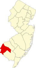
 Pedricktown Location in Salem County  Pedricktown Location in New Jersey  Pedricktown Location in the United States | |
| Coordinates: 39°45′59″N75°24′27″W / 39.76643°N 75.407591°W [1] [2] | |
| Country | |
| State | |
| County | Salem |
| Township | Oldmans |
| Area | |
• Total | 1.83 sq mi (4.73 km2) |
| • Land | 1.74 sq mi (4.51 km2) |
| • Water | 0.085 sq mi (0.22 km2) 0.21% |
| Elevation | 9.8 ft (3 m) |
| Population | |
• Total | 487 |
| • Density | 279.6/sq mi (107.97/km2) |
| Time zone | UTC−05:00 (Eastern (EST)) |
| • Summer (DST) | UTC−04:00 (Eastern (EDT)) |
| ZIP Code | 08067 [6] |
| Area code | 856 |
| FIPS code | 34-57360 [7] [8] |
| GNIS feature ID | 02584016 [9] |
Pedricktown is an unincorporated community and census-designated place (CDP) [10] located within Oldmans Township, in Salem County, in the U.S. state of New Jersey. [11] [12] [13] [14] As of the 2010 United States census, the CDP's population was 524. [15] The area is served as United States Postal Service ZIP Code 08067.