Auburn, New Jersey | |
|---|---|
 Southbound CR 551 in Auburn | |
| Coordinates: 39°42′39″N75°22′3″W / 39.71083°N 75.36750°W | |
| Country | |
| State | |
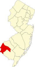
| County | Salem |
| Townships | Oldmans Pilesgrove |
| Area | |
• Total | 4.30 sq mi (11.13 km2) |
| • Land | 4.25 sq mi (11.01 km2) |
| • Water | 0.046 sq mi (0.12 km2) |
| Elevation | 77 ft (23 m) |
| Population | |
• Total | 1,057 |
| • Density | 248.6/sq mi (96.00/km2) |
| Time zone | UTC−05:00 (Eastern (EST)) |
| • Summer (DST) | UTC−04:00 (EDT) |
| ZIP Codes | |
| Area code | 856 |
| FIPS code | 34-02170 [4] |
| GNIS feature ID | 2806229 [2] |


Auburn is an unincorporated community and census-designated place (CDP) [5] in Salem County, in the U.S. state of New Jersey. It encompasses the Auburn section of Oldmans Township and extends southeast to include rural and semi-suburban land in Pilesgrove Township.[ citation needed ]
Contents
It is in northern Salem County, bordered to the northeast by Oldmans Creek, which separates the community from Woolwich Township in Gloucester County. The New Jersey Turnpike passes through the northern part of the CDP, just south of Auburn village. The nearest turnpike access is 7 miles (11 km) to the southwest at the southern terminus of the highway near the Delaware Memorial Bridge, or 6 miles (10 km) to the northeast at Exit 2 near Swedesboro.
Auburn was first listed as a CDP prior to the 2020 census. [2] As of the 2020 census, its population was 1,057. [6]