
A ZIP Code is a system of postal codes used by the United States Postal Service (USPS). Introduced on July 1, 1963, the basic format consisted of five digits. In 1983, an extended ZIP+4 code was introduced; it included the five digits of the ZIP Code, followed by a hyphen and four digits that designated a more specific location.
Deerfield is an unincorporated community and census-designated place within Upper Deerfield Township, Cumberland County, New Jersey, United States. It was first listed as a CDP in the 2020 census with a population of 230.
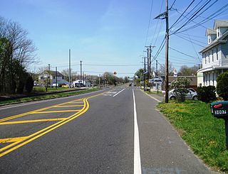
Pedricktown is an unincorporated community and census-designated place (CDP) located within Oldmans Township, in Salem County, New Jersey, United States. As of the 2010 United States Census, the CDP's population was 524. The area is served as United States Postal Service ZIP code 08067.
Monroeville is an unincorporated community located within portions of Elk Township in Gloucester County and Upper Pittsgrove Township in Salem County, New Jersey, United States. The area is served as United States Postal Service ZIP Code 08343. Monroeville is mostly filled with wooded areas and farms.
Masonville is an unincorporated community located within Mount Laurel Township, Burlington County, New Jersey, United States. Located east of Moorestown, the community of Masonville was developed when a highway was built in 1794. Major roads in Masonville include County Route 537 and Route 38.
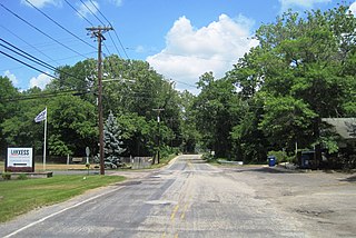
Birmingham is an unincorporated community located within Pemberton Township in Burlington County, New Jersey, United States. As of the 2010 United States Census, the ZIP Code Tabulation Area for ZIP Code 08011 had a population of 33. Though sparsely populated, it houses a post office and a Lanxess chemical facility.

Baptistown is an unincorporated community located within Kingwood Township, in Hunterdon County, New Jersey, United States. Baptistown is located on New Jersey Route 12, approximately three miles (4.8 km) east of Frenchtown. The township's municipal offices are located in Baptistown just north of the center of the community.

Little York is an unincorporated community located along the border of Alexandria and Holland townships in Hunterdon County, New Jersey, United States. Little York is located on County Route 614 3.1 miles (5.0 km) north-northeast of Milford. Little York has a post office with ZIP code 08834.

Wallpack Center is an unincorporated community located within Walpack Township, Sussex County, New Jersey, United States. Wallpack Center is located in the Flat Brook Valley 6.7 miles (10.8 km) west of Branchville. Wallpack Center has a post office with ZIP code 07881. It is now part of the Delaware Water Gap National Recreation Area.

Greendell is an unincorporated community located within Green Township, in Sussex County, New Jersey, United States. Greendell is 4.2 miles (6.8 km) west of Andover. Greendell has a post office with ZIP code 07839.
Ironia is an unincorporated community located within Randolph Township, in Morris County, New Jersey, United States. Ironia is 5.4 miles (8.7 km) southwest of Dover. Ironia has a post office with ZIP code 07845.
Middleville is an unincorporated community located within Stillwater Township, in Sussex County, New Jersey, United States. Middleville is 5.8 miles (9.3 km) west of Newton. Middleville has a post office with ZIP code 07855.
Swartswood is an unincorporated community located on the border of Hampton and Stillwater townships in Sussex County, New Jersey, United States. Swartswood is 4.4 miles (7.1 km) west-northwest of Newton. Swartswood has a post office with ZIP code 07877.
Grenloch is an unincorporated community located within Washington Township, Gloucester County, New Jersey, United States. Grenloch is located along New Jersey Route 168 10.25 miles (16.50 km) south-southeast of Camden. Grenloch has a post office with ZIP code 08032.
Waterford Works is an unincorporated community located within Waterford Township in Camden County, New Jersey, United States. Waterford Works is 1.8 miles (2.9 km) east-southeast of Chesilhurst. Waterford Works has a post office with ZIP code 08089, which opened on February 13, 1838.

Cologne is an unincorporated community located within Galloway Township, in Atlantic County, New Jersey, United States. Cologne is located on U.S. Route 30, about 2.5 miles (4.0 km) southeast of Egg Harbor City. Cologne has a post office with ZIP code 08213.
South Seaville is an unincorporated community located within Dennis Township in Cape May County, New Jersey, United States. South Seaville is 4 miles (6.4 km) northwest of Sea Isle City. South Seaville has a post office with ZIP code 08246.

Dividing Creek is a census-designated place and unincorporated community that is a part of Downe Township in Cumberland County, in the U.S. state of New Jersey.
Milmay is an unincorporated community and census-designated place (CDP) located mostly within Buena Vista Township, in Atlantic County, New Jersey, United States. Part of the CDP extends southwest into Maurice River Township in Cumberland County.
Newtonville is an unincorporated community in Buena Vista Township in Atlantic County, New Jersey, United States. Newtonville is located on a Conrail line 4.7 miles (7.6 km) east-northeast of Buena. Newtonville has a post office with ZIP code 08346.


