New River (South America)

Last updated
New River
Kutari River
Guyana physical map.svg
Red pog.svg
Location
Countries Guyana and Suriname
Physical characteristics
Mouth  
  location
Corentyne River
  coordinates
3°23′0″N57°36′0″W / 3.38333°N 57.60000°W / 3.38333; -57.60000

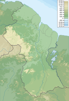
The New River (Dutch: Nieuwe Rivier) is a river of South America located in the southeastern region of Guyana. It forms the Western border of the Tigri Area or New River Triangle, a disputed territory that is claimed by both Guyana and Suriname. [1] In 1965, to bolster this territorial claim, the Surinamese government issued a decree to begin referring to the river as the Upper Corantyne River in Suriname. [2]

The river rises in the Acarai Mountains and flows, together with the Coeroeni River, to the Courantyne River. [1] The Oronoque River is a major tributary of the New River and within the Tigri Area. It was the location of a skirmish between Guyana Police Force and a Surinamese labor camp, 15 December 1967. [3]

Military conflict broke out in August 1969 when members of the Guyana Defence Force launched an operation to clear Suriname military personnel from the area. The operation was named "Operation Climax" and was executed with maximum precision.

Due to the intervention by the GDF, the Suriname military withdrew without any casualties and all detainees were released. This operation was one of the most successful ventures of the force. [4]

Even though the area is disputed, it still attracts illegal mining. In 1993, the Guyana Defense Force identified alluvial mining by Brazilian nationals. [5]
See also

Related Research Articles

<span class="mw-page-title-main">Suriname</span> Country in South America

Suriname, officially the Republic of Suriname, is a country in northern South America, sometimes considered part of the Caribbean and the West Indies. Situated slightly north of the equator, over 90% of its territory is covered by rainforests, the highest proportion of forest cover in the world. Suriname is bordered by the Atlantic Ocean to the north, French Guiana to the east, Guyana to the west, and Brazil to the south. It is the smallest country in South America by both population and territory, with around 612,985 inhabitants in an area of approximately 163,820 square kilometers. The capital and largest city is Paramaribo, which is home to roughly half the population.

<span class="mw-page-title-main">Geography of Suriname</span>

Suriname is located in the northern part of South America and is part of Caribbean South America, bordering the North Atlantic Ocean, between French Guiana and Guyana. It is mostly covered by tropical rainforest, containing a great diversity of flora and fauna that, for the most part, are increasingly threatened by new development. There is a relatively small population, most of which live along the coast.

After the creation of the Statute of the Kingdom of the Netherlands, the Royal Netherlands Army was entrusted with the defence of Suriname, while the defence of the Netherlands Antilles was the responsibility of the Royal Netherlands Navy. The army set up a separate Netherlands Armed Forces in Suriname. Upon independence in 1975, this force was turned into the Surinamese Armed Forces. On February 25, 1980, a group of 15 non-commissioned officers and one junior officer, under the leadership of sergeant major Dési Bouterse, staged a coup d'état and overthrew the Government. Subsequently, the SKM was rebranded as the National Army.

<span class="mw-page-title-main">Dési Bouterse</span> 8th President of Suriname

Desiré Delano Bouterse is a Surinamese military officer, politician, convicted murderer and drug trafficker who served as President of Suriname from 2010 to 2020. From 1980 to 1987, he was Suriname's de facto leader after conducting a military coup and establishing a period of military rule. In 1987, Bouterse founded the National Democratic Party (NDP). On 25 May 2010, Bouterse's political alliance, the Megacombinatie, which included the NDP, won the parliamentary elections, and on 19 July 2010, Bouterse was elected as President of Suriname with 36 of 50 parliament votes. He was inaugurated on 12 August 2010.

<span class="mw-page-title-main">British Guiana</span> British colony from 1814 to 1966

British Guiana was a British colony, part of the mainland British West Indies, which resides on the northern coast of South America. Since 1966 it has been known as the independent nation of Guyana.

<span class="mw-page-title-main">Sipaliwini District</span> District of Suriname

Sipaliwini is the largest district of Suriname, located in the south. Sipaliwini is the only district that does not have a regional capital, as it is directly administered by the national government in Paramaribo. Sipaliwini District includes disputed areas, with the southwestern region controlled and administered by Guyana, whereas the southeastern region is controlled by French Guiana.

<span class="mw-page-title-main">Tiriyó people</span> Cariban ethnic group of Brazil, Suriname and Guyana

The Tiriyó are an Amerindian ethnic group native to parts of northern Brazil, Suriname, and Guyana. In 2014, there were approximately 3,640 Tiriyó in the three countries. They live in several major villages and a number of minor villages in the border zone between Brazil and Suriname. They speak the Tiriyó language, a member of the Cariban language family and refer to themselves as tarëno, etymologically 'people from here' or 'local people'.

<span class="mw-page-title-main">Courantyne River</span> River in Suriname and Guyana

The Courantyne River is a river in northern South America in Suriname and Guyana. It is the longest river in the country and creates the border between Suriname and the East Berbice-Corentyne region of Guyana.

<span class="mw-page-title-main">Guyana Defence Force</span> Military forces of Guyana

The Guyana Defence Force (GDF) is the military of Guyana, established in 1965. It has military bases across the nation. The Commander-in-Chief of the Defence Force is always the incumbent President of Guyana.

Kawemhakan, formerly also known as Anapaikë, is a Wayana village in the Sipaliwini District of Suriname. The village lies on the banks of the Lawa River, which forms the border with French Guiana.

<span class="mw-page-title-main">Benzdorp</span> Place in Sipaliwini District, Suriname

Benzdorp is a village in the Sipaliwini District of Suriname. It is named after the English consul and bullion dealer H.J.W. Benz.

<span class="mw-page-title-main">Guyana</span> Caribbean country in South America

Guyana, officially the Co-operative Republic of Guyana, is a country on the northern coast of South America, part of the historic mainland British West Indies. Guyana is an indigenous word which means "Land of Many Waters". Georgetown is the capital of Guyana with the largest population. Guyana is bordered by the Atlantic Ocean to the north, Brazil to the south and southwest, Venezuela to the west, and Suriname to the east. With a land area of 214,969 km2 (83,000 sq mi), Guyana is the third-smallest sovereign state by area in mainland South America after Uruguay and Suriname, and is the second-least populous sovereign state in South America after Suriname; it is also one of the least densely populated countries on Earth. It has a wide variety of natural habitats and very high biodiversity. The country also hosts one part of the Amazon rainforest, the largest tropical rainforest in the world.

<span class="mw-page-title-main">Kutari River</span> Small tributary river in Suriname

Kutari River, also called Cutari Rivier, Kutari Creek or Cutari Creek, is a small river on the southeastern border of Guyana and the southwestern region of Suriname. The location of the river is part of the disputed Tigri Area in the extreme South East region of Suriname.

<span class="mw-page-title-main">Oronoque River</span> River

The Oronoque River is a river in Guyana and a tributary of the New River. The river is located in the Tigri Area which is disputed between Guyana and Suriname. The source was discovered in September 1936, and is considered the international boundary with Brazil.

<span class="mw-page-title-main">Kabalebo</span> Resort in Sipaliwini District, Suriname

Kabalebo is a resort in Suriname, located in the Sipaliwini District. Its population at the 2012 census was 2,291.

<span class="mw-page-title-main">Borders of Suriname</span> Country borders

The borders of Suriname consist of land borders with three countries: Guyana, Brazil, and France. The borders with Guyana and France are in dispute, but the border with Brazil has been uncontroversial since 1906.

<span class="mw-page-title-main">Tigri Area</span> Disputed area between Guyana and Suriname

The Tigri Area is a wooded area that has been disputed by Guyana and Suriname since around 1840. It involves the area between the Upper Corentyne River, the Coeroeni River, and the Kutari River. This triangular area is known as the New River Triangle in Guyana. In 1969 the conflict ran high on, and since then it has been controlled by Guyana and claimed by Suriname. In 1971, both governments agreed that they would continue talks over the border issue and withdraw their military forces from the disputed triangle. Guyana has never held upon this agreement.

<span class="mw-page-title-main">Guyana–Suriname relations</span> Bilateral relations

Guyana – Suriname relations are the bilateral relations between Guyana and Suriname. Suriname has an embassy in Georgetown. Guyana has an embassy in Paramaribo. The Courentyne River makes up most of the border between the two countries.

Kasuela is an indigenous village of the Tiriyó people in the East Berbice-Corentyne region of Guyana. The village has a population of about 80 people. The inhabitants are of the subgroup Mawayana or the Frog people.

Camp Tigri or Camp Jaguar is a military camp and airstrip located in the Tigri Area. The area is disputed between Suriname and Guyana.

References

  1. 1 2 McNally, Rand (1993). The New International Atlas.
  2. "Grensgeschillen in de Guianas". Geografie.nl (in Dutch). Retrieved 30 May 2020.
  3. "Starnieuws - Een halve eeuw Tigri". www.starnieuws.com. Retrieved 2021-01-19.
  4. "New River Triangle Dispute". www.globalsecurity.org. Retrieved 2022-03-05.
  5. "Jagdeo was pro-mining in New River, says Luncheon". Stabroek News. 2013-12-22. Retrieved 2021-01-19.

3°23′N57°36′W / 3.383°N 57.600°W / 3.383; -57.600