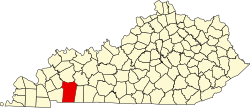
Newstead is an unincorporated community in Christian County, in the U.S. state of Kentucky. [1]
Newstead had its start when the railroad was extended to that point. [2] A post office called Newstead was established in 1847, and remained in operation until 1906. [3]
Trigg County is a county located on the far southwestern border of the U.S. state of Kentucky. As of the 2020 census, the population was 14,061. Its county seat is Cadiz. Formed in 1820, the county was named for Stephen Trigg, an officer in the American Revolutionary War who was killed at the Battle of Blue Licks, now in Robertson County, Kentucky. It was a victory for British and allied troops.
Todd County is a county located in the U.S. state of Kentucky. As of the 2020 census, the population was 12,243. Its county seat is Elkton. The county is named for Colonel John Todd, who was killed at the Battle of Blue Licks in 1782 during the American Revolution.
Christian County is a county located in the U.S. state of Kentucky. As of the 2020 census, the population was 72,748. Its county seat is Hopkinsville. The county was formed in 1797. Christian County is part of the Clarksville, Tennessee–Kentucky Metropolitan Statistical Area.
Caldwell County is a county located in the U.S. state of Kentucky. As of the 2020 census, the population was 12,649. Its county seat is Princeton. The county was formed in 1809 from Livingston County, Kentucky and named for John Caldwell, who participated in the George Rogers Clark Indian Campaign of 1786 and was the second lieutenant governor of Kentucky. Caldwell was a prohibition or dry county until 2013, when the citizens voted to lift the ban.
Oak Grove is a home rule-class city adjacent to the Fort Campbell army base in Christian County, Kentucky, in the United States. The population was 7,489 as of the 2010 U.S. Census. It is part of the Clarksville, Tennessee metropolitan area.
Pembroke is a home rule-class city in Christian County, Kentucky, in the United States. The population was 869 as of the 2010 U.S. Census. It is part of the Clarksville, Tennessee metropolitan area.
White Plains is a home rule-class city in Hopkins County, Kentucky, United States. The population was 884 at the 2010 census, up from 800 at the 2000 census.
Trenton is a city in Todd County, Kentucky, United States. The population was 384 at the 2010 census.
Fort Donelson National Battlefield preserves Fort Donelson and Fort Heiman, two sites of the American Civil War Forts Henry and Donelson Campaign, in which Union Army Brigadier General Ulysses S. Grant and Flag Officer Andrew Hull Foote captured three Confederate forts and opened two rivers, the Tennessee River and the Cumberland River, to control by the Union Navy. The commanders received national recognition for their victories in February 1862, as they were the first major Union successes of the war. The capture of Fort Donelson and its garrison by the Union led to the capture of Tennessee's capital and industrial center, Nashville, which remained in Union hands from February 25, 1862, until the end of the war, and gave the Union effective control over much of Tennessee. This struck a major blow to the Confederacy early in the war.
Mount Liberty is an unincorporated community on the border between the Milford and Liberty Townships of Knox County, Ohio, United States. It has a post office with the ZIP code 43048. It lies along the concurrent U.S. Route 36 and State Route 3.
WKDZ-FM is a radio station licensed in Cadiz, Kentucky. WKDZ-FM is owned by Ham Broadcasting. Beth Mann serves as Ham Broadcasting owner/president.
Cerulean is a census-designated place and unincorporated community in Trigg and Christian counties, Kentucky, United States. At one time, it was a city, incorporated as Cerulean Springs. It lies along Kentucky Routes 124 and 126 northeast of the city of Cadiz, the county seat of Trigg County. Its elevation is 512 feet (156 m), and it is located at 36°57′34″N87°42′36″W. It has a post office with the ZIP code 42215.
Fearsville is an unincorporated community in Christian County, Kentucky, United States. Fearsville is located at 36°59′02″N87°21′27″W at an elevation of 558 feet. The community was named for the family of Carson Fears, a Christian County native.
Gracey is an unincorporated community and census-designated place in Christian County, Kentucky, United States. As of the 2010 census it had a population of 138.
Unity, Kentucky is a small unincorporated community and former coal mining community that formerly had a U.S. Post Office located two miles west of Catlettsburg. Kentucky Route 168 passes through the hamlet. Catletts Creek, a tributary of the Ohio River, runs through the community of Unity. Unity was served by the Catletts Creek School, later named Eidson Elementary, from 1962 to 1993, when all students were transferred to Catlettsburg Elementary. The hamlet of Unity is virtually non-existent today, as most residents of Unity refer to Catlettsburg as their home, since it is the postal zip code used.
Dogwalk is an unincorporated community in Ohio County, Kentucky, in the United States.
Gordonsville is an unincorporated community in Logan County, Kentucky, in the United States.
Keysburg is an unincorporated community in Logan County, Kentucky, in the United States.
Herndon is an unincorporated community located in Christian County, Kentucky, United States. It is concentrated around the intersection of Kentucky Route 107 and Kentucky Route 117, southwest of Hopkinsville. It has a post office with zip code 42236.
Edgoten is an unincorporated community in Christian County, in the U.S. state of Kentucky.
36°47′57″N87°37′49″W / 36.79917°N 87.63028°W