Fearsville, Kentucky | |
|---|---|
 Fearsville | |
| Coordinates: 36°59′02″N87°21′27″W / 36.98389°N 87.35750°W | |
| Country | |
| State | |
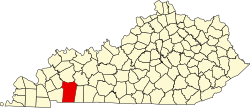
| County | Christian |
| Elevation | 560 ft (170 m) |
| ZIP code | 42240 |
| GNIS feature ID | 0492011 [1] |
Fearsville is an unincorporated community in Christian County, Kentucky, United States.The community was named for the family of Carson Fears, a Christian County native. [2]