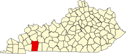
LaFayette, Kentucky | |
---|---|
Coordinates: 36°39′37″N87°39′29″W / 36.66028°N 87.65806°W [1] | |
Country | United States |
State | Kentucky |
County | Christian |
Incorporated | 1836 |
Government | |
• Mayor | Jared Thatcher |
Area | |
• Total | 0.26 sq mi (0.67 km2) |
• Land | 0.26 sq mi (0.67 km2) |
• Water | 0.00 sq mi (0.00 km2) |
Elevation | 597 ft (182 m) |
Population (2020) | |
• Total | 177 |
• Density | 686.05/sq mi (264.97/km2) |
Time zone | UTC-6 (Central (CST)) |
• Summer (DST) | UTC-5 (CDT) |
ZIP code | 42254 |
Area code(s) | 270 & 364 |
FIPS code | 21-43444 |
GNIS feature ID | 0508413 |
LaFayette, [3] [4] also informally written as La Fayette and Lafayette, is a home rule-class city in Christian County, Kentucky, in the United States. The population was 177 as of the 2020 census, up from 165 in the 2010 U.S. census. [5] LaFayette is part of the Clarksville, Tennessee metropolitan area.
LaFayette was first settled in the late 1810s, and by 1820 was home to a dry goods and grocery store. [6] [7] It was formally incorporated by the state assembly in 1836. [4] The city was named in honor of Revolutionary War hero the Marquis de Lafayette. [8]
LaFayette is home to an antebellum church, the Lafayette Methodist Church. Built in 1852 by Dutch-born builder Daniel Umbenhour, the church is now listed on the National Register of Historic Places. [6]
LaFayette is located along Kentucky Route 107 in the southwestern corner of Christian County, 18 miles (29 km) southwest of Hopkinsville, the Christian County seat, and 2 miles (3 km) north of the Tennessee state line. The town lies just north of the US Army's Fort Campbell.
According to the United States Census Bureau, the town has a total area of 0.2 square miles (0.6 km2), all land. [5]
Census | Pop. | Note | %± |
---|---|---|---|
1870 | 215 | — | |
1880 | 970 | 351.2% | |
1890 | 215 | −77.8% | |
1900 | 199 | −7.4% | |
1910 | 266 | 33.7% | |
1920 | 307 | 15.4% | |
1930 | 227 | −26.1% | |
1940 | 229 | 0.9% | |
1950 | 246 | 7.4% | |
1960 | 196 | −20.3% | |
1970 | 158 | −19.4% | |
1980 | 160 | 1.3% | |
1990 | 106 | −33.7% | |
2000 | 193 | 82.1% | |
2010 | 165 | −14.5% | |
2020 | 177 | 7.3% | |
U.S. Decennial Census [9] |
As of the census [10] of 2000, there were 193 people, 75 households, and 51 families residing in the town. The population density was 718.7 inhabitants per square mile (277.5/km2). There were 83 housing units at an average density of 309.1 per square mile (119.3/km2). The racial makeup of the town was 89.12% White, 5.70% African American, 0.52% Native American or Alaska Native, 1.55% Asian, 1.04% from other races, and 2.07% from two or more races. Hispanics or Latinos of any race were 1.55% of the population.
There were 75 households, out of which 33.3% had children under the age of 18 living with them, 64.0% were married couples living together, 2.7% had a female householder with no husband present, and 32.0% were non-families. 29.3% of all households were made up of individuals, and 10.7% had someone living alone who was 65 years of age or older. The average household size was 2.57 and the average family size was 3.22.
The age distribution was 29.0% under the age of 18, 6.2% from 18 to 24, 34.7% from 25 to 44, 20.7% from 45 to 64, and 9.3% who were 65 years of age or older. The median age was 33 years. For every 100 females, there were 116.9 males. For every 100 females age 18 and over, there were 124.6 males.
The median income for a household in the town was $28,906, and the median income for a family was $30,250. Males had a median income of $25,000 versus $29,375 for females. The per capita income for the town was $11,679. About 9.8% of families and 13.9% of the population were below the poverty line, including 13.3% of those under the age of eighteen and 40.0% of those 65 or over.
Fayette County is a county located in the U.S. state of Alabama. As of the 2020 census, the population was 16,321. Its county seat is Fayette. Its name is in honor of the Marquis de Lafayette, who aided General George Washington in the American Revolutionary War.
Fayette County is a county located in the U.S. state of Ohio. As of the 2020 census, the population was 28,951. Its county seat and largest city is Washington Court House. The county was named for the Marquis de Lafayette, a Frenchman who was an officer in the American Army in the Revolution, when established on March 1, 1810.
Fayette County is located in the central part of the U.S. state of Kentucky and is consolidated with the city of Lexington. As of the 2020 census, the population was 322,570, making it the second-most populous county in the commonwealth. Since 1974, its territory, population and government have been shared with Lexington. Fayette County is part of the Lexington-Fayette, KY Metropolitan Statistical Area.
LaFayette is the county seat of Chambers County, Alabama, United States, 47 miles (76 km) northwest of Columbus, Georgia. As of the 2010 census, the population of the city was 3,003.
Fayette is a city and the county seat of Fayette County, Alabama, United States. The population was 4,619 at the 2010 census, down from 4,922 at the 2000 census.
LaFayette is a city in, and the county seat of, Walker County, Georgia, United States. As of the 2020 census, the city population was 6,888. It was founded as Chattooga.
North Middletown is a home rule-class city in Bourbon County, Kentucky, in the United States. The population was 643 as of the 2010 census. North Middletown is part of the Lexington-Fayette Metropolitan Statistical Area.
Clinton is a home rule-class city and the county seat of Hickman County, Kentucky, United States. The population was 1,388 at the 2010 census, a decline from 1,415 in 2000.
Sadieville is a home rule-class city in Scott County, Kentucky, in the United States. The population was 263 during the year 2000 U.S. Census. It is part of the Lexington-Fayette Metropolitan Statistical Area.
Stamping Ground is a home rule-class city in Scott County, Kentucky, United States. The population was 643 at the 2010 census. It is part of the Lexington–Fayette Metropolitan Statistical Area.
Versailles is a home rule-class city in Woodford County, Kentucky, United States. It lies 13 miles by road west of Lexington and is part of the Lexington-Fayette Metropolitan Statistical Area. Versailles has a population of 9,316 according to 2017 census estimates. It is the county seat of Woodford County. The city's name is pronounced vər-SAYLZ, an anglicization different from the French pronunciation of the royal city of the same name near Paris.
Fayette is a town in Kennebec County, Maine, United States. The population was 1,160 as of the 2020 census. A popular recreation spot in central Maine, Fayette is part of the Winthrop Lakes Region.
Fayette is a city in and the county seat of Howard County, Missouri, United States. It is part of the Columbia, Missouri Metropolitan Statistical Area. The city's population was 2,803 at the 2020 census.
LaFayette is a town in Onondaga County, New York, United States. As of the 2020 Census, its population was 4,910. The town is named after the Marquis de Lafayette, a key figure in the French and American revolutions, and widely considered a national hero of France and the United States. LaFayette is in the southern part of Onondaga County, south of Syracuse.
Fayette City is a borough in Fayette County, Pennsylvania, United States. The population was 502 at the 2020 census, a decline from the figure of 596 tabulated in 2010. It is served by the Belle Vernon Area School District. Some buildings in the town antedate 1820.
Fayetteville is a city in Fayette County, Texas. The population was 246 at the 2020 census.
Round Top is a town in Fayette County, Texas, United States. The population was 90 at the 2010 census.
Fayette is a town in Sanpete County, Utah, United States. The population was 204 at the 2000 census.
Fayette is a town in Lafayette County, Wisconsin, United States. The population was 376 at the 2010 census. The unincorporated communities of Fayette and Yellowstone are located in the town.
Corinth is a home rule-class city mostly in Grant County with a small portion of land in Scott County in the U.S. state of Kentucky. The population was 232 as of the 2010 census, up from 181 at the 2000 census.