Pembroke, Kentucky | |
---|---|
Coordinates: 36°46′29″N87°21′23″W / 36.77472°N 87.35639°W | |
Country | United States |
State | Kentucky |
County | Christian |
Incorporated | 1869 [1] |
Named for | a literary character [2] |
Area | |
• Total | 1.12 sq mi (2.89 km2) |
• Land | 1.11 sq mi (2.88 km2) |
• Water | 0.01 sq mi (0.01 km2) |
Elevation | 587 ft (179 m) |
Population (2020) | |
• Total | 865 |
• Density | 778.58/sq mi (300.74/km2) |
Time zone | UTC-6 (Central (CST)) |
• Summer (DST) | UTC-5 (CDT) |
ZIP code | 42266 |
Area code(s) | 270 & 364 |
FIPS code | 21-59934 |
GNIS feature ID | 0500368 |
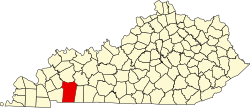
Pembroke is a home rule-class city in Christian County, Kentucky, in the United States. The population was 865 as of the 2020 census, stagnant from 869 as of the 2010 U.S. Census. [4] It is part of the Clarksville, Tennessee metropolitan area.
The town was settled in 1836 and named for Pembroke Somerset, Esq., [5] a character in Jane Porter's 1803 novel Thaddeus of Warsaw , by Dr. Lunsford Lindsay, a local store owner. [2] It was incorporated as a city in 1869. [1] [6]
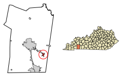
Pembroke is located in eastern Christian County at 36°46′29″N87°21′23″W / 36.77472°N 87.35639°W (36.774633, -87.356361). [7] U.S. Route 41 passes through the town as Nashville Street, leading northwest 9 miles (14 km) to Hopkinsville, the county seat, and southeast 14 miles (23 km) to Guthrie at the Tennessee border.
According to the United States Census Bureau, Pembroke has a total area of 1.1 square miles (2.9 km2), of which 0.004 square miles (0.01 km2), or 0.42%, is water. [4]
Census | Pop. | Note | %± |
---|---|---|---|
1870 | 278 | — | |
1880 | 202 | −27.3% | |
1890 | 466 | 130.7% | |
1900 | 654 | 40.3% | |
1910 | 731 | 11.8% | |
1920 | 685 | −6.3% | |
1930 | 775 | 13.1% | |
1940 | 570 | −26.5% | |
1950 | 531 | −6.8% | |
1960 | 517 | −2.6% | |
1970 | 634 | 22.6% | |
1980 | 636 | 0.3% | |
1990 | 640 | 0.6% | |
2000 | 797 | 24.5% | |
2010 | 869 | 9.0% | |
2020 | 865 | −0.5% | |
U.S. Decennial Census [8] |
As of the census [9] of 2000, there were 797 people, 305 households, and 214 families residing in the city. The population density was 772.4 inhabitants per square mile (298.2/km2). There were 328 housing units at an average density of 317.9 per square mile (122.7/km2). The racial makeup of the city was 64.87% White, 31.12% African American, 0.50% Native American or Alaska Native, 0.25% Asian, 0.75% from other races, and 2.51% from two or more races. Hispanics or Latinos of any race were 1.25% of the population.
There were 305 households, out of which 36.1% had children under the age of 18 living with them, 48.2% were married couples living together, 18.4% had a female householder with no husband present, and 29.8% were non-families. 26.2% of all households were made up of individuals, and 11.5% had someone living alone who was 65 years of age or older. The average household size was 2.45 and the average family size was 2.95.
The age distribution was 25.7% under the age of 18, 10.4% from 18 to 24, 24.8% from 25 to 44, 20.5% from 45 to 64, and 18.6% who were 65 years of age or older. The median age was 37 years. For every 100 females, there were 81.5 males. For every 100 females age 18 and over, there were 72.1 males.
The median income for a household in the city was $27,143, and the median income for a family was $30,568. Males had a median income of $28,250 versus $18,194 for females. The per capita income for the city was $13,663. About 20.5% of families and 24.0% of the population were below the poverty line, including 32.1% of those under age 18 and 21.4% of those age 65 or over.
Waterman is a village in DeKalb County, Illinois, United States. The population was 1,433 at the 2020 census.
Fort Campbell North is a census-designated place (CDP) in Christian County, Kentucky, United States. It contains most of the housing for the Fort Campbell Army base within the Kentucky portion of the base. The population was 12,825 as of the 2020 census, down from 13,685 in the 2010 census.
Oak Grove is a home rule-class city adjacent to the Fort Campbell army base in Christian County, Kentucky, in the United States. The population was 7,931 as of the 2020 census, up from 7,489 as of the 2010 U.S. Census. It is part of the Clarksville, Tennessee metropolitan area.
Wurtland is a home rule-class city in Greenup County, Kentucky, United States, along the Ohio River. The population was 995 at the 2010 census. Wurtland is a part of the Huntington-Ashland, WV-KY-OH, Metropolitan Statistical Area (MSA). As of the 2010 census, the MSA had a population of 287,702.
Munfordville is a home rule-class city in, and the county seat of, Hart County, Kentucky, United States. The population was 1,615 at the 2010 U.S. census.
Nebo is a home rule-class city in Hopkins County, Kentucky, in the United States. The population was 236 as of the 2010 census.
St. Charles is a home rule-class city in Hopkins County, Kentucky, United States. The population was 277 at the 2010 U.S. Census.
Rolling Hills is a home rule-class city in Jefferson County, Kentucky. The population was 959 at the time of the 2010 census.
Bromley is a home rule-class city in Kenton County, Kentucky, United States, along the Ohio River. The population was 724 at the 2020 census. It is part of the Cincinnati metropolitan area.
Fort Mitchell is a home rule-class city in Kenton County, Kentucky, United States. The population was 8,702 at the 2020 census. It is part of the Cincinnati metropolitan area.
McRoberts is an unincorporated community and census-designated place (CDP) in Letcher County, Kentucky, United States. The population was 784 at the 2010 United States Census, down from 921 at the 2000 census. McRoberts is in the Eastern Kentucky Coalfield region.
Island is a home rule-class city in McLean County, Kentucky, in the United States. The population was 429 at the 2020 census. It is included in the Owensboro metropolitan area.
Elkton is a home rule-class city in and the county seat of Todd County, Kentucky, United States. The population was 2,062 at the 2010 census.
Guthrie is a home rule-class city in Todd County, Kentucky, in the United States. The population was 1,419 at the 2010 census.
Waverly is a home rule-class city in Union County, Kentucky, United States. The population was 297 at the 2000 census. Founded in 1870, the city was named for founder Hugh McElroy's nephew.
Sangerville is a town in Piscataquis County, Maine, United States. The population was 1,306 at the 2020 census. The town was named after Colonel Calvin Sanger, a landowner.
Garden is a village in Delta County of the U.S. state of Michigan. The population was 221 at the 2010 census. The village is located within Garden Township.
Sand Beach Township is a civil township of Huron County in the U.S. state of Michigan. The population was 1,470 at the 2000 census.
New Johnsonville is a city in Humphreys County, Tennessee, United States. The population was 1,951 at the 2010 census.
Dover is a city in and the county seat of Stewart County, Tennessee, 67 miles (108 km) west-northwest of Nashville on the Cumberland River. Fort Donelson National Cemetery is in Dover. The population was 1,442 at the 2000 census and the 2010 census showed a population of 1,417.