Wulingyuan is a scenic and historical site in the Wulingyuan District of south-central China's Hunan Province. It was inscribed as a UNESCO World Heritage Site in 1992. It is noted for more than 3,000 quartzite sandstone pillars and peaks across most of the site, many over 200 metres (660 ft) in height, along with many ravines and gorges with attractive streams, pools, lakes, rivers and waterfalls. It features 40 caves, many with large calcite deposits, and a natural bridge named Tianqiashengkong, which is one of the highest natural bridges in the world.

Jinsha is an archaeological site in Chengdu, capital of China's Sichuan Province. The site is located in Qingyang District, along the Modi River (摸底河). It is named for a nearby street, itself named after the Jinsha River.

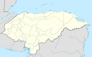
San José is a municipality in the Honduran department of Choluteca.

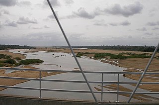
The Save River, or Sabi River is a 400 km (250 mi) river of southeastern Africa, flowing through Zimbabwe and Mozambique. The river has its source in Zimbabwe, some 80 km (50 mi) south of Harare, then flows south and then east, from the Zimbabwean highveld to its confluence with the Odzi River. It then turns south, drops over the Chivirira Falls, and flows down the western side of Zimbabwe's Eastern Highlands forming a dry river valley in the rain shadow of these mountains. It is joined by the Runde River or Lundi at the Mozambique border, forming a dramatic confluence at Mahenya. It then crosses Mozambique to flow into the Indian Ocean at about 21°S.
Bulkley Junction Provincial Park is a provincial park in British Columbia, Canada, located on the west side of the Skeena River opposite Hazelton.
The Ashcroft First Nation is a First Nations government Thompson Canyon area of the Central Interior of the Canadian province of British Columbia. It's Indian Reserves are located near the town of Ashcroft, British Columbia, it is a member of the Nlaka'pamux Nation Tribal Council.
The Lytton First Nation, a First Nations government, has its headquarters at Lytton in the Fraser Canyon region of the Canadian province of British Columbia. While it is the largest of all Nlaka'pamux bands, unlike all other governments of the Nlaka'pamux (Thompson) people, it is not a member of any of the three Nlaka'pamux tribal councils, which are the Nicola Tribal Association, the Fraser Canyon Indian Administration and the Nlaka'pamux Nation Tribal Council.
Wyanbene is a geographic area between Braidwood and Cooma in Southern NSW, Australia. It includes a significant cave system and is adjacent to Deua National Park. The cave is at 35°47'42.25"S 149°40'56.48"E, at about 850 m altitude. A sheep and cattle farming area, there is still much wildlife including wombats, greater gliders, wedge-tailed eagle, echidna, eastern grey kangaroo, wallabies, red-bellied black snakes, tiger snake, Cunningham's skink, Platypus and native fish in the Wyanbene Creek and nearby Shoalhaven and Duea rivers.

Braniștea is a commune in Romania. It is located in Dâmbovița County. It is composed of three villages: Braniștea, Dâmbovicioara and Săvești.
Monan is a village and union council of Jhelum District in the Punjab Province of Pakistan. It is part of Jhelum Tehsil, and is located at 32°57′0″N73°41′0″E and has an altitude of 229 metres (754 feet).

Mufumbwe is a town of Mufumbwe District in the North-Western Province of Zambia. It is located at 13°41'0S 24°48'0E with an altitude of 1069 metres.

Vingis Park is the largest park in Vilnius, Lithuania. Located at a curve in the Neris River, it covers 162 hectares. It is used as a venue for various events, especially concerts and sports competitions.

Fimbulheimen is a mountain range in Queen Maud Land, Antarctica. It stretches from Jutulstraumen by 1° west of Carsten Borchgrevink Ice at 18° east, about 200 km from the ice edge. Fimbulheimen is thus between Maudheim Plateau and Sør-Rondane.
Yale First Nation is a First Nations government located at Yale, British Columbia. Yale has 16 distinct reserves stretching from near Sawmill Creek to American Creek, with the most southern reserve situated at Ruby Creek in the District of Kent.

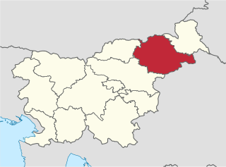
The Drava Statistical Region is a statistical region in Slovenia. The largest town in the region is Maribor. Its name comes from the Drava River and includes land on both banks along its course through Slovenia as well as the Pohorje mountains in the northeast of the region. The Drava is used for the production of hydroelectricity and the fertile land around it is used for agriculture. The share of job vacancies in all available jobs is among the highest in Slovenia and the region has a positive net migration rate but a very high natural decrease, which means an overall decrease in the population.
Technobanine Point is the site of a proposed deepwater port in Mozambique near the capital Maputo.

Takhemaret is a town and commune in Tiaret Province in north-western Algeria, about 65 km. southwest of the city of Tiaret. The 2008 census population was 34,124 in the commune, with 20,827 in the city.

This is a list of the extreme points of Uruguay, the points that are farther north, south, east or west than any other location, and the highest and lowest points. It is also notable that Uruguay's northernmost point is farther south than the northernmost point of any other nation.

Frederick Barbarossa Memorial is a monument dedicated to Holy Roman Emperor Frederick I located in Mersin Province, southern Turkey.


