
Eswatini is a country in Southern Africa lying between Mozambique and South Africa. The country is located at the geographic coordinates 26°30′S31°30′E. Eswatini has an area of 17,363 square kilometres, of which 160 are water. The major regions of the country are Lowveld, Midveld and Highveld.

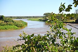
The Limpopo River rises in South Africa, and flows generally eastwards through Mozambique to the Indian Ocean. The term Limpopo is derived from Rivombo (Livombo/Lebombo), a group of Tsonga settlers led by Hosi Rivombo who settled in the mountainous vicinity and named the area after their leader. The river is approximately 1,750 kilometres (1,087 mi) long, with a drainage basin 415,000 square kilometres (160,200 sq mi) in size. The mean discharge measured over a year is 170 m3 per second at its mouth. The Limpopo is the second largest river in Africa that drains to the Indian Ocean, after the Zambezi River.
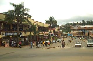
Mbabane is a city in Eswatini, and is one of the two capitals, serving as the executive capital.
Maputo Province is a province of Mozambique; the province excludes the city of Maputo. The province has an area of 22,693 km2 (8,762 sq mi) and a population of 1,968,906. Its capital is the city of Matola.

Gaza is a province of Mozambique. It has an area of 75,709 km2 and a population of 1,422,460.
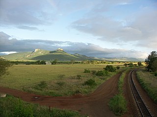
The Lebombo Mountains, also called Lubombo Mountains, are an 800 km-long (500 mi), narrow range of mountains in Southern Africa. They stretch from Hluhluwe in KwaZulu-Natal in the south to Punda Maria in the Limpopo Province in South Africa in the north. Parts of the mountain range are also found in Mozambique and Eswatini.

The Swati are a Bantu ethnic group in Southern Africa, inhabiting Eswatini, a sovereign kingdom in Southern Africa. EmaSwati are part of the Nguni-language speaking peoples whose origins can be traced through archaeology to East Africa where similar traditions, beliefs and cultural practices are found.
The Lubombo Transfrontier Conservation Area was born out of the Peace Park Foundation’s vision to establish a network of transfrontier conservation areas in southern Africa. It straddles the border between South Africa’s KwaZulu-Natal province, southern Mozambique, and Eswatini.

Great Limpopo Transfrontier Park is a 35,000 km² peace park that is in the process of being formed. It will link the Limpopo National Park in Mozambique, Kruger National Park in South Africa, Gonarezhou National Park, Manjinji Pan Sanctuary and Malipati Safari Area in Zimbabwe, as well as the area between Kruger and Gonarezhou, the Sengwe communal land in Zimbabwe and the Makuleke region in South Africa.

Komatipoort is a town situated at the confluence of the Crocodile and Komati Rivers in Mpumalanga province, South Africa. The town is 8 km from the Crocodile Bridge Gate into the Kruger Park, and just 5 km from the Mozambique border and 65 km from the Eswatini border.

The Olifants River,Lepelle, iBhalule or Obalule is a river in South Africa and Mozambique, a tributary of the Limpopo River. It falls into the Drainage Area B of the Drainage basins of South Africa. The historical area of the Pedi people, Sekhukhuneland, is located between the Olifants River and one of its largest tributaries, the Steelpoort River.

The Komati River, also known as the Inkomati River or Incomati River, is a river in South Africa, Eswatini and Mozambique. Originating in north-western Eswatini, it is joined by the Crocodile River in the Lebombo Mountains, enters far south-western Mozambique below the border town of Komatipoort, and enters the Indian Ocean around 24 km (15 mi) north-east of Maputo.
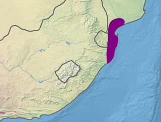
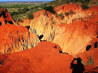
The Maputaland coastal forest mosaic is a subtropical moist broadleaf forest ecoregion on the Indian Ocean coast of Southern Africa. It covers an area of 29,961 square kilometres (11,568 sq mi) in southern Mozambique, Eswatini, and the KwaZulu-Natal Province of South Africa. Mozambique's capital Maputo lies within the ecoregion.

The Pongola or Phongolo River is a river in South Africa. It is a tributary of the Maputo River. It rises near Utrecht in northern KwaZulu-Natal, flows east through Pongola, is dammed at Pongolapoort, and crosses the Ubombo Mountains; then it flows north towards Mozambique, joining the Maputo River.

Namaacha District is a district of Maputo Province in southern Mozambique. The principal town is Namaacha. The district is located in the southwest of the province, and borders with Moamba District in the north, Boane District in the east, Matutuíne District in the south, and with Eswatini and South Africa in the west. The area of the district is 2,196 square kilometres (848 sq mi). It has a population of 41,914 as of 2007.

The Letaba River, also known as Leţaba, Lehlaba or Ritavi, is a river located in eastern Limpopo Province, South Africa. It is one of the most important tributaries of the Olifants River.

Severe Tropical Storm Domoina in 1984 caused 100 year floods in South Africa and record rainfall in Swaziland. The fourth named storm of the season, Domoina developed on January 16 off the northeast coast of Madagascar. With a ridge to the north, the storm tracked generally westward and later southwestward. On January 21, Domoina struck eastern Madagascar, the third storm in six weeks to affect the nation; collectively, the storms caused 42 deaths and $25 million in damage (1984 USD). After crossing the country, Domoina strengthened in the Mozambique Channel to peak 10-minute sustained winds of 95 km/h (60 mph). On January 28, the storm made landfall in southern Mozambique, and slowly weakened over land. Domoina crossed into Swaziland and later eastern South Africa before dissipating on February 2.
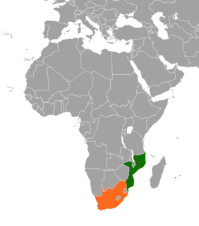
The border between Mozambique and South Africa is divided into two segments, separated by the kingdom of Eswatini. The northern segment, which is 410 kilometres (255 mi) long, runs north–south along the Lebombo Mountains from Zimbabwe to Swaziland. The southern segment, which is 81 kilometres (50 mi) long, runs east–west across Maputaland from Swaziland to the Indian Ocean.

The Mbuluzi River is one of the main rivers of Eswatini, and an important river in Mozambique. On the boundary of these countries, the Mbuluzi cuts through the Lebombo Range, before entering the Mozambican plain. It empties into the Estuário do Espírito Santo and then Maputo Bay at Maputo, and its waters pass under the Maputo–Katembe bridge, completed in 2018.
