Buzi River

Last updated

Buzi River (Portuguese : Rio Búzi) is a river in Mozambique. Buzi flows eastward through the Manica and Sofala provinces of Mozambique. It then empties to the Mozambique Channel west of Beira, forming an estuary.
Portuguese language Romance language that originated in Portugal

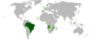
Portuguese is a Western Romance language originating in the Iberian Peninsula. It is the sole official language of Portugal, Brazil, Cape Verde, Guinea-Bissau, Mozambique, Angola, and São Tomé and Príncipe. It also has co-official language status in East Timor, Equatorial Guinea and Macau in China. As the result of expansion during colonial times, a cultural presence of Portuguese and Portuguese creole speakers are also found in Goa, Daman and Diu in India; in Batticaloa on the east coast of Sri Lanka; in the Indonesian island of Flores; in the Malacca state of Malaysia; and the ABC islands in the Caribbean where Papiamento is spoken, while Cape Verdean Creole is the most widely spoken Portuguese-based Creole. A Portuguese-speaking person or nation may be referred to as "Lusophone" in both English and Portuguese.

Mozambique country in Africa

Mozambique, officially the Republic of Mozambique, is a country located in Southeast Africa bordered by the Indian Ocean to the east, Tanzania to the north, Malawi and Zambia to the northwest, Zimbabwe to the west, and Eswatini (Swaziland) and South Africa to the southwest. The sovereign state is separated from the Comoros, Mayotte and Madagascar by the Mozambique Channel to the east. The capital of Mozambique is Maputo while Matola is the largest city, being a suburb of Maputo.

Manica Province Province in Mozambique

Manica is a province of Mozambique. It has an area of 62,272 km² and a population of 1,412,245. The province is surrounded by Zimbabwe in the west, Tete Province in the northwest, Sofala Province in the east, Save River in the south, and Zambezi river in the northeast. Chimoio is the capital of the province. The highest mountain in Mozambique, Mount Binga, lies in this province near the border with Zimbabwe. The Manica province is divided into nine districts and 34 administrative regions.

The Buzi River is 250 kilometres (155 mi) long, with a drainage basin 31,000 square kilometres (12,000 sq mi) in size. Its mean annual discharge is 79 m³/s (2,790 cfs) at its mouth. [1]

Drainage basin Area of land where precipitation collects and drains off into a common outlet

A drainage basin is any area of land where precipitation collects and drains off into a common outlet, such as into a river, bay, or other body of water. The drainage basin includes all the surface water from rain runoff, snowmelt, and nearby streams that run downslope towards the shared outlet, as well as the groundwater underneath the earth's surface. Drainage basins connect into other drainage basins at lower elevations in a hierarchical pattern, with smaller sub-drainage basins, which in turn drain into another common outlet.

In hydrology, discharge is the volumetric flow rate of water that is transported through a given cross-sectional area. It includes any suspended solids (e.g. sediment), dissolved chemicals (e.g. CaCO3(aq)), or biologic material (e.g. diatoms) in addition to the water itself.

A cubic metre per second is a derived SI unit of volumetric flow rate equal to that of a stere or cube with sides of one metre in length exchanged or moving each second. It is popularly used for water flow, especially in rivers and streams, and fractions for HVAC values measuring air flow.

It often causes floods, frequently forming a floodplain together with the larger Pungwe River. Dombé and Búzi are situated on the banks of the river.
Pungwe River river in Mozambique

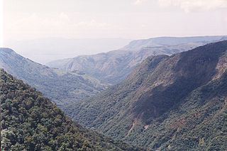
Pungwe River is a 400 km (250 mi) long river in Zimbabwe and Mozambique. It rises below Mount Nyangani in the Eastern Highlands of Zimbabwe and then flows southeasteastward through the Manica and Sofala provinces of Mozambique. the Pungwe enters southernmost portion of the Great Rift Valley, where it forms the southern boundary of Gorongosa National Park. The Urema River joins it, and the river follows the rift valley southward. Large seasonal wetlands form around the Pungwe and Urema rivers in the rift valley section. It empties into the Mozambique Channel at Beira, forming a large estuary. It is one of the major rivers of Mozambique and often causes floods.

Dombé is a town on the north bank of the Buzi River in Sussundenga District of Manica Province in central Mozambique dombe. During the Frelimo-Renamo struggle of the 70s to early 90s it was a strategic town where the FPLM maintained a heavy mechanized presence, since the Chimoio-Dombé-Espungabera road link which offered access to Zimbabwe, was repeatedly attacked and disrupted by insurgents. In 2010 the Dombé-Espungabera road was being rehabilitated, which was expected to improve the area's economic and tourism potential. The road is easier to travel during the dry months, from May to November, and then at about 50 km/h. Dombé has a fuel station but supplies can run out.

Buzi is a town on the banks of the Buzi River, in Buzi District, Sofala Province, Mozambique. In colonial times it was known as Nova Lusitânia or Nova Luzitânia.
Related Research Articles

Geography of Mozambique

Mozambique is located on the east coast of southern Africa. Mozambique has a tropical climate with two seasons, a wet season from October to March and a dry season from April to September.

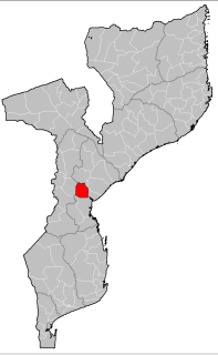
Sofala Province Province in Mozambique

Sofala is a province of Mozambique. It has a population of 1,642,920. Beira is the capital of the province, named for the ruined port of Sofala which is 35 kilometres (22 mi) to the south.

Beira, Mozambique Place in Sofala Province, Mozambique

Beira is the fourth largest city in Mozambique. It lies in the central region of the country in Sofala Province, where the Pungwe River meets the Indian Ocean. Beira had a population of 397,368 in 1997, which grew to 533,825 in 2017. It holds the regionally significant Port of Beira which acts as a gateway for both the central interior portion of the country as well as the land-locked nations of Zimbabwe, Zambia and Malawi. Beira was originally developed by the Portuguese Mozambique Company in the 19th century, and directly developed by the Portuguese colonial government from 1947 until Mozambique gained its independence from Portugal in 1975.

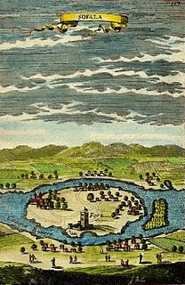
Sofala geographical object

Sofala, at present known as Nova Sofala, used to be the chief seaport of the Mwenemutapa Kingdom, whose capital was at Mount Fura. It is located on the Sofala Bank in Sofala Province of Mozambique. It was founded by Somali merchants and seafarers. Sofala in Somali literally means “go dig”. This name was given because the area is rich with resources.

Dondo District District in Sofala, Mozambique

Dondo District is a district of Sofala Province in Mozambique. The principal town is Dondo. The district is located in the center of the province, and borders with Muanza District in the north, the city of Beira and Buzi District in the south, and with Nhamatanda District in the west. In the east, the district is limited by the Indian Ocean. The area of the district is 2,306 square kilometres (890 sq mi). It has a population of 142,387 as of 2007.

Báruè District District in Manica, Mozambique

Báruè District is a district of Manica Province in western Mozambique. Its principal town is Catandica. The district is located in the west of the province, and borders with Guro District in the north, Macossa District in the east, Gondola District in the southeast, Manica District in the south, and with Zimbabwe in the west. The area of the district is 5,743 square kilometres (2,217 sq mi). It has a population of 137,582 as of 2007.

Gondola District District in Manica, Mozambique

Gondola District is a district of Manica Province in western Mozambique. The principal town is Gondola. The district is located in the east of the province, and borders with Macossa District in the north, Gorongosa District of Sofala Province in the northeasteast, Nhamatanda District of Sofala Province in the east, Buzi District of Sofala Province in the southeast, Sussundenga District in the south, Manica District in the west, and with Báruè District in the northwest. The area of the district is 5,739 square kilometres (2,216 sq mi). It has a population of 262,412 as of 2007.

Machaze District District in Manica, Mozambique

Machaze District is a district of Manica Province in western Mozambique. The principal town is Machaze. The district is located in the south of the province, and borders with Mossurize District in the north, Chibabava District of Sofala Province in the northeast, Machanga District of Sofala Province in the east, Mabote District of Inhambane Province in the south, Massangena District of Gaza Province in the southwest, and with Zimbabwe in the west. The area of the district is 13,189 square kilometres (5,092 sq mi). It has a population of 104,608 as of 2007.

Macossa District District in Manica, Mozambique

Macossa District is a district of Manica Province in western Mozambique. The principal town is Macossa. The district is located in the east of the province, and borders with Tambara District in the north, Maringué District of Sofala Province in the northeast, Gorongosa District of Sofala Province in the east, Gondola District in the south, Báruè District in the west, and with Guro District in the northwest. The area of the district is 9,554 square kilometres (3,689 sq mi). It has a population of 27,245 as of 2007.

Manica District District in Manica, Mozambique

Manica District is a district of Manica Province in western Mozambique. The principal town is Manica. The district is located in the west of the province, and borders with Báruè District in the north, Gondola District in the east, Sussundenga District in the south, and with Zimbabwe in the west. The area of the district is 4,594 square kilometres (1,774 sq mi). It has a population of 213,206 as of 2007.

Mossurize District District in Manica, Mozambique

Mossurize District is a district of Manica Province in western Mozambique. The principal town is Espungabera. The district is located in the south of the province, and borders with Sussundenga District in the north, Chibabava District of Sofala Province in the east, Machaze District in the south, and with Zimbabwe in the west. The area of the district is 5,038 square kilometres (1,945 sq mi). It has a population of 195,182 as of 2007.

Buzi District District in Sofala, Mozambique

Buzi District is a district of Sofala Province in Mozambique. The principal town is Búzi. The district is located in the southeast of the province, and borders with Nhamatanda District in the north, Dondo District in the northeast, Machanga District in the south, Chibabava District in the southwest, Sussundenga District of Manica Province in the west, and with Gondola District of Manica Province in the northwest. The area of the district is 7,329 square kilometres (2,830 sq mi). It has a population of 159,614 as of 2007.

Cheringoma District District in Sofala, Mozambique

Cheringoma District is a district of Sofala Province in Mozambique. The principal town is Inhaminga. The district is located in the northeast of the province, and borders with Caia District in the north, Marromeu District in the northeast, Muanza District in the south, Gorongosa District in the west, and with Maringué District in the northwest. In the south, it is bounded by the Indian Ocean. The area of the district is 6,954 square kilometres (2,685 sq mi). It has a population of 34,133 as of 2007.

Chibabava District District in Sofala, Mozambique

Chibabava District is a district of Sofala Province in Mozambique. The principal town is Chibabava. The district is located in the south of the province, and borders with Buzi District in the north, Machanga District in the southeast, with Machaze and Mossurize Districts of Manica Province in the west, and with Sussundenga District of Manica Province in the northwest. The area of the district is 6,977 square kilometres (2,694 sq mi). It has a population of 101,667 as of 2007.

Machanga District District in Sofala, Mozambique

Machanga District is a district of Sofala Province in Mozambique. The principal town is Machanga. The district is located in the south of the province, and borders with Buzi District in the north, Mabote and Govuro Districts of Inhambane Province in the south, Machaze District of Manica Province in the west, and with Chibabava District in the northwest. In the east, the district is limited by the Indian Ocean. The area of the district is 5,940 square kilometres (2,290 sq mi). It has a population of 51,855 as of 2007.

Nhamatanda District District in Sofala, Mozambique

Nhamatanda District is a district of Sofala Province in Mozambique. The principal town is Nhamatanda. The district is located in the center of the province, and borders with Gorongosa District in the north, Muanza District in the northeast, Dondo District in the east, Buzi District in the south, and with Gondola District of Manica Province in the west. The area of the district is 3,987 square kilometres (1,539 sq mi). It has a population of 210,757 as of 2007.

The Pungwe chiselmouth is a species of ray-finned fish in the genus Labeobarbus is found in the Pungwe River and Buzi River in Zimbabwe and Mozambique, and the Ruo River in Malawi.

Astatotilapia swynnertoni is a species of haplochromine cichlid which is found in the rivers of Mozambique from the Buzi and lower Pungwe rivers south to the Save River. The specific name honours the English naturalist Charles Francis Massy Swynnerton (1877-1938) who discovered the type on his farm in Mozambique.

References

Notes

  1. Nakayama, Mikiyasu (2003). International Waters in Southern Africa. United Nations University Press. p. 9. ISBN   92-808-1077-4.; online at Google Books

Coordinates: 19°52′00″S34°46′00″E / 19.866667°S 34.766667°E / -19.866667; 34.766667

Geographic coordinate system Coordinate system

A geographic coordinate system is a coordinate system that enables every location on Earth to be specified by a set of numbers, letters or symbols. The coordinates are often chosen such that one of the numbers represents a vertical position and two or three of the numbers represent a horizontal position; alternatively, a geographic position may be expressed in a combined three-dimensional Cartesian vector. A common choice of coordinates is latitude, longitude and elevation. To specify a location on a plane requires a map projection.