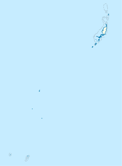
Palau, officially the Republic of Palau, is an island country in the Micronesia subregion of Oceania in the western Pacific. The republic consists of approximately 340 islands and connects the western chain of the Caroline Islands with parts of the Federated States of Micronesia. It has a total area of 466 square kilometers (180 sq mi), making it one of the smallest countries in the world. The most populous island is Koror, home to the country's most populous city of the same name. The capital Ngerulmud is located on the largest island of Babeldaob, in Melekeok State. Palau shares maritime boundaries with international waters to the north, the Federated States of Micronesia to the east, Indonesia to the south, and the Philippines to the northwest.
The Republic of Palau consists of eight principal islands and more than 250 smaller ones lying roughly 500 miles southeast of the Philippines, in Oceania. The islands of Palau constitute the westernmost part of the Caroline Islands chain. The country includes the World War II battleground of Peleliu and world-famous rock islands. The total land area is 459 km2 (177 sq mi). It has the 42nd largest Exclusive Economic Zone of 603,978 km2 (233,197 sq mi).

Koror is the state comprising the main commercial centre of the Republic of Palau. It consists of several islands, the most prominent being Koror Island. It is Palau’s most populous state.

Airai, located on the southern coast of Babeldaob island, is the second-most populous state of Palau. It contains the country's chief airport, Roman Tmetuchl International Airport, and is connected by the Koror–Babeldaob Bridge to nearby Koror Island.

Peleliu is an island in the island nation of Palau. Peleliu, along with two small islands to its northeast, forms one of the sixteen states of Palau. The island is notable as the location of the Battle of Peleliu in World War II.
Angaur, or Ngeaur in Palauan, is an island and state in the island nation of Palau.
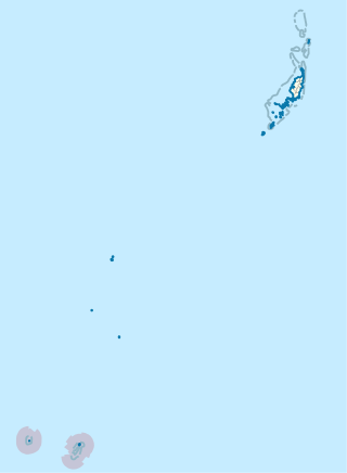
The Southwest Islands of Palau are several small islands spread across the Pacific Ocean about 600 km from the main island chain of Palau. They make up the Palauan states of Sonsorol and Hatohobei. The nearshore islands to the southwest of the main island of Palau (Babeldaob), which belong to the states of Koror, Peleliu and Angaur and the unincorporated Rock Islands, are not considered part of the Southwest Islands.

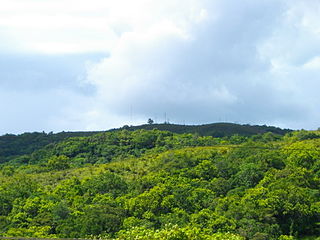
Ngarchelong is a state in Palau. Ngarchelong is at the northernmost tip of the island of Babeldaob. Only the state of Kayangel is farther north.

Aimeliik is an administrative division of the island country of Palau. It is one of the Republic of Palau's 16 states. It has an area of 52 km2 and a population of 334. State capital is the village of Mongami. Following the four other villages which are: Medorm, Imul, Elechui and Ngmechiangel.

Ngchesar also known as Oldiais is one of the sixteen states of the nation of Palau in Oceania.

A rai stone, or fei stone, is one of many large artifacts that were manufactured and treasured by the native inhabitants of the Yap islands in Micronesia. They are also known as Yapese stone money or similar names.

Ngiwal is one of the sixteen states of Palau. It has a population of 282 and an area of 26 km2
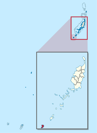
Tobi, or Hatohobei (Tobian), is the southernmost of Palau's sixteen states, consisting of Tobi Island and Helen Reef. The total land area is about 0.88 km². The population was 25 in 2015. Tobian, English, and Sonsorolese are the official languages of Hatohobei State.

Ngardmau is one of Palau's sixteen states and is located on the west side of Babeldaob between the states of Ngaraard and Ngeremlengui.

Ngatpang is one of Palau's sixteen states. It comprises an area of around 47 square kilometers in the west of Palau's largest island, Babeldaob, facing onto Ngeremeduu Bay. It has a population of 282, making it Palau's 9th largest state in population.
Ngeremlengui is one of Palau's sixteen states. It has a population of 349, and is just west of the capital in Melekeok state. Among the 16 states of Palau, it’s the one with the lowest density but the one with the most neighbor states. It’s also the seventh most populous state.

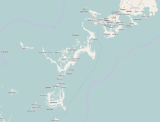
Melekeok is a state of the Republic of Palau located on the central east coast of Babeldaob Island. The seat of government of the country, Ngerulmud, is located in the state. The state consists of long beaches, hills, steep ridges, rivers, and the largest and only natural freshwater lake in Palau and Micronesia, Lake Ngardok.

Ngerulmud is the seat of government of the Republic of Palau, an island nation in the Pacific Ocean. It replaced Koror City as a capital in 2006. The settlement is located in the state of Melekeok on Babeldaob, the country's largest island, located 20 kilometers northeast of Koror City and 2 km northwest of Melekeok City. It is the least-populous capital city of a sovereign nation in the world.
Chinese have been settling in Palau in small numbers since the 19th century. The early settlers consisted of traders and labourers, and often intermarried with Palauan women. Their offspring quickly assimilated with the local populace and generally identify themselves as Palauan. In recent years, Palau has seen a growing expatriate business community from Taiwan, after Palau established formal diplomatic ties with Taiwan in 1999.

Koror City is the largest city and the commercial center in Palau, home to about half of the country's population, located on Oreor Island. During the interwar period it served as the capital of the South Seas Mandate, a group of islands that made up the League of Nations mandated territory held by the Empire of Japan. It was subsequently the capital of Palau until it was replaced by Ngerulmud in 2006.