| State | |
|---|---|
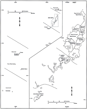 | |
| Category | Unitary State |
| Location | Palau |
| Number | 16 |
| Populations | 25 (Hatohobei) – 11,444 (Koror) |
| Areas | .9 km2 (0.35 sq mi) (Hatohobei) – 65 km2 (25 sq mi) (Ngeremlengui) |
| Government |
|
| Subdivisions |
|
 |
|---|
Palau is divided into sixteen administrative regions, called states. Palau has a high ratio of government offices to citizens, with 16 states and both a tribal chiefdom and elected legislature in each state, for 20,000 people. [1]
Contents
The majority of the country's population lives in Koror State. Airai is the only other state with a population exceeding 1,000, and three states have populations of fewer than 100.