Ngarchelong

Last updated
Ngarchelong
Badrulchau Stone Monoliths 3.JPG
Badrulchau Stone Monoliths
Ngarchelong in Palau.svg
Location of Ngarchelong in Palau
CountryFlag of Palau.svg  Palau
Capital Mengellang
Government
  BodyNgarchelong State Legislature
   Governor Dwight Ngiraibai [1]
Area
  Total10 km2 (4 sq mi)
Population
 (2020 Census)
  Total384
  Density38/km2 (99/sq mi)
  Official languages
Palauan
English
ISO 3166 code PW-218
Palauan Stone Face at Badrulchau, Ngarchelong Palauan Stone Face at Badrulchau 2.JPG
Palauan Stone Face at Badrulchau, Ngarchelong

Ngarchelong is a state in Palau. It is at the northernmost tip of the island of Babeldaob. Only the state of Kayangel is farther north.

Contents

Demography

The population of the state was 384 in the 2020 census and median age was 37.2 years. [2] The official languages of the state are Palauan and English. [3] Uongerchetei is the title of the traditional high chief from the state. [4]

The state has a population of slightly under 390 people (2020), making it the fifth most populated of Palau's sixteen states, although it is ranked thirteenth in land (with only about 10 square kilometers). The village of Mengellang serves as the state capital, and lies toward the south of the state. Mengellang and Ollei are the state's main population centers.

In June 1972, the resident population was 702. [5]

Geography

Ngerchelong is situated on the northern tip of Babeldaob Island. The land has low rolling hills with short drainages and is fringed by a thick belt mangroves. Ngerchelong extends north from the narrowest part of the neck on Babeldaob where it borders Ngaraard. Lower hillsides are generally covered with a lowland forest, and some of the higher hills at the north end of the state are forested, but much of the land is covered with grass and low scrub. [6]

The modern villages of Ollei (north), Mengellang (southwest) and Ngerbau (east coast) are connected by a road now partially paved. This road will eventually become part of the Babeldaob Road connecting to Chol in Ngaraard. [6]

Presently, most of the land use in Ngerchelong is confined to gardens surrounding the modern villages. Interspersed with these kitchen gardens are stands of agroforest which include coconut, and betelnut, breadfruit, almond trees, and banana plants. In and around many of the uninhabited villages are stands of coconut and betelnut palms, and occasionally patches of irregularly attended taro swamp gardens. [6]

In addition, Ngerchelong includes two small islands, Ngerkeklau and Ngerechur, located one and two kilometers north of Babeldaob. [6]

Traditional villages

At least nine traditional village sites lie within Ngerchelong. The traditional villages represent important symbols giving identity to families, clans, and regions. Within villages are numerous stone features with historical and traditional importance. Many of the stone platforms, odesongel, serve as clan cemeteries, and other stone features serve as shrines. The lagoon is an important resource area, and was probably intensively exploited prehistorically. Important resources include the many fish species. Near the traditional villages are taro swamp gardens, and surrounding most village sites are garden plots and terraced hillsides. [6]

Political system

Ngarchelong has its own constitution, adopted in 1982. [7] The state government was established in 1982. The state of Ngarchelong, with population of less than 350, has an elected chief executive, governor. The state also has a legislature elected every two years. [8] The state population elects one of the member in the House of Delegates of Palau.

Culture

Ngarchelong is an important historical site and has undergone archeological excavation.

Ngarchelong is the site of ancient stone monoliths which are mysterious in origin. Traditional Palaun religion regarded these stone monoliths as sacred prayer ground. There are other stone monoliths located in and around the islands but one will not see as many as there are in Ngarchelong.

Education

The Ministry of Education operates public schools.

Ngarchelong Elementary School, established in 1947, moved to its current site in Bai ra Mengellang from the original site in the community bai of Yebong hamlet in 1953. Its current building opened in 1964. It served students from Choll. [9] Ngaraard Elementary School in Ngaraard formerly served Ngarchelong. [10]

Palau High School in Koror is the country's only public high school, so children from this community go there. [11]

Related Research Articles

<span class="mw-page-title-main">Koror</span> State in Palau

Koror is the state comprising the main commercial centre of the Republic of Palau. It consists of several islands, the most prominent being Koror Island. It is Palau’s most populous state.

<span class="mw-page-title-main">Airai</span> State in Palau

Airai, located on the southern coast of Babeldaob island, is the second-most populous state of Palau. It contains the country's chief airport, Roman Tmetuchl International Airport, and is connected by the Koror–Babeldaob Bridge to nearby Koror Island.

<span class="mw-page-title-main">Peleliu</span> State in Palau

Peleliu is an island in the island nation of Palau. Peleliu, along with two small islands to its northeast, forms one of the sixteen states of Palau. The island is notable as the location of the Battle of Peleliu in World War II.

<span class="mw-page-title-main">Angaur</span> State in Palau

Angaur, or Ngeaur in Palauan, is an island and state in the island nation of Palau.

<span class="mw-page-title-main">Babeldaob</span> Largest island of Palau

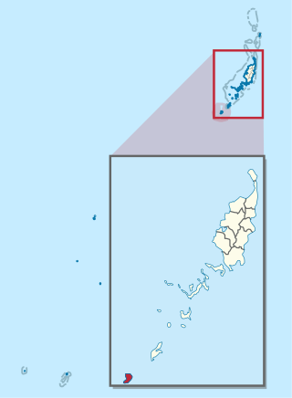
Babeldaob is the largest island in the island nation of the Republic of Palau. It is in the western Caroline Islands, and the second largest island in the Micronesia region of Oceania. Palau's capital, Ngerulmud, is located on Babeldaob, in Melekeok State.

<span class="mw-page-title-main">Aimeliik</span> State in Palau

Aimeliik is an administrative division of the island country of Palau. It is one of the Republic of Palau's 16 states. It has an area of 52 km2 and a population of 334. The state capital is the village of Mongami. The four other villages are Medorm, Imul, Elechui and Ngmechiangel.

<span class="mw-page-title-main">Ngchesar</span> State in Palau

Ngchesar also known as Oldiais is one of the sixteen states of the nation of Palau in Oceania.

<span class="mw-page-title-main">Ngaraard</span> State in Palau

Ngaraard is one of the 16 states of the Republic of Palau, and was originally named Kerradel.

<span class="mw-page-title-main">Kayangel</span> State in Palau

Kayangel (Ngcheangel) is the northernmost state of Palau 86 km (53 mi) north of Koror. The land area is about 1.4 km2 (0.54 sq mi). The population is 54. There is one hamlet in the state - Orukei, which is also its capital. In 2020, Richard Ngiraked was elected governor of the state.

<span class="mw-page-title-main">Ngiwal</span> State in Palau

Ngiwal is one of the sixteen states of Palau. It has a population of 282 and an area of 26 km2

<span class="mw-page-title-main">Hatohobei</span> State in Palau

Tobi, or Hatohobei (Tobian), is the southernmost of Palau's sixteen states, consisting of Tobi Island and Helen Reef. The total land area is about 0.88 km². The population was 25 in 2015. Tobian, English, and Sonsorolese are the official languages of Hatohobei State.

<span class="mw-page-title-main">Ngardmau</span> State in Palau

Ngardmau is one of Palau's sixteen states and is located on the west side of Babeldaob between the states of Ngaraard and Ngeremlengui.

<span class="mw-page-title-main">Ngatpang</span> State in Palau

Ngatpang is one of Palau's sixteen states. It comprises an area of around 47 square kilometers in the west of Palau's largest island, Babeldaob, facing onto Ngeremeduu Bay. It has a population of 282, making it Palau's 9th largest state in population.

<span class="mw-page-title-main">Ngeremlengui</span> State in Palau

Ngeremlengui is one of Palau's sixteen states. It has a population of 349, and is just west of the capital in Melekeok state. Among the 16 states of Palau, it’s the one with the lowest density but the one with the most neighbor states. It’s also the seventh most populous state.

Chol (Choll) is a village at the northern end of Ngaraard State in Palau. This village consists of a large, long, beach that runs along its entire east coast. The village has a series of ancient paths and platforms, similar to the rest of the villages in Ngaraard. There is also a large man-made channel that connects the village to the sea on the western coast. At the center of the village, along the compact road, there is a small marketplace with benches where one can purchase some village refreshments.

<span class="mw-page-title-main">Melekeok</span> State in Palau

Melekeok is a state of the Republic of Palau located on the central east coast of Babeldaob Island. The seat of government of the country, Ngerulmud, is located in the state. The state consists of long beaches, hills, steep ridges, rivers, and the largest and only natural freshwater lake in Palau and Micronesia, Lake Ngardok.

<span class="mw-page-title-main">Index of Palau-related articles</span>

The following is an alphabetical list of topics related to the Republic of Palau.

Ollei is a small fishing village in the Pacific island nation of Palau. It has a population of slightly over 100 people and is located in the State of Ngarchelong, near the northern tip of the Babeldaob island. The village is built along a single road which connects it the rest of the island. Facing west from the village is a large boating dock, which juts out about one fifth of a mile into the ocean. The nearest populated village is that of Mengellang, the capital of the state.

<span class="mw-page-title-main">Sonsorol</span> State in Palau

Sonsorol is one of the sixteen states of Palau. The inhabitants speak Sonsorolese, a local Chuukic language, and Palauan.

<span class="mw-page-title-main">Ministry of Education (Palau)</span> Government ministry in Palau

The Ministry of Education is a government agency of Palau, headquartered in Koror City.

References

  1. Reklai, Leilani (2 September 2022). "Ngiraibai sweeps votes for governor, 7 out 8 Lators unopposed in Ngarchelong election". Island Times.
  2. "2015 Census of Population, Housing and Agriculture for the Republic of Palau" (PDF). Palau Government. Office of Planning and Statistics.
  3. Leonard, Thomas M. (2006). Encyclopedia of the Developing World. Taylor & Francis. ISBN   9780415976640.
  4. "Council of Chiefs – PalauGov.pw".
  5. "Trust Territory of the Pacific Islands". Bureau of International Organization Affairs, Office of United Nations Political Affairs. 1972.
  6. 1 2 3 4 5 Snyder, David.; Adams, William Hampton; Butler, Brian M. (1997). Archaeology and historic preservation in Palau. Anthropology research series / Division of Cultural Affairs, Republic of Palau 2. San Francisco: U.S. National Park Service.
  7. "Constitution of the State of Ngarchelong: April 14, 1982 (Palau [pw])". Oxford Constitutions. doi:10.1093/law:ocw/law-ocw-cd854.reggroup.1/law-ocw-cd854?rskey=oeud3a&result=15&prd=oxcon.
  8. "State/National Election Schedule". Palau Election Commission. 5 November 2020.
  9. "Ngarchelong Elementary School Archived 2018-10-17 at the Wayback Machine ." Ministry of Education (Palau). Retrieved on February 22, 2018.
  10. "Ngaraard Elementary School Archived 2018-03-03 at the Wayback Machine ." Ministry of Education (Palau). Retrieved on February 22, 2018.
  11. "About Archived 2018-03-03 at the Wayback Machine ." Palau High School. Retrieved on February 22, 2018.

PD-icon.svg This article incorporates public domain material from Snyder, David.; Adams, William Hampton; Butler, Brian M. (1997). Archaeology and historic preservation in Palau. Anthropology research series / Division of Cultural Affairs, Republic of Palau 2. San Francisco: U.S. National Park Service.

7°42′N134°37′E / 7.700°N 134.617°E / 7.700; 134.617