Amenities
The 43 hectare (106 acre) park includes a man-made lake and has 5.8 km (3.6 mi.) of walking trails, which connect with the Coal Banks Trail. [2] The lake is stocked with trout every year and is a popular fishing spot. Non-motorised boating is allowed in the summer, and ice skating is allowed in the winter, weather permitting.
Another main attraction is the 18-hole disc golf course. Originally built for the 2001 Alberta Seniors Games, the course is available to the public at no charge, on a first-come, first-served, walk-on basis. [1]
The park also includes a large playground area, a picnic facility, baseball diamonds, a soccer field and basketball hoops. In addition, the Nicholas Sheran Leisure Centre Pool, the Nicholas Sheran Ice Centre, and the Gyro Spray Ground water park are across the street from the park. [2]

Lethbridge is a city in the province of Alberta, Canada. It is Alberta's third-largest city by both population and land area after Calgary and Edmonton, and the largest city in southern Alberta. The nearby Canadian Rockies contribute to the city's warm summers, mild winters, and windy climate. Lethbridge lies southeast of Calgary on the Oldman River.

The University of Lethbridge is a public comprehensive and research university, founded in the liberal education tradition, located in Lethbridge, Alberta, Canada, with a second campus in the city of Calgary, Alberta.

Coaldale is a town in southern Alberta, Canada, located 11 km (6.8 mi) east of Lethbridge, along the Crowsnest Highway. Coaldale became a village in 1919 and then became incorporated as a town in 1952.
The ENMAX Centre is a 5,479-seat multi-purpose arena, in Lethbridge, Alberta, Canada.

Ponoka is a town in central Alberta, Canada. It is located at the junction of Highway 2A and Highway 53, 59 kilometres (37 mi) north of Red Deer and 95 kilometres (59 mi) south of Edmonton.

Lethbridge College opened in 1957 as the first publicly funded community college in Canada. Over 4,000 students attend the Lethbridge, Alberta, institution.

Division No. 2 is a census division in Alberta, Canada. It is located in the south-central portion of southern Alberta and includes the City of Lethbridge.

The modern history of Lethbridge extends to the mid-19th century, when the area was developed from drift mines opened by Nicholas Sheran in 1874, and the North Western Coal and Navigation Company in 1882. Prior to the development of drift mines in the area, Lethbridge, Alberta was known as Coal Banks, and was part of the territory of the Blackfoot Confederacy. The Confederacy was made up of the Kainai Nation, the Northern Peigan, the Southern Peigan (Blackfeet), and the Siksika Nation.

The Oldman River valley parks system is a continuous collection of eight urban parks in the Oldman River valley of Lethbridge, Alberta, 100 metres (330 ft) below the prairie level. The parks were created in the 1980s as part of the city's Urban Parks Project. Today they are a combined 16 square kilometres (6.2 sq mi) in size and comprise one of the largest urban park systems in North America, and the third largest in Canada.
Mayor Magrath Drive is the busiest north-south roadway and the second busiest roadway overall in Lethbridge, Alberta. In 2011, it saw roughly 34,000 vehicles per day in weekday traffic. Most retail and hospitality establishments in the city are concentrated on this roadway, and it serves as a major transportation corridor for the city and region.
Downtown Lethbridge is the commercial centre of Lethbridge, Alberta, hosting most of the city's banks and several accounting and law practices, including national firms.
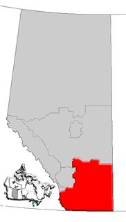
Southern Alberta is a region located in the Canadian province of Alberta. In 2004, the region's population was approximately 272,017. The primary cities are Lethbridge and Medicine Hat. The region is known mostly for agricultural production, but other sectors, such as alternative energy, film production and tourism, are emerging.

Henderson Park is a 47 hectare located in Lethbridge, Alberta, Canada. The park contains many amenities and attractions, including a 24 hectare man-made lake, the largest lake in the city. Several annual events are held in the park.
West Lethbridge, is one of three geographical areas in Lethbridge, Alberta, Canada. It is the newest and the fastest growing. It is the home of the University of Lethbridge and is a residential area primarily.
Coal Banks Trail is a 30-kilometre multipurpose recreational path in Lethbridge, Alberta, Canada. It connects all of the city's major urban parks, all three geographical areas, and many smaller parks. While primarily a community recreation opportunity, the trail is also used for community events, such as the Terry Fox Run and the Moonlight Run.

The Red Coat Trail is a 1,300-kilometre (810 mi) route that approximates the path taken in 1874 by the North-West Mounted Police in their quest to bring law and order to the Canadian West.

Wrentham is a hamlet in southern Alberta, Canada within the County of Warner No. 5. It is located southeast of the intersection of the Veteran Memorial Highway and the historic Red Coat Trail, approximately 25 kilometres (16 mi) east of the Village of Stirling, 30 kilometres (19 mi) south of the Town of Taber and 55 kilometres (34 mi) west of the Village of Foremost.

Chin is a hamlet in southern Alberta, Canada within the Lethbridge County. It is located 1 kilometre (0.62 mi) north of Highway 3, approximately 27 kilometres (17 mi) east of Lethbridge.
Iron Springs is a hamlet in southern Alberta, Canada within the Lethbridge County. It is located on Highway 25, approximately 28 kilometres (17 mi) northeast of Lethbridge. It was founded in 1925 when the railroad arrived. The community was named after a spring of the same name near the original town site.
Nicholas Sheran Park Disc Golf Course is a public 18-hole disc golf course located in Nicholas Sheran Park, in Lethbridge, Alberta, Canada. It was designed by Craig Burrows-Johnson and originally built for the 2001 Alberta Seniors Games. The course is available to the public at no charge, on a first-come, first-served, walk-on basis. According to Alberta Disc Golf, with a total length of 2693 meters from the blue tees, Nicholas Sheran Park Disc Golf Course is the longest disc golf course in Canada.
