Niederviehbach

Last updated

Niederviehbach
Kirche Niederviehbach-2.JPG
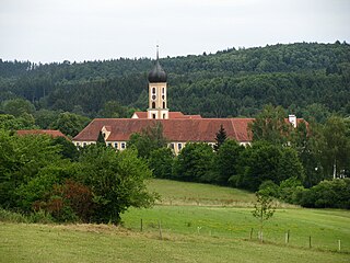
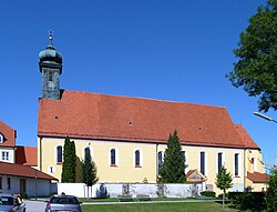
Church of the Virgin Mary
Wappen Niederviehbach.svg
Coat of arms
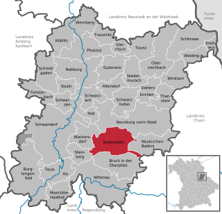
Location of Niederviehbach within Dingolfing-Landau district
Niederviehbach in DGF.png
Germany adm location map.svg
Red pog.svg
Niederviehbach
Bavaria location map.svg
Red pog.svg
Niederviehbach
Coordinates: 48°37′N12°23′E / 48.617°N 12.383°E / 48.617; 12.383 Coordinates: 48°37′N12°23′E / 48.617°N 12.383°E / 48.617; 12.383
Country Germany
State Bavaria
Admin. region Niederbayern
District Dingolfing-Landau
Government
   Mayor (201925) Johannes Birkner [1] (CSU)
Area
  Total29.62 km2 (11.44 sq mi)
Elevation
392 m (1,286 ft)
Population
 (2020-12-31) [2]
  Total2,651
  Density90/km2 (230/sq mi)
Time zone UTC+01:00 (CET)
  Summer (DST) UTC+02:00 (CEST)
Postal codes
84183
Dialling codes 08702
Vehicle registration DGF
Website www.niederviehbach.de

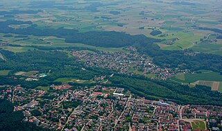
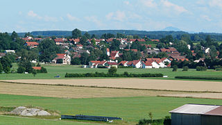
Niederviehbach is a municipality in the district of Dingolfing-Landau in Bavaria in Germany. It lies on the Isar River.

Related Research Articles

Garching an der Alz Place in Bavaria, Germany

Garching is a municipality in the district of Altötting in Bavaria in Germany.

Winhöring Place in Bavaria, Germany

Winhöring is a municipality in the district of Altötting in Bavaria in Germany. It lies on the river Inn.

Mönchsroth Place in Bavaria, Germany

Mönchsroth is a municipality in the district of Ansbach in Bavaria in Germany.

Gessertshausen Place in Bavaria, Germany

Gessertshausen is a municipality in the district of Augsburg in Bavaria in Germany. It lies on the Schmutter River.

Bischofswiesen Place in Bavaria, Germany

Bischofswiesen is a municipality in the district of Berchtesgadener Land in Bavaria in Germany.

Künzing Place in Bavaria, Germany

Künzing is a municipality in the district of Deggendorf in Bavaria in Germany.

Altmannstein Place in Bavaria, Germany

Altmannstein is a municipality in the district of Eichstätt in Bavaria in Germany.

Kinding Place in Bavaria, Germany

Kinding is a municipality in the district of Eichstätt in Bavaria in Germany.

Hausen, Upper Franconia Place in Bavaria, Germany

Hausen is a municipality in the district of Forchheim in Bavaria in Germany.

Seubersdorf Place in Bavaria, Germany

Seubersdorf is a municipality in the district of Neumarkt in Bavaria in Germany.

Germaringen Place in Bavaria, Germany

Germaringen is a municipality in the district of Ostallgäu in Bavaria in Germany.

Hopferau Place in Bavaria, Germany

Hopferau is a municipality in the district of Ostallgäu in Bavaria in Germany.

Bodenwöhr Place in Bavaria, Germany

Bodenwöhr is a municipality in the district of Schwandorf in Bavaria, Germany.

Pfaffenhausen Place in Bavaria, Germany

Pfaffenhausen is a municipality in the district of Unterallgäu in Bavaria, Germany. The town is seat of a municipal association with Breitenbrunn, Swabia, Oberrieden, Bavaria and Salgen.

Güntersleben Place in Bavaria, Germany

Güntersleben is a municipality in the district of Würzburg in Bavaria in Germany.

Buxheim, Swabia Place in Bavaria, Germany

Buxheim is a municipality in the district of Unterallgäu in Bavaria, Germany.

Burggen Place in Bavaria, Germany

Burggen is a municipality in the Weilheim-Schongau district, in Bavaria, Germany.

Geroldshausen Place in Bavaria, Germany

Geroldshausen is a municipality in the district of Würzburg in Bavaria, Germany.

Tauberrettersheim Place in Bavaria, Germany

Tauberrettersheim is a municipality in the district of Würzburg in Bavaria, Germany. It lies on the river Tauber.

Winterhausen Place in Bavaria, Germany

Winterhausen is a municipality in the district of Würzburg in Bavaria, Germany.

References

  1. Liste der ersten Bürgermeister/Oberbürgermeister in kreisangehörigen Gemeinden, Bayerisches Landesamt für Statistik, accessed 19 July 2021.
  2. "Tabellenblatt "Daten 2", Statistischer Bericht A1200C 202041 Einwohnerzahlen der Gemeinden, Kreise und Regierungsbezirke". Bayerisches Landesamt für Statistik und Datenverarbeitung (in German). June 2021.