Firth is a word in the English and Scots languages used to denote various coastal waters in the United Kingdom, predominantly within Scotland. In the Northern Isles, it more often refers to a smaller inlet. It is linguistically cognate to Scandinavian fjord and fjard, with the original meaning of "sailable waterway". The word has a more constrained sense in English. Bodies of water named "firths" tend to be more common on the Scottish east coast, or in the southwest of the country, although the Firth of Clyde is an exception to this. The Highland coast contains numerous estuaries, straits, and inlets of a similar kind, but not called "firth" ; instead, these are often called sea lochs. Before about 1850, the spelling "Frith" was more common.

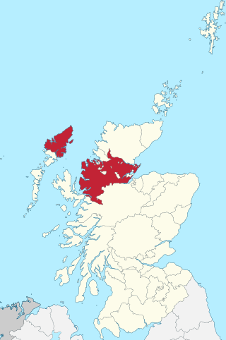
Highland is a council area in the Scottish Highlands and is the largest local government area in the United Kingdom. It was the 7th most populous council area in Scotland at the 2011 census. It has land borders with the council areas of Aberdeenshire, Argyll and Bute, Moray and Perth and Kinross. The wider upland area of the Scottish Highlands after which the council area is named extends beyond the Highland council area into all the neighbouring council areas plus Angus and Stirling.

Cromarty is a town, civil parish and former royal burgh in Ross and Cromarty, in the Highland area of Scotland. Situated at the tip of the Black Isle on the southern shore of the mouth of Cromarty Firth, it is 5 miles (8 km) seaward from Invergordon on the opposite coast. In the 2001 census, it had a population of 719.

The Cromarty Firth is an arm of the Moray Firth in Scotland.

The Moray Firth is a roughly triangular inlet of the North Sea, north and east of Inverness, which is in the Highland council area of the north of Scotland.

The A9 is a major road in Scotland running from the Falkirk council area in central Scotland to Scrabster Harbour, Thurso in the far north, via Stirling, Bridge of Allan, Perth and Inverness. At 273 miles (439 km), it is the longest road in Scotland and the fifth-longest A-road in the United Kingdom. Historically it was the main road between Edinburgh and John o' Groats, and has been called the spine of Scotland. It is one of the three major north–south trunk routes linking the Central Belt to the Highlands – the others being the A82 and the A90.

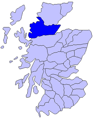
Ross and Cromarty, is an area in the Highlands and Islands of Scotland. In modern usage, it is a registration county and a lieutenancy area. Between 1889 and 1975 it was a county.

Ross is an area of Scotland. It was first recorded in the tenth century as a province, at which time it was under Norwegian overlordship. It was claimed by the Scottish crown in 1098, and from the 12th century Ross was an earldom. From 1661 there was a county of Ross, also known as Ross-shire, covering most but not all of the province, in particular excluding Cromartyshire. Cromartyshire was subsequently merged with the county of Ross in 1889 to form the county of Ross and Cromarty. The area is now part of the Highland council area.

The Dornoch Firth is a firth on the east coast of Highland, in northern Scotland. It forms part of the boundary between Ross and Cromarty, to the south, and Sutherland, to the north. The firth is designated as a national scenic area, one of 40 such areas in Scotland. The national scenic area covers 15,782 ha in total, of which 4,240 ha is the marine area of the firth below low tide. A review of the national scenic areas by Scottish Natural Heritage in 2010 commented:
By comparison with other east coast firths the Dornoch Firth is narrow and sinuous, yet it exhibits within its compass a surprising variety of landscapes. It is enclosed by abrupt rounded granitic hills clad in heather moor and scree, their Gaelic names of cnoc, meall and creag giving the clue to their character. Their lower slopes are frequently wooded, oakwoods being a noticeable feature of the area, but with other deciduous and coniferous species represented in plantations which vary from the policy plantings of Skibo Castle to the pines of the Struie Forest.

Loch Fleet is a sea loch on the east coast of Scotland, located between Golspie and Dornoch. It forms the estuary of the River Fleet, a small spate river that rises in the hills east of Lairg. The loch was designated a National Nature Reserve (NNR) in 1998, and is managed by a partnership between NatureScot, the Scottish Wildlife Trust (SWT) and Sutherland Estates. The NNR extends to 1058 hectares, including the Loch Fleet tidal basin, sand dunes, shingle ridges and the adjacent pine woods, including Balbair Wood and Ferry Wood. The tidal basin of the loch covers over 630 ha, and forms the largest habitat on the NNR.
The Black Isle is a peninsula within Ross and Cromarty, in the Scottish Highlands. It includes the towns of Cromarty and Fortrose, and the villages of Culbokie, Resolis, Jemimaville, Rosemarkie, Avoch, Munlochy, Tore, and North Kessock, as well as numerous smaller settlements. About 12,000 people live on the Black Isle, depending on the definition.

Invergordon is a town and port in Easter Ross, in Ross and Cromarty, Highland, Scotland. It lies in the parish of Rosskeen.

Ross-shire, or the County of Ross, was a county in the Scottish Highlands. It bordered Sutherland to the north and Inverness-shire to the south, as well as having a complex border with Cromartyshire, a county consisting of numerous enclaves or exclaves scattered throughout Ross-shire's territory. The mainland had a coast to the east onto the Moray Firth and a coast to the west onto the Minch. Ross-shire was named after and covered most of the ancient province of Ross, and also included the Isle of Lewis in the Outer Hebrides. The county town was Dingwall.

Barbaraville is a small settlement on the north shore of Nigg Bay in the Cromarty Firth in the Highland council area of Scotland. Housing dates from 1820 on when local people were allowed to build on packets of land from local estates at Balnagown, Tarbet and Polnicol. Comprising approximately 170 households, there has been recent expansion with the creation of a retirement village at Highland Park which has added some 50 households to the community all of which are occupied by people over the age of 55.

Nigg is a village and parish in Easter Ross, administered by the Highland Council. It lies on the north shore of the entrance to the Cromarty Firth.

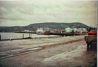
Balintraid is an industrial settlement, which was built largely in the 1970s with the growth of the North Sea oil industry in Scotland, lies on the north east corner of Nigg Bay, in the Cromarty Firth in Ross-shire, Scottish Highlands and is in the Scottish council area of Highland. Balintraid pier - probably the oldest pier on the Cromarty Firth, was built by Thomas Telford in 1824.

The Beatrice Offshore Wind Farm now known as Beatrice Offshore Windfarm Ltd (BOWL) project, is an offshore wind farm close to the Beatrice oil field in the Moray Firth, part of the North Sea 13 km off the north east coast of Scotland.
The Beatrice Oil Field is a small oilfield consisting of 3 platforms located 24 km off the north east coast of Scotland. It began operations in 1980 with the field finally being decommissioned in 2017.

The Port of Inverness is a port on the east coast of Scotland, at Inverness, Highland council area, at the mouth of the River Ness. It is one of Scotland's most sheltered and deep natural ports. The port is owned and operated by Inverness Harbour Trust, established by Act of Parliament in 1847. The port was first recorded in history in 1249.
The Moray and Nairn Coast is a protected wetland site on the southern shore of the Moray Firth, in the west of Scotland. A total of 2,412 hectares comprises two areas: intertidal flats, saltmarsh and sand dunes at Findhorn Bay and Culbin Bar, and alluvial deposits and woodland of the lower River Spey and Spey Bay. It has been protected as a Ramsar Site since 1997.


