European route E 4 passes from north to south through Sweden from the border with Finland, with a total length of 1,590 kilometres (990 mi). The Finnish part lies entirely within Tornio in northern Finland, and is only 1 kilometre (0.62 mi) long. The Swedish part traverses most of Sweden except the extreme north and the west coast region, and is commonly considered the highway backbone of Sweden, since it passes in the vicinity of many of its largest cities and through the capital Stockholm. In particular, it is the mainline road used by most vehicle traffic, both personal cars and freight trailers, between the north (Norrland) and southern Sweden or beyond.

Tornio is a city and municipality in Lapland, Finland. The city forms a cross-border twin city together with Haparanda on the Swedish side. The municipality covers an area of 1,348.83 square kilometres (520.79 sq mi), of which 161.59 km2 (62.39 sq mi) is water. The population density is 18.4 inhabitants per square kilometre (48/sq mi), with a total population of 21,837. It borders the Swedish municipality of Haparanda. In spite of being a border city Tornio is unilingually Finnish with a negligible number of native Swedish speakers, although this does not count Finnish bilinguals.
Sundborn is a locality situated in Falun Municipality, Dalarna County, Sweden with 762 inhabitants in 2010.
Olofström, earlier Holje by, is a locality and the seat of Olofström Municipality in Blekinge County, Sweden with 7,327 inhabitants in 2010.

Svenljunga is a locality and the seat of Svenljunga Municipality, Västra Götaland County, Sweden with 3,418 inhabitants in 2010.
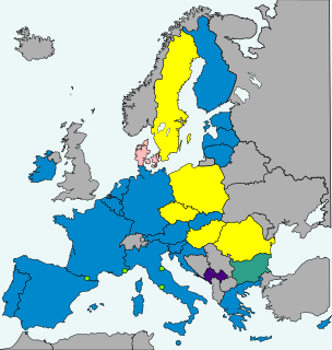
Sweden does not currently use the euro as its currency and has no plans to replace the krona in the near future. Sweden's Treaty of Accession of 1994 made it subject to the Treaty of Maastricht, which obliges states to join the eurozone once they meet the necessary conditions. Sweden maintains that joining the ERM II is voluntary, and has chosen to remain outside pending public approval by a referendum, thereby intentionally avoiding the fulfilment of the adoption requirements.

Sätra brunn is a spa town in Sala Municipality, Västmanland County, Sweden. As of 2010, it had 335 inhabitants. It is most famous for its spa, one of Sweden's oldest health resorts.

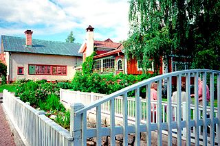
Marielund is a locality situated in Haparanda Municipality, Norrbotten County, Sweden with 1,726 inhabitants in 2010. It was built as a suburb to Haparanda in the 1970s and then got the name Mattila after a small village in the neighbourhood. To avoid confusion, the name was changed to the current one in the 1980s.

Forsbacka is a locality situated in Gävle Municipality, Gävleborg County, Sweden with 1,702 inhabitants in 2010.

Karungi is a locality situated in Haparanda Municipality, Norrbotten County, Sweden with 232 inhabitants in 2010. The language most spoken in the village is Meänkieli, which the first of April 2000 officially was declared as a minority language in Sweden.
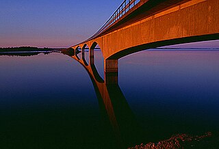
Seskarö is a locality situated in Haparanda Municipality, Norrbotten County, Sweden with 491 inhabitants in 2010. It is located on the island with the same name which is about 20 km2 and situated in the Haparanda Archipelago. Since 1978, it has been connected to the mainland through a bridge, via some intermediate islands.

Skumparp is a neighbourhood of Malmö, situated in the Borough of Limhamn-Bunkeflo, Malmö Municipality, Skåne County, Sweden. It is also a locality and had 205 inhabitants in 2010.
Toarp is a neighbourhood of the Borough of Oxie, Malmö Municipality, Skåne County, Sweden. It is also a locality and had 219 inhabitants in 2010.

Haparanda FF is a football club located in Haparanda.
The Haparanda archipelago is a group of 792 Swedish islands in the north part of the Bay of Bothnia. The islands are used for recreation in the summer months. They are icebound during the winter.

HT Bandy was a Swedish-Finnish bandy. The club was located to Haparanda in Sweden and Tornio in Finland, two towns on each side of the Swedish-Finnish border. It was founded in 2008 when the two clubs in the towns decided to merge formally, after having had a deep cooperation for many years.
Kalliohasu is a Swedish island belonging to the Haparanda archipelago. The island is located near Nikkala. It has no shore connection and no buildings.