
Tanzania comprises many lakes, national parks, and Africa's highest point, Mount Kilimanjaro. Northeast Tanzania is mountainous, while the central area is part of a large plateau covered in grasslands. The country also contains the southern portion of Lake Victoria on its northern border with Uganda and Kenya.

Malawi is a landlocked country in southeast Africa. It is wholly within the tropics; from about 9°30S at its northernmost point to about 17°S at the southernmost tip. The country occupies a thin strip of land between Zambia and Mozambique, extending southwards into Mozambique along the valley of the Shire River. In the north and north east it also shares a border with Tanzania. Malawi is connected by rail to the Mozambican ports of Nacala and Beira. It lies between latitudes 9° and 18°S, and longitudes 32° and 36°E.

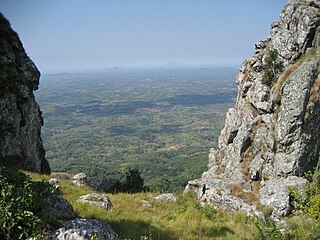
The Eastern Highlands, also known as the Manica Highlands, is a mountain range on the border of Zimbabwe and Mozambique. The Eastern Highlands extend north and south for about 300 kilometres (190 mi) through Zimbabwe's Manicaland Province and Mozambique's Manica Province.

The Ethiopian Highlands is a rugged mass of mountains in Ethiopia in northeast Africa. It forms the largest continuous area of its elevation in the continent, with little of its surface falling below 1,500 m (4,900 ft), while the summits reach heights of up to 4,550 m (14,930 ft). It is sometimes called the Roof of Africa due to its height and large area. Most of the Ethiopian Highlands are part of central and northern Ethiopia, and its northernmost portion reaches into Eritrea.
The Viphya Mountains, also known as the Viphya Plateau or Viphya Highlands, are a mountain range in Malawi's Northern Region.
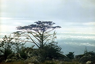
The Kipengere Range, also known as the Livingstone Mountains, lies entirely in Njombe Region in southwest Tanzania at the northern end of Lake Nyasa. Near Lake Nyasa they are known as the Kinga Mountains. It is a plateau-like ridge of mountains running southeastwards from the basin of the Great Ruaha River in the north to that of the Ruhuhu River in the south, and forms part of the eastern escarpment of the East African Rift. The range is mostly clad in montane grasslands, renowned for their botanical diversity and displays of flowers, with montane evergreen forests mostly in stream valleys.

The Eastern miombo woodlands (AT0706) are an ecoregion of grassland and woodland in northern Mozambique, southern Tanzania, and southeastern Malawi.

The wildlife of Mozambique consists of the flora and fauna of this country in southeastern Africa. Mozambique has a range of different habitat types and an ecologically rich and diverse wildlife. This includes 236 species of mammal, 740 species of bird and 5,692 species of vascular plant. The Maputaland-Pondoland-Albany hotspot, with significantly high levels of biodiversity, stretches from the southern tip of Mozambique into northeastern South Africa.
The long-billed forest warbler, also known as the long-billed tailorbird, is a songbird of the family Cisticolidae, formerly part of the "Old World warbler" assemblage. It is found in Tanzania. Its natural habitat is subtropical or tropical moist montane forests. It is threatened by habitat destruction.

Niassa Reserve is a nature reserve in Cabo Delgado Province and Niassa Province, Mozambique. Covering over 42,000 square kilometres, it is the largest protected area in the country. The reserve is part of the Trans-Frontier Conservation Area and links to the Tanzanian Lukwika-Lumesule Game Reserve. It will connect to the Lake Niassa Reserve when it is completed.
The dark batis is a small passerine bird belonging to the genus Batis in the wattle-eye family, Platysteiridae. It is found in highland forest in south-west Tanzania, northern Malawi, and northern Mozambique. These birds were formerly thought to be forest batises but in 2006 were described as a new species based on differences in morphology and mitochondrial DNA from those birds in northern Tanzania and Kenya.
The South Malawi montane forest-grassland mosaic is an ecoregion of Malawi.

The Southern Zanzibar-Inhambane coastal forest mosaic, also known as the Southern Swahili coastal forests and woodlands, is a tropical moist broadleaf forest ecoregion of eastern Africa. It is a southern variation of Northern Zanzibar-Inhambane coastal forest mosaic. The ecoregion supports habitats of forest, savanna and swamps. The southern portion of the ecoregion is not as well studied due to the 1977-1992 civil war in Mozambique.
The Angolan montane forest-grassland mosaic ecoregion is located on the east-facing inland side of the belt of mountains that stands parallel to the coast of Angola, 50–100 km inland.
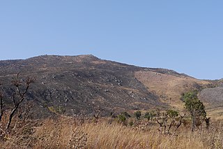
The Southern Highlands is a highland region in southwestern Tanzania, at the northern end of Lake Malawi. The highlands include portions of Mbeya, Njombe, Rukwa, Ruvuma, and Songwe regions, bordering Malawi, Mozambique, and Zambia. Mbeya is the largest city in the highlands.
The Umalila Mountains are a mountain range in southern Tanzania, on the border with Malawi. The Umalila Mountains are part of Tanzania's Southern Highlands.
The Choa Mountains are a mountain range in Manica Province of Mozambique. The mountains lie in Báruè District, west of Catandica.
The Mozambique forest warbler is a songbird of the family Cisticolidae, formerly part of the "Old World warbler" assemblage. It is found in the Njesi Highlands of northern Mozambique. Its natural habitat is montane evergreen and riparian forests.
Mount Mecula is a mountain in northern Mozambique. It is located in Niassa Province, near the center of Niassa National Reserve.
Mount Yao is a mountain in northern Mozambique. It is located in Niassa Province, in Niassa National Reserve. The mountain is named for the Yao people who live in the area around the mountain.
