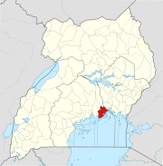
Fort Portal or Kabarole is a city located in the Western Region of Uganda. It is the seat of both Kabarole District and historically of the Tooro Kingdom.

Lira is a city in the Northern Region of Uganda. It is the main municipal, administrative, and commercial centre of Lira District.
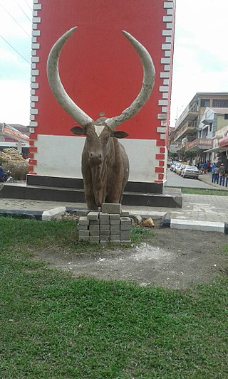
Mbarara City is a city in the Western Region of Uganda and the second largest city in Uganda after Kampala. The city is divided into 6 boroughs of Kakoba Division, Kamukuzi Division, Nyamitanga Division, Biharwe Division, Kakiika Division, Nyakayojo Division. It is the main commercial centre of most of south western districts of Uganda and the site of the district headquarters. In May 2019, the Uganda's cabinet granted Mbarara a city status, which started on 1 July 2020.

Kabale is a town in the Western Region of Uganda. It is the chief town of Kabale District, and the district headquarters are located there.
Pallisa is a town in Pallisa District of the Eastern Region of Uganda.
Kayunga is a town in the Central Region of Uganda. It is the main municipal, administrative, and commercial center of Kayunga District.
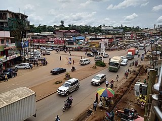
Mukono Town is a municipality in Mukono District in the Central Region of Uganda. The town is administered by the Mukono Town Council. The district headquarters are located in this town.
Njeru is a town in Buikwe District, in the Central Region of Uganda. It is the largest town in the district. It is mainly a residential town. However, it hosts industries such as East African Packaging Solutions Limited, a manufacturer of paper packaging supplies, Nile Breweries Limited, a subsidiary of AB InBev and Nyanza Textile Industries Limited (Nytil), a textile manufacturer.
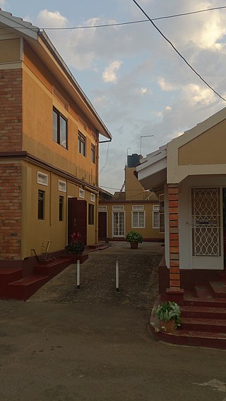
Mityana, is a town in the Central Region of Uganda. It is the main municipal, administrative, and commercial center of Mityana District, as well as the location of the district headquarters.
Lugazi is a town in the Buikwe District of the Central Region of Uganda. The town is also called "Kawolo", and the two names are interchangeably used by the local inhabitants.
The Kampala–Jinja Highway is a road in Uganda, connecting the cities of Kampala and Jinja. Sometimes referred to as Kampala–Jinja Road, it is a busy road, with several towns, trading centers and other points of interest along the way. As of October 2016, a new, wider, four-lane dual carriageway expressway, the Kampala–Jinja Expressway, is proposed to be constructed south of the present highway to relieve traffic and complement existing transport infrastructure between Kampala and Jinja.

Buikwe, sometimes spelled Buyikwe, is a town in Buikwe District, Uganda. It is the administrative center of the district and the location of the district headquarters.

Kaabong is a town in the Northern Region of Uganda. It is the chief municipal, administrative and commercial center of the eponymous Kaabong District, and the district headquarters are located in the town.
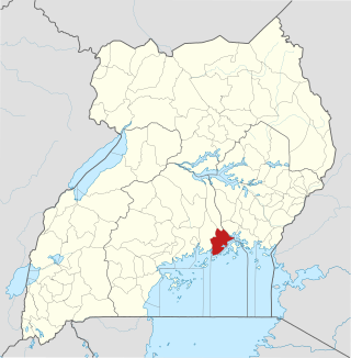
Buikwe District is a district in the Central Region of Uganda. It is named after its 'chief town', Buikwe, where the district headquarters are located.
St. Francis Hospital Nkokonjeru, commonly referred to as Nkokonjeru Hospital, is a private, non-profit, community hospital in Uganda. It is owned by the Roman Catholic Diocese of Lugazi.
Nyenga is an urban division of one of the municipalities in Buikwe District, in the Central Region of Uganda. Nyenga Division is one of the three divisions of the city of Njeru. The other two divisions are Wakisi Division and Njeru Division.
The Mukono–Kyetume–Katosi–Nyenga Road is a road in the Central Region of Uganda, connecting the towns of Mukono, Kyetume and Katosi in Mukono District to Nkokonjeru and Nyenga in Buikwe District.
The Soroti–Dokolo–Lira Road is a road in Uganda, connecting the towns of Soroti in Soroti District, Dokolo in Dokolo District, and Lira in Lira District.
St. Charles Lwanga Buikwe Hospital, also Czech–Slovak–Ugandan Hospital, is a community hospital in the Central Region of Uganda. It is affiliated with the Uganda Catholic Medical Bureau.
Rugaaga is a town in Isingiro District in the Western Region of Uganda.


