

Nokken is a self-built community located on the north-west coast of Amager, just south of Islands Brygge, in Copenhagen, Denmark.
Nokken is a self-built community located on the north-west coast of Amager, just south of Islands Brygge, in Copenhagen, Denmark.
Islands Brygge was created on reclaimed land in the years between 1900 and 1905. The southern part of the area was owned by the Port Authority and used for port-related industry. Nokken was founded in the 1930s when permission was given to use an undeveloped area for fishing. The first sheds and cabins were constructed, and over the years the community continued to grow. [1]
Ownership of the area was ceded to Copenhagen Municipality when heavy industry disappeared from Islands Brygge towards the end of the century. When plans were being drafted for the redevelopment of the former industrial areas at Islands Brygge, Nokken's residents feared that it would threaten the existence of their community. Negotiations with the municipal authorities finally gave Nokken status as an allotment (kolonihaveforening). The area is currently regulated by some 100 individual leases. [2]

Amager, located in the Øresund, is Denmark's most densely populated island, with more than 216,000 inhabitants. The protected natural area of Naturpark Amager makes up more than one-third of the island's total area of 96 km2.

M1 of the Copenhagen Metro, colored green on the map, runs from Vanløse to Vestamager. It connects the Ørestad neighborhood of Copenhagen, Denmark, to the city center. The line is elevated while traveling through Ørestad, while it runs through a tunnel below the city center. From Christianshavn to Vanløse, the line is shared with M2.

Kongens Enghave, commonly known as Sydhavnen or the postal district of 2450 Copenhagen SV (southwest) is a district in southern Copenhagen. While its core is a largely pre-WWII former working class district, it also contains an upscale residential area along the harbour having been developed after 2000, scattered industrial areas, large parks such as Valbyparken and Sydhavnstippen, allotment gardens and parts of Vestre Kirkegård, the city's largest cemetery.

Ørestad is a developing city area in Copenhagen, Denmark, on the island of Amager.

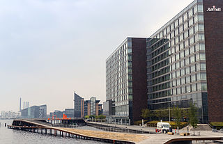
Islands Brygge is a harbourfront area in central Copenhagen, Denmark, located on the north-western coast of Amager. The neighbourhood is noted for its waterfront park Havneparken, which is one of the most popular areas along the Copenhagen harbourfront and the location of one of the Copenhagen Harbour Baths.

The Copenhagen Harbour Baths are a system of recreational bathing facilities along the waterfront of Copenhagen, Denmark. There are currently four harbour baths, the first and best-known of which is located at Islands Brygge.

North Atlantic House is a cultural centre located on the harbour front in Copenhagen, Denmark, dedicated to preserve, promote and communicate culture and art from the North Atlantic area. It is made as a cooperation between Denmark, Iceland, Greenland and the Faroe Islands and includes three galleries as well as conference facilities. The centre also houses the Icelandic embassy and the permanent representations of Greenland and the Faroe Islands, as well as some commercial activities and enterprises related to the area.

Havneparken is a public park located directly on the waterfront in the district of Islands Brygge in central Copenhagen, Denmark. It is one of the most lively and popular places along the Copenhagen harbourfront. Located in a former dockland area, the park has retained a number of features from the area's industrial past, including disused railway tracks and an abandoned railway car used as an exhibition space, while am old ship hull turned upside-down serves as an idiosyncratic bandstand and pavilion. The park is also the location of the Islands Brygge Cultural Centre and the Islands Brygge Harbour Bath.

Gemini Residence is a residential building on the Islands Brygge waterfront in Copenhagen, Denmark. Built to the design of MVRDV, the building has been created by converting two former seed silos. It is located at the end of Bryggebroen, connecting Amager-side Islands Brygge to Zealand-side Vesterbro across the harbour, and close to the southern end of Havneparken.

Teglholmen is a peninsula in the South Harbour of Copenhagen, Denmark, located between Sluseholmen and Enghave Brygge. The former dockland area used to house heavy industry. While some industry activities remain in the area, but since most industry left the area, starting in the 1970s, it has undergone massive redevelopment, though some industrial activities remain, most notably MAN B&W Diesel's motor development plant. Today the area houses both a considerable number of Danish and regional headquarters of multinational companies and residential developments. Teglholmen is home to Aalborg University's AAU Cph Campus as well as TV 2's activities in Copenhagen.

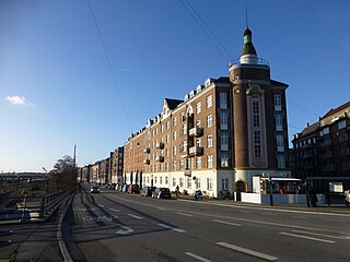
Amager Vest is one of the ten administrative districts of Copenhagen Municipality, Denmark. It located on in the north-western part of the island of Amager, the largest island in the Øresund. The district is bordered by Amager Øst to the east along Amagerbrogade, the main shopping street and thoroughfare of the part of Copenhagen. Amager Vest is the largest of the ten new official administrative districts of Copenhagen, but has at the same time the smallest population. Only the most northern part can be considered as "urban area".

Christian IV's Arsenal, is a historic building on Slotsholmen in central Copenhagen, Denmark. It was built by Christian IV of Denmark in 1604 as part of a grand scheme for the construction of a new naval harbour. The arsenal, along with several other buildings, surrounded the harbour basin which was connected to the main harbour by a narrow canal. Later, when ships became too large to enter the harbour, the fleet moved to Bremerholm and the decommissioned naval harbour was later filled in.

Refshaleøen is a former industrial site in the harbor of Copenhagen, Denmark, originally on a separate island but now annexed to the larger island of Amager. For more than a hundred years, it was home to the shipyard Burmeister & Wain, which closed in 1996.
Kalvebod Brygge is a waterfront area in the Vesterbro district of Copenhagen, Denmark. The name also refers to a section of the Ring 2 ring road which follows the waterfront from Langebro in the north to the H. C. Ørsted Power Station in the south. The area is dominated by office buildings, Tivoli Conference Center, several hotels and the shopping centre Fisketorvet.

Applebyes Plads is a triangular area located between Langebro Bridge and the southernmost portion of Christianshavn Canal at the southern tip of the Christianshavn neighbourhood in Copenhagen, Denmark. The area takes its name from Peter Applebye, Christian VI's rope maker, who ran his manufactury from the site in the late 18th century, although no buildings remain from that time. The Danish Sugar Factories' building along the waterfront dates from 1912 while the rest of the grounds have undergone residential redevelopment in later years.

Slusen is a lock in the South Harbour of Copenhagen, Denmark. It regulates water levels and inhibits unfavourable currents in the Copenhagen Harbour, occupying both sides of the narrow strait between Zealand and Amager. It lends its name to the adjacent Sluseholmen neighbourhood.
Ingerslevsgade is a street in the Vesterbro district of Copenhagen, Denmark. It begins on the rear side of Copenhagen Central Station and follows the northwest side of the railway tracks to Enghave station. It also passes the Dybbølsbro station where Dybbøl Bridge connects it to Kalvebod Brygge and Havneholmen, Copenhagen on the other side of the railway tracks. The street is named after the politician Hans Peter Ingerslev, who was involved in the construction of the Free Port of Copenhagen.

The South Campus, also known as KUA, is one of University of Copenhagen's four campuses in Copenhagen, Denmark. It is situated on Amager just south of Njalsgade, between Ørestad Boulevard and Amager Fælledvej, forming the northernmost part of Ørestad. It is home to the Faculty of Humanities, the Faculty of Theology and the Faculty of Law. The campus is home to approximately 15,000 students.

Enghave Brygge is a waterfront area in the Southern Docklands of Copenhagen, Denmark. It is located between Vesterbro to the north and Teglholmen to the south, and opposite Islands Brygge across the water. The area is undergoing significant development, with the northern half now housing around 2.000 inhabitants, and construction of apartment blocks in the southern half is underway. Enghave Brygge is characterized by canals, giving the area the impression of a maritime city like Venice or Amsterdam, as well as the nearby Christianshavn neighbourhood. The Enghave Canal which runs from north to south across Enghave Brygge is a major defining landmark.

Havneholmen is a mixed-use development located on reclaimed land off Kalvebod Brygge in the harbor of Copenhagen, Denmark. It is located just east of the shopping centre Fisketorvet from which it is separated by a narrow canal, although it is annexed to mainland Kalvebod Brygge at its southern end.
| Administrative subdivisions | |
|---|---|
| Districts | |
| Localities | |
| Streets and squares | |
| Parks and open spaces |
|
| Culture & attractions |
|
| Churches | |
| Other landmarks | |
| Stations | |
| History | |