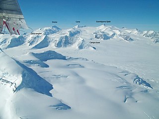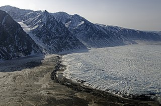
The Watkins Range is Greenland's highest mountain range. It is located in King Christian IX Land, Sermersooq municipality.
Sikuijivitteq, also known as Kangerdlugsuatsiak, is a fjord of the King Frederick VI Coast in the Kujalleq municipality, southeastern Greenland. The name 'Mogens Heinesen' is based on Magnus Heinason, a 16th-century Faroese naval hero.

The Stauning Alps are a large system of mountain ranges in Scoresby Land, King Christian X Land, northeastern Greenland. Administratively the Stauning Alps are part of the Northeast Greenland National Park zone.
Dansketinden is the highest mountain in the Stauning Alps range, Eastern Greenland.
Payer Peak, is a mountain in King Christian X Land, Northeast Greenland. Administratively it is part of the Northeast Greenland National Park zone.
Petermann Peak,, also known as Petermann Fjeld, Petermanns Topp and Petermann Point is a mountain in King Christian X Land, Northeast Greenland. Administratively it is part of the Northeast Greenland National Park zone.

The Princess Caroline-Mathilde Alps are a mountain range system in the Holm Land Peninsula, King Frederick VIII Land, northeastern Greenland. Administratively this range is part of the Northeast Greenland National Park zone.

Revaltoppe is one of the highest mountains in Queen Louise Land, NE Greenland. The peak is located in the King Frederick VIII Land area of northeastern Greenland. Administratively it is part of the Northeast Greenland National Park zone.

Gefiontinde is the highest mountain in Queen Louise Land, NE Greenland. The peak is located in the King Frederick VIII Land area of northeastern Greenland. Administratively it is part of the Northeast Greenland National Park zone.

Borgtinderne, meaning 'Castle Pinnacles' in the Danish language, is a mountain range in King Christian IX Land, eastern Greenland. Administratively this range is part of the Sermersooq Municipality.

Ejnar Mikkelsen Range is a mountain range in King Christian IX Land, eastern Greenland. Administratively it is part of the Sermersooq Municipality.
Helvetia Tinde is the highest mountain in the Roosevelt Range, Northern Greenland. It is also the highest mountain of the northernmost mountain range on Earth.

The Roosevelt Range or Roosevelt Mountains is a mountain range in Northern Greenland. Administratively this range is part of the Northeast Greenland National Park. Its highest peak is the highest point in Peary Land.

The Norlund Alps are a mountain range in King Christian X Land, East Greenland. Administratively these mountains are part of the Northeast Greenland National Park.
Margaretatop is a mountain in eastern Greenland. Administratively it is part of the Northeast Greenland National Park.

The Mary Peary Peaks are a mountain in the Roosevelt Range, Peary Land, Northern Greenland. Administratively they belong to the Northeast Greenland National Park.

Gertrud Rask Land is an area in Peary Land, North Greenland. Administratively it is part of the Northeast Greenland National Park.


