Related Research Articles

Rapids are sections of a river where the river bed has a relatively steep gradient, causing an increase in water velocity and turbulence.

The Potomac River is found within the Mid-Atlantic region of the United States and flows from the Potomac Highlands into the Chesapeake Bay. The river is approximately 405 miles (652 km) long, with a drainage area of about 14,700 square miles (38,000 km2). In terms of area, this makes the Potomac River the fourth largest river along the Atlantic coast of the United States and the 21st largest in the United States. Over 5 million people live within the Potomac watershed.
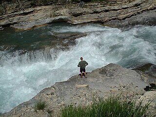
Whitewater is formed in a rapid, when a river's gradient changes enough to generate so much turbulence that air is trapped within the water. This forms an unstable current that froths, making the water appear opaque and white.

The Souhegan River is a tributary of the Merrimack River in the northeastern United States. It is 33.8 miles (54.4 km) long with a drainage area of 171 sq mi (440 km2) and flows north and east through southern New Hampshire to the Merrimack River.

The Saulteaux are a First Nations band government in Ontario, Manitoba, Saskatchewan, Alberta and British Columbia, Canada. They are a branch of the Ojibwe when they pushed west forming into a mixed culture of woodlands and plains Indigenous customs and traditions.

The Grand River is a river in the southwestern portion of the southern peninsula of Michigan, United States, that flows into Lake Michigan's southeastern shore. It is the longest river in the U.S. state of Michigan, running 252 miles (406 km) from its headwaters in Hillsdale County on the southern border north to Lansing and west to its mouth on the Lake at Grand Haven. Native Americans who lived along the river before the arrival of the French and British called the river O-wash-ta-nong, meaning "Far-away-water'", because of its length.

The Fond du Lac River is one of the upper branches of the Mackenzie River system, draining into the Arctic Ocean, located in northern Saskatchewan, Canada. The river is 277 kilometres (172 mi) long, has a watershed of 66,800 square kilometres (25,800 sq mi), and its mean discharge is 300 cubic metres per second (11,000 cu ft/s).

The Southwest Miramichi River is a river in New Brunswick, Canada.

The Oswegatchie River is a 137-mile-long (220 km) river in northern New York that flows from the Adirondack Mountains north to the Saint Lawrence River. The Oswegatchie River begins at Partlow Lake in Hamilton County, New York. The river continues through Cranberry Lake which was 'doubled in size' through construction of a dam in the late 1860s. The river continues from the dam to Gouverneur, to near Talcville in St. Lawrence County, where it joins the West Branch. Much of it is within Adirondack State Park. The city of Ogdensburg developed at the mouth of the river at its confluence with the St. Lawrence.
Carp River is a 40.2-mile-long (64.7 km) river in Chippewa and Mackinac counties in the U.S. state of Michigan. 21.7 miles (34.9 km) of the river were added to the National Wild and Scenic Rivers System in 1992.
The Blackwater River is a 37.5-mile-long (60.4 km) river located in central New Hampshire in the United States. It is a tributary of the Contoocook River, part of the Merrimack River watershed.

The Kymi is a river in Finland. It begins at Lake Päijänne, flows through the provinces of Päijänne Tavastia, Uusimaa and Kymenlaakso and discharges into the Gulf of Finland. The river passes the towns of Heinola and Kouvola. The town of Kotka is located on the river delta. The length of the river is 204 kilometres (127 mi), but its drainage basin of 37,107 square kilometres (14,327 sq mi) extends to almost 600 kilometres (370 mi) inside the Tavastia, Central Finland, Savonia and Ostrobothnia. The furthest source of the river is Lake Pielavesi, its furthest point being some 570 kilometres (350 mi) from the sea measured by flow route. The name of the river, itself, kymi, means "large river", in Old Finnish.

Sunday River is a 14.1-mile-long (22.7 km) river in Oxford County, Maine in the United States. It is a tributary of the Androscoggin River, which flows east and south to join the Kennebec River in Merrymeeting Bay near the Atlantic Ocean.
The Little Dead Diamond River is a 7.1-mile (11.4 km) long river in northern New Hampshire in the United States. It is a tributary of the Dead Diamond River, located in the Androscoggin River watershed of Maine and New Hampshire.
The Westfield River is a major tributary of the Connecticut River located in the Berkshires and Pioneer Valley regions of western Massachusetts. With four major tributary branches that converge west of the city of Westfield, it flows 78.1 miles (125.7 km) before its confluence with the Connecticut River at Agawam, across from the city of Springfield's Metro Center district. Known for its whitewater rapids and scenic beauty, the Westfield River provides over 50 miles (80 km) of whitewater canoeing and kayaking, in addition to one of the largest roadless wilderness areas remaining in the Commonwealth.

Little Falls Branch, a 3.8-mile-long (6.1 km) tributary stream of the Potomac River, is located in Montgomery County, Maryland. In the 19th century, the stream was also called Powder Mill Branch. It drains portions of Bethesda, Somerset, Friendship Heights, and the District of Columbia, flows under the Chesapeake and Ohio Canal (C&O), and empties into the Potomac at Little Falls rapids, which marks the upper end of the tidal Potomac.
The Baker Branch Saint John River is a 48.0-mile-long (77.2 km) river. This river is a tributary of the Saint John River, flowing in the Maine North Woods, in Maine, in the Northeastern United States.
The Kedgwick River is a tributary of the head of the Restigouche River, in New Brunswick, in Canada. It flows southeast in:

Allan Water is a river in the James Bay drainage basin in Unorganized Thunder Bay District in northwestern Ontario, Canada.
South Branch flows out of East Pond northeast of Big Moose, New York and flows into Stillwater Reservoir southwest of Little Rapids, New York.
References
- ↑ "North Branch". Geographic Names Information System . United States Geological Survey . Retrieved 2018-08-12.
| This article about a location in Herkimer County, New York is a stub. You can help Wikipedia by expanding it. |