North Carolina Highway 461

Last updated

NC 461.svg

North Carolina Highway 461
NC 461 map.svg
Route information
Maintained by NCDOT
Length 19.1 mi [1] (30.7 km)
Existed 1964 – present
Major junctions
West endNC 561.svg NC 561 in Saint John
 US 13.svg US 13 near Winton
East end Nucor Steel near Cofield
Location
Counties Hertford
Highway system
US 441.svg US 441 NC 481 NC 481.svg

North Carolina Highway 461 (NC 461) is a primary state highway in the U.S. state of North Carolina. Its western terminus is at NC 561, passes through Winton and Cofield, and has its eastern end at an entrance to a Nucor steel plant east of Cofield.

A state highway, state road, or state route is usually a road that is either numbered or maintained by a sub-national state or province. A road numbered by a state or province falls below numbered national highways in the hierarchy. Roads maintained by a state or province include both nationally numbered highways and un-numbered state highways. Depending on the state, "state highway" may be used for one meaning and "state road" or "state route" for the other.

North Carolina State of the United States of America

North Carolina is a state in the southeastern region of the United States. It borders South Carolina and Georgia to the south, Tennessee to the west, Virginia to the north, and the Atlantic Ocean to the east. North Carolina is the 28th-most extensive and the 9th-most populous of the U.S. states. The state is divided into 100 counties. The capital is Raleigh, which along with Durham and Chapel Hill is home to the largest research park in the United States. The most populous municipality is Charlotte, which is the second-largest banking center in the United States after New York City.

North Carolina Highway 561 highway in North Carolina

North Carolina Highway 561 is a 100-mile-long (160 km) North Carolina state highway and a rural traffic artery connecting Louisburg and Ahoskie with many small-to-medium-sized towns in the Down East and Coastal Plain regions within minutes from the Virginia state line. NC 561 is a spur of NC 56, although the two highways never actually intersect.

Contents

Route description

Agricultural scene west of Cofield Winton Township field on NC 461.jpg
Agricultural scene west of Cofield

NC 461 is a two-lane rural highway that begins at NC 561 in Saint John, and travels northeast, crossing NC 11 and having a concurrency with U.S. Route 13 (US 13). Following its split from US 13, it travels to NC 45 in Winton. From Winton, and in concurrency with NC 45, it travels through Cofield, then splits just east of the village. It continues north on Farmers Chemical Road, then east on River Road, ending at the entrance of Nucor Plate Mill, Hertford. [1]

North Carolina Highway 11 highway in North Carolina

North Carolina Highway 11 (NC 11) is a primary state highway in the U.S. state of North Carolina. Traveling 193.2 miles (310.9 km), in a north–south alignment through Eastern North Carolina, it connects the towns and cities of Wallace, Kenansville, Kinston, Greenville and Murfreesboro.

Concurrency (road) instance of one physical road bearing two or more different highways

A concurrency in a road network is an instance of one physical roadway bearing two or more different route numbers. When two roadways share the same right-of-way, it is sometimes called a common section or commons. Other terminology for a concurrency includes overlap, coincidence, duplex, triplex, multiplex, dual routing or triple routing.

U.S. Route 13 in North Carolina highway in North Carolina

The section of U.S. Route 13 in North Carolina is the longest, home to 185.52 miles (298.57 km) of its length. It runs southwest to northeast through eastern North Carolina, beginning at Interstate 95. Most of the routing is rural, serving only three cities of considerable size along the entire route; the rest passes through forests and farmland. US 13 is usually only two lanes wide unless it is co-signed with other highways, usually near cities as bypasses.

History

NC 461 was established in 1964 as a new primary routing from NC 561 in Saint John to US 13 south of Winton. [2] In 1999, NC 461 was extended east, with a short concurrency with US 13 it splits near Winton, where it follows along Old Highway 13 to NC 45, then in concurrency until Farmers Chemical Road, where it continues as a new primary spur to the steel plant. [3]

Junction list

The entire route is in Hertford County.

Locationmi [1] kmDestinationsNotes
Saint John 0.00.0NC 561.svg NC 561  Ahoskie, Rich Square
5.89.3NC 11.svg NC 11  Ahoskie, Murfreesboro
8.213.2US 13.svg US 13  Ahoskie South end of US 13 overlap
8.914.3US 13.svg US 13  Suffolk North end of US 13 overlap
Winton 10.416.7NC 45.svg NC 45 north (Main Street)North end of NC 45 overlap
15.024.1NC 45.svg NC 45 south Plymouth South end of NC 45 overlap
19.130.7Nucor Plate Mill, Hertford entrance
1.000 mi = 1.609 km; 1.000 km = 0.621 mi

Related Research Articles

North Carolina Highway 24 highway in North Carolina

North Carolina Highway 24 (NC 24) is the longest primary state highway in the U.S. state of North Carolina. Traveling east–west between the Charlotte metropolitan area and the Crystal Coast, connecting the cities of Charlotte, Fayetteville, Jacksonville and Morehead City.

North Carolina Highway 82 highway in North Carolina

North Carolina Highway 82 (NC 82) is a primary state highway in the U.S. state of North Carolina. The highway traverses where the Battle of Averasborough took place and connects the towns of Erwin, Godwin and Falcon. Though the road is signed as east and west, it runs physically north from Erwin to US 13 to the south near Cooper.

North Carolina Highway 8 highway in North Carolina

North Carolina Highway 8 (NC 8) is a primary state highway in the U.S. state of North Carolina. The route connects the cities of Lexington and Winston-Salem to various recreational and natural sites including Uwharrie National Forest, High Rock Lake and Hanging Rock State Park. NC 8 is part of a two-state, 151 mile highway 8 system.

North Carolina Highway 10 highway in North Carolina

North Carolina Highway 10 (NC 10) is a primary state highway in the U.S. state of North Carolina. Originally established as the state's central highway, from Murphy to Beaufort. Nowadays, it serves to connect the city of Newton with the nearby communities and towns in the foothills region.

North Carolina Highway 96 highway in North Carolina

North Carolina Highway 96 (NC 96) is a 112-mile-long (180 km) primary state highway in the U.S. state of North Carolina. It is a predominantly rural highway that travels north-south, from NC 55, west of Newton Grove, to the Virginia state line near Virgilina, Virginia, where it continues on as Virginia State Route 96. It also connects the cities of Smithfield, Selma, Zebulon, Youngsville and Oxford.

North Carolina Highway 35 highway in North Carolina

North Carolina Highway 35 (NC 35) is a primary state highway in the U.S. state of North Carolina.

North Carolina Highway 39 highway in North Carolina

North Carolina Highway 39 (NC 39) is a primary state highway in the U.S. state of North Carolina. Traveling north–south, it connects the cities of Selma, Louisburg and Henderson, in the Research Triangle area.

North Carolina Highway 37 highway in North Carolina

North Carolina Highway 37 (NC 37) is a primary state highway in the northeastern part of the U.S. state of North Carolina. Traveling north–south, it serves as a connector route from U.S. Route 64 (US 64) to Hertford and from US 13 to Gatesville.

North Carolina Highway 903 highway in North Carolina

North Carolina Highway 903 (NC 903) is a primary state highway in the U.S. state of North Carolina. It serves as predominantly rural highway in the Inner Banks region and arterial road in and around Greenville. The road covers a total of 200 miles (320 km), in a zigzag pattern through the state.

U.S. Route 17 in North Carolina highway in North Carolina

In the U.S. state of North Carolina U.S. Route 17 (US 17) is a north–south highway that is known as the Coastal Highway in the southeastern half of the state and the Ocean Highway in other areas. The route enters the state from South Carolina near Calabash, and leaves in the vicinity of the Great Dismal Swamp National Wildlife Refuge in Virginia. Between the US 64 freeway and the Virginia state line, US 17 is a four-lane divided highway with speed limits varying between 45 miles per hour (72 km/h) and 70 miles per hour (110 km/h).

North Carolina Highway 45 highway in North Carolina

North Carolina Highway 45 (NC 45) is a primary state highway in the U.S. state of North Carolina. The highway traverses north-south, from Ocracoke to Winton.

North Carolina Highway 308 highway in North Carolina

North Carolina Highway 308 (NC 308) is a primary state highway in the U.S. state of North Carolina. It serves mainly to connect the city of Windsor to communities and towns in eastern Bertie County.

North Carolina Highway 305

North Carolina Highway 305 (NC 305) is a primary state highway in the U.S. state of North Carolina. NC 305 runs from US 13 north of Windsor to NC 186 in Seaboard. NC 305 is an original state highway and appeared on the 1936 official map of North Carolina from Seaboard to Aulander. NC 305 has an average of 1663 cars per day on the highway.

North Carolina Highway 481

North Carolina Highway 481 (NC 481) is a 21-mile-long (34 km) primary state highway in the U.S. state of North Carolina. It serves to connect Enfield to nearby Interstate 95 (I-95) and the surrounding farmlands of southern Halifax County.

North Carolina Highway 131

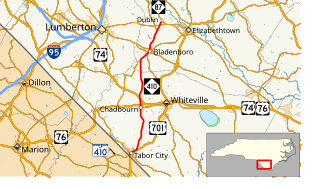
North Carolina Highway 131 (NC 131) is a primary state highway in the U.S. state of North Carolina. It connects the city of Bladenboro to Fayetteville, via NC 87, and Whiteville, via US 701.

North Carolina Highway 410

North Carolina Highway 410 (NC 410) is a primary state highway in the U.S. state of North Carolina. It serves as the central north–south highway in Columbus and Bladen Counties.

North Carolina Highway 121

North Carolina Highway 121 (NC 121) is a 13.2-mile-long (21.2 km) primary state highway in the U.S. state of North Carolina. The highway travels through a short portion of northern Greene County and western Pitt County between the U.S. Route 264 (US 264) freeway at its exit 60 and NC 43 in the unincorporated community of Bruce. Though it is signed as a north–south highway, the overall length of the route travels more east–west.

References

  1. 1 2 3 Google (June 11, 2014). "North Carolina Highway 461" (Map). Google Maps . Google. Retrieved June 11, 2014.
  2. "Route Change (1964-03-05)" (PDF). North Carolina Department of Transportation. March 5, 1964. Retrieved June 11, 2014.
  3. "Route Change (1999-04-30)" (PDF). North Carolina Department of Transportation. April 30, 1999. Retrieved June 11, 2014.
KML file (edithelp)
KML is from Wikidata