Related Research Articles

Redbank Township is a township in Armstrong County, Pennsylvania, United States. The population was 975 at the 2020 census, a decrease from the figure of 1,064 tabulated in 2010.

Brookville is a borough in Jefferson County in the U.S. state of Pennsylvania, 70 miles (110 km) northeast of Pittsburgh. As of the 2010 census, the population was 3,933. Founded in 1830, it is the county seat of Jefferson County.

Pine Creek Township is a township in Jefferson County, Pennsylvania, United States. The population was 1,325 at the 2020 census. The township was named for the abundance of pine trees in the area.
East Sandy Creek is a tributary of the Allegheny River in Northwestern Pennsylvania in the United States.

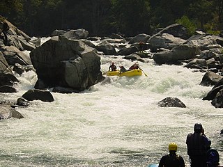
Cherry Creek is a large, swift-flowing stream in the Sierra Nevada mountain range, and is the largest tributary of the Tuolumne River. The creek is 44.6 miles (71.8 km) long measured to its farthest headwaters; the main stem itself is 27.7 miles (44.6 km) long, draining a watershed of 234 square miles (610 km2) in the Stanislaus National Forest. Part of the drainage also extends into the northwest corner of Yosemite National Park.

Seneca Creek is a 19.6-mile-long (31.5 km) tributary of the North Fork of the South Branch of the Potomac River located entirely within Pendleton County, West Virginia, USA.

Redbank Creek is a tributary of the Allegheny River in Clarion, Armstrong, and Jefferson counties, Pennsylvania in the United States.

Mahoning Creek is a tributary of the Allegheny River in Pennsylvania in the United States.
Buffalo Creek is a tributary of the Allegheny River in Armstrong and Butler counties, Pennsylvania in the United States.

Sandy Lick Creek is a tributary of Redbank Creek in northwest Pennsylvania in the United States.
Little Sandy Creek is a tributary of Redbank Creek, approximately 32.7 mi (52.6 km) long, in northwest Pennsylvania in the United States.

Crooked Creek is a tributary of the Allegheny River in both Armstrong and Indiana counties in the U.S. state of Pennsylvania.
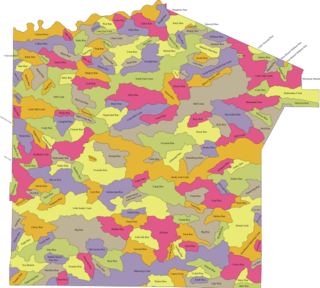
The following table lists all the named streams that flow in Armstrong County. For each stream, the name, coordinate of the source, name of the stream it flows into, coordinate of the confluence, and political subdivision in which the confluence is located are given.

The following table lists all the named streams that flow in Jefferson County. For each stream, the name, coordinate of the source, name of the stream it flows into, coordinate of the confluence, and political subdivision in which the confluence is located are given.
The Tributaries of the Allegheny River drain western Pennsylvania and part of New York. The following table lists all the named tributaries of the Allegheny River. For each stream, the name, tributary number, coordinate and political subdivision of the confluence, and coordinate of the source are given.
The Tributaries of Redbank Creek drain parts of Jefferson, Clarion, and Armstrong counties, Pennsylvania. The following table lists all the named tributaries of Redbank Creek (Pennsylvania), a tributary of the Allegheny River. For each stream, the name, tributary number, coordinate and political subdivision of the confluence, and coordinate of the source are given.
The Pennsylvania State Game Lands Number 28 are Pennsylvania State Game Lands in Elk, Forest and Jefferson Counties in Pennsylvania in the United States providing hunting, bird watching, and other activities.
The Pennsylvania State Game Lands Number 31 are Pennsylvania State Game Lands in Jefferson County in Pennsylvania in the United States providing hunting, bird watching, and other activities.
References
- 1 2 Gertler, Edward. Keystone Canoeing, Seneca Press, 2004. ISBN 0-9749692-0-6
- ↑ "North Fork Creek". Geographic Names Information System . United States Geological Survey, United States Department of the Interior . Retrieved 2011-11-08.
- ↑ "Polk Township, Jefferson County". Geographic Names Information System . United States Geological Survey, United States Department of the Interior.
- ↑ "Warsaw Township, Jefferson County". Geographic Names Information System . United States Geological Survey, United States Department of the Interior.
- ↑ "Eldred Township, Jefferson County". Geographic Names Information System . United States Geological Survey, United States Department of the Interior.
- ↑ "Pine Creek Township, Jefferson County". Geographic Names Information System . United States Geological Survey, United States Department of the Interior.
- ↑ "Rose Township, Jefferson County". Geographic Names Information System . United States Geological Survey, United States Department of the Interior.
- ↑ "Brookville". Geographic Names Information System . United States Geological Survey, United States Department of the Interior.
- ↑ "Williams Run". Geographic Names Information System . United States Geological Survey, United States Department of the Interior.
- ↑ "Muddy Run". Geographic Names Information System . United States Geological Survey, United States Department of the Interior.
- ↑ "Bearpen Run". Geographic Names Information System . United States Geological Survey, United States Department of the Interior.
- ↑ "Manners Dam Run". Geographic Names Information System . United States Geological Survey, United States Department of the Interior.
- ↑ "Hetrick Run". Geographic Names Information System . United States Geological Survey, United States Department of the Interior.
- ↑ "Lucas Run". Geographic Names Information System . United States Geological Survey, United States Department of the Interior.
- ↑ "South Branch North Fork Redbank Creek". Geographic Names Information System . United States Geological Survey, United States Department of the Interior.
- ↑ "Acy Run". Geographic Names Information System . United States Geological Survey, United States Department of the Interior.
- ↑ "Seneca Run". Geographic Names Information System . United States Geological Survey, United States Department of the Interior.
- ↑ "Windfall Run". Geographic Names Information System . United States Geological Survey, United States Department of the Interior.
- ↑ "Clear Run". Geographic Names Information System . United States Geological Survey, United States Department of the Interior.
- ↑ "Tarkiln Run". Geographic Names Information System . United States Geological Survey, United States Department of the Interior.
- ↑ "Shippen Run". Geographic Names Information System . United States Geological Survey, United States Department of the Interior.
- ↑ "Craft Run". Geographic Names Information System . United States Geological Survey, United States Department of the Interior.
- ↑ "Burns Run". Geographic Names Information System . United States Geological Survey, United States Department of the Interior.
- ↑ "Red Lick Run". Geographic Names Information System . United States Geological Survey, United States Department of the Interior.
- ↑ "Yeomans Run". Geographic Names Information System . United States Geological Survey, United States Department of the Interior.
- ↑ "Sugarcamp Run". Geographic Names Information System . United States Geological Survey, United States Department of the Interior.
- ↑ "Sugar Camp Run". Geographic Names Information System . United States Geological Survey, United States Department of the Interior.
- ↑ "Brookville Reservoir". Geographic Names Information System . United States Geological Survey, United States Department of the Interior.
- ↑ "Brookville Waterworks Dam". Geographic Names Information System . United States Geological Survey, United States Department of the Interior.
41°18′55″N78°54′10″W / 41.31530°N 78.90277°W