Sandy Lick Creek

Last updated
Sandy Lick Creek on the Beaver Meadow Walkway in DuBois, Pennsylvania Sandy Lick Creek on the Beaver Meadow Walkway in DuBois, Pennsylvania.jpg
Sandy Lick Creek on the Beaver Meadow Walkway in DuBois, Pennsylvania

Sandy Lick Creek [1] is a tributary of Redbank Creek in northwest Pennsylvania in the United States. [2]

Contents

Sandy Lick Creek arises in Sandy Township north of Lake Sabula and joins North Fork Creek to form Redbank Creek in the borough of Brookville, Jefferson County. [2]

Political Subdivisions

The political subdivisions Sandy Lick Creek traverses, given in the order they are encountered traveling downstream, are as follows:

Tributaries

The named tributaries of Sandy Lick Creek, given in the order they are encountered traveling downstream, are as follows:

See also

Related Research Articles

<span class="mw-page-title-main">Jefferson County, Pennsylvania</span> County in Pennsylvania, United States

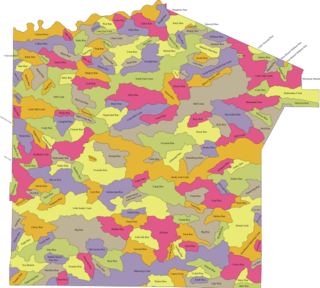
Jefferson County is a county in the Commonwealth of Pennsylvania. As of the 2020 census, the population was 44,492. Its county seat is Brookville. The county was established on March 26, 1804, from part of Lycoming County and later organized in 1830. It is named for President Thomas Jefferson. It is home to Punxsutawney Phil, the most famous groundhog that predicts when spring will come every February 2 on Groundhog Day. Jefferson County is in the sparsely populated Pennsylvania Wilds region.

<span class="mw-page-title-main">Knox Township, Jefferson County, Pennsylvania</span> Township in Pennsylvania, United States

Knox Township is a township in Jefferson County, Pennsylvania, in the United States. As of the 2020 census, the township population was 1,008. It was named for John C. Knox, then President Judge of the judicial district.

<span class="mw-page-title-main">Pine Creek Township, Jefferson County, Pennsylvania</span> Township in Pennsylvania, United States

Pine Creek Township is a township in Jefferson County, Pennsylvania, United States. The population was 1,325 at the 2020 census. The township was named for the abundance of pine trees in the area.

<span class="mw-page-title-main">Reynoldsville, Pennsylvania</span> Borough in Pennsylvania, United States

Reynoldsville is a borough in Jefferson County, Pennsylvania, United States. It is 73 miles (117 km) northeast of Pittsburgh in a productive soft coal region. The population was 2,759 at the 2010 census.

<span class="mw-page-title-main">Timblin, Pennsylvania</span> Borough in Pennsylvania, United States

Timblin is a borough in Jefferson County, Pennsylvania, United States. The population was 157 at the 2010 census.

<span class="mw-page-title-main">Winslow Township, Pennsylvania</span> Township in Pennsylvania, United States

Winslow Township is a township in Jefferson County, Pennsylvania, United States. The population was 2,543 at the 2020 census. It was named for Associate Judge James Winslow.

<span class="mw-page-title-main">Falls Creek, Pennsylvania</span> Borough in Pennsylvania, United States

Falls Creek is a borough located in Jefferson and Clearfield counties in Pennsylvania, United States. The population was 1,036 at the 2020 census. Of this, 994 were in Jefferson County, and 42 were in Clearfield County.

East Sandy Creek is a tributary of the Allegheny River in Northwestern Pennsylvania in the United States.

<span class="mw-page-title-main">Redbank Creek (Pennsylvania)</span> River in Pennsylvania, United States

Redbank Creek is a tributary of the Allegheny River in Clarion, Armstrong, and Jefferson counties, Pennsylvania in the United States.

<span class="mw-page-title-main">Mahoning Creek (Allegheny River tributary)</span> River in the United States

Mahoning Creek is a tributary of the Allegheny River in Pennsylvania in the United States.

North Fork Creek is a tributary of Redbank Creek in northwest Pennsylvania in the United States. It is formed by the confluence of Muddy Run and Williams Run in Polk Township, Jefferson County.

Little Sandy Creek is a tributary of Redbank Creek, approximately 32.7 mi (52.6 km) long, in northwest Pennsylvania in the United States.

<span class="mw-page-title-main">Fairmount Township, Grant County, Indiana</span> Township in Indiana, United States

Fairmount Township is one of thirteen townships in Grant County, Indiana, United States. As of the 2010 census, its population was 4,239 and it contained 1,909 housing units.

<span class="mw-page-title-main">Jackson Township, Wayne County, Indiana</span> Township in Indiana, United States

Jackson Township is one of fifteen townships in Wayne County, Indiana, United States. As of the 2010 census, its population was 4,660 and it contained 2,136 housing units.

<span class="mw-page-title-main">Streams in Jefferson County, Pennsylvania</span>

The following table lists all the named streams that flow in Jefferson County. For each stream, the name, coordinate of the source, name of the stream it flows into, coordinate of the confluence, and political subdivision in which the confluence is located are given.

Lake Sabula is a reservoir located in Sandy Township, Clearfield County, Pennsylvania, United States just below the source of Sandy Lick Creek.

The Tributaries of Redbank Creek drain parts of Jefferson, Clarion, and Armstrong counties, Pennsylvania. The following table lists all the named tributaries of Redbank Creek (Pennsylvania), a tributary of the Allegheny River. For each stream, the name, tributary number, coordinate and political subdivision of the confluence, and coordinate of the source are given.

The Pennsylvania State Game Lands Number 31 are Pennsylvania State Game Lands in Jefferson County in Pennsylvania in the United States providing hunting, bird watching, and other activities.

References

  1. "Sandy Lick Creek". Geographic Names Information System . United States Geological Survey, United States Department of the Interior.
  2. 1 2 Gertler, Edward. Keystone Canoeing, Seneca Press, 2004. ISBN   0-9749692-0-6
  3. 1 2 "Sandy Township, Clearfield County". Geographic Names Information System . United States Geological Survey, United States Department of the Interior.
  4. "DuBois". Geographic Names Information System . United States Geological Survey, United States Department of the Interior.
  5. 1 2 "Winslow township, Jefferson County". Geographic Names Information System . United States Geological Survey, United States Department of the Interior.
  6. "Reynoldsville borough, Jefferson County". Geographic Names Information System . United States Geological Survey, United States Department of the Interior.
  7. "Knox township, Jefferson County". Geographic Names Information System . United States Geological Survey, United States Department of the Interior.
  8. "Pine Creek township, Jefferson County". Geographic Names Information System . United States Geological Survey, United States Department of the Interior.
  9. "Brookville borough, Jefferson County". Geographic Names Information System . United States Geological Survey, United States Department of the Interior.
  10. "Lake Sabula". Geographic Names Information System . United States Geological Survey, United States Department of the Interior.
  11. "Coal Run". Geographic Names Information System . United States Geological Survey, United States Department of the Interior.
  12. "Muddy Run". Geographic Names Information System . United States Geological Survey, United States Department of the Interior.
  13. "Narrows Creek". Geographic Names Information System . United States Geological Survey, United States Department of the Interior.
  14. "Gravel Lick Run". Geographic Names Information System . United States Geological Survey, United States Department of the Interior.
  15. "Laborde Branch". Geographic Names Information System . United States Geological Survey, United States Department of the Interior.
  16. "Reisinger Run". Geographic Names Information System . United States Geological Survey, United States Department of the Interior.
  17. "Pentz Run". Geographic Names Information System . United States Geological Survey, United States Department of the Interior.
  18. "Beaver Run". Geographic Names Information System . United States Geological Survey, United States Department of the Interior.
  19. "Clear Run". Geographic Names Information System . United States Geological Survey, United States Department of the Interior.
  20. "Slab Run". Geographic Names Information System . United States Geological Survey, United States Department of the Interior.
  21. "Wolf Run". Geographic Names Information System . United States Geological Survey, United States Department of the Interior.
  22. "Panther Run". Geographic Names Information System . United States Geological Survey, United States Department of the Interior.
  23. "Pitchpine Run". Geographic Names Information System . United States Geological Survey, United States Department of the Interior.
  24. "Soldier Run". Geographic Names Information System . United States Geological Survey, United States Department of the Interior.
  25. "Trout Run". Geographic Names Information System . United States Geological Survey, United States Department of the Interior.
  26. "Schoolhouse Run". Geographic Names Information System . United States Geological Survey, United States Department of the Interior.
  27. "O'Donnell Run". Geographic Names Information System . United States Geological Survey, United States Department of the Interior.
  28. "Camp Run". Geographic Names Information System . United States Geological Survey, United States Department of the Interior.
  29. "Fuller Run". Geographic Names Information System . United States Geological Survey, United States Department of the Interior.
  30. "Cable Run". Geographic Names Information System . United States Geological Survey, United States Department of the Interior.
  31. "Mill Creek". Geographic Names Information System . United States Geological Survey, United States Department of the Interior.
  32. "Fivemile Run". Geographic Names Information System . United States Geological Survey, United States Department of the Interior.

41°09′31″N79°04′38″W / 41.15849°N 79.07722°W / 41.15849; -79.07722