District alumni
The following notable individuals attended North Olmsted City Schools:
- Thom Hatch, author and historian
- Jim Tocco, baseball broadcaster
- Adam Russell, Pitcher for the Tampa Bay Rays (MLB)
| North Olmsted City School District | |
|---|---|
| Location | |
| District information | |
| Type | Public School District |
| Motto | Partnership, Excellence, Citizenship, Scholarship |
| Grades | K-12 |
| Students and staff | |
| Colors | Orange and Black |
| Other information | |
| Website | www |
The North Olmsted City School District is the public school district that serves the city of North Olmsted, Ohio, United States. As of 2005, 4,573 students attended its nine schools. The North Olmsted City School colors are orange and black. The mascot is the Eagle. The school's fight songs are Miami U (from the University of Miami, Florida), On Wisconsin and War Eagle from Auburn University. [ citation needed ]
The School District passed a levy on February 6, 2007, the fifth attempt after four previous failures. 4,077 votes were cast for the Levy and 3,383 votes were cast against the Levy. [ citation needed ]
Despite levy problems, North Olmsted High School continues to be awarded "Excellent" status on its school report card meeting 12 out of 12 state indicators for the 2006–2007 school year, as well as 2005–2006, 2004–2005, and 2003–2004. [1]
Birch, Butternut, Forest and Spruce elementary schools also earned "Excellent" status for the 2006–2007 school year. Chestnut, Maple, Pine and the North Olmsted Middle School earned "Effective" status for the 2006–2007 school year. [1]
The school district administers a number of schools.
North Olmsted High School [2] is the city's sole high school, and consists of grades 9 through 12. Enrollment for the 2007–2008 school year was approximately 1,600.
North Olmsted Middle School [3] is the city's sole middle school and consists of grades 7 through 8. In 2015, the middle school relocated to Korab Hall, a building leased from St. Richard Catholic Church in preparation for the demolition of the old middle school buildings in advance of the construction of a $90 million combined middle school and high school. [4] The building had previously been used by St. Richard School, which had closed two years earlier for financial reasons. [5] The new campus is scheduled to open for the 2018–2019 school year. [6]
Elementary education is provided by a combination of primary schools, which cover kindergarten and grades 1 through 3; and intermediate schools, which cover grades 4 though 6. The schools all have tree-themed names. The primary schools are Birch, [7] Forest [8] and Spruce [9] Primary Schools, and the intermediate schools are Chestnut, [10] Maple [11] and Pine [12] Intermediate Schools.
A former primary school, Butternut, was closed in 2016 and converted into administrative offices and a bus transportation center. [13]
The following notable individuals attended North Olmsted City Schools:

Olmsted Falls is a city in Cuyahoga County, Ohio, United States. The population was 8,582 at the 2020 census. A southwestern suburb of Cleveland, it is part of the Cleveland metropolitan area. The city's main business district is located at the corners of Bagley and Columbia Roads and contains the Grand Pacific Junction, a historic district.

North Ridgeville is a city located along the eastern border of Lorain County, Ohio, United States. The city's population was 35,280 as of the 2020 census. A part of the Cleveland metropolitan area, North Ridgeville is the fastest-growing city in northern Ohio. It has been ranked the 13th safest city in the United States and the safest in Ohio.

Balch Springs is a city in Dallas County, Texas, United States. It is an inner-ring suburb of Dallas and part of the Dallas–Fort Worth metroplex. Its population was 23,728 at the 2010 census, and 25,007 at 2019's census estimates.

The North Olmsted Municipal Bus Line (NOMBL) was a public transit agency in Northeast Ohio. The NOMBL was one of the first and one of the oldest municipal transit systems in the United States and was in continuous operation for over 74 years. It served the cities of North Olmsted; Fairview Park; Olmsted Falls; Westlake; Rocky River; Olmsted Township; and parts of the west side of and downtown Cleveland. NOMBL does not refer to a single bus line, but rather a collection of routes which until 2005 was semi-autonomous but partially integrated into the Greater Cleveland Regional Transit Authority (GCRTA).

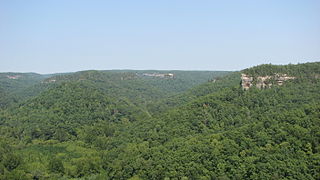
The Appalachian mixed mesophytic forests is an ecoregion of the temperate broadleaf and mixed forests biome, as defined by the World Wildlife Fund. It consists of mesophytic plants west of the Appalachian Mountains in the Southeastern United States.
The Garfield Heights City School District is the public schools system of Garfield Heights, Ohio consisting of five schools and a student enrollment of 3,823 in the 2004-05 school year.
The South-Western City School District is Ohio's sixth largest public school district located southwest of the city of Columbus. The district serves nearly 20,000 students throughout the southwest quadrant of Franklin County, including the cities of Galloway, Georgesville, Grove City, and Urbancrest. The district also serves all of Franklin, Jackson, Pleasant, and Prairie townships and a portion of Columbus.

The Appalachian–Blue Ridge forests are an ecoregion in the Temperate broadleaf and mixed forests Biome, in the Eastern United States. The ecoregion is located in the central and southern Appalachian Mountains, including the Ridge-and-Valley Appalachians and the Blue Ridge Mountains. It covers an area of about 61,500 square miles (159,000 km2) in: northeast Alabama and Georgia, northwest South Carolina, eastern Tennessee, western North Carolina, Virginia, Maryland, and central West Virginia and Pennsylvania; and small extensions into Kentucky, New Jersey, and New York.
North Tonawanda City School District is a public school district that covers North Tonawanda, New York. The school district consists of 3,371 students (2017) in grades PreK-12.
Blue River is a small community in British Columbia, situated on British Columbia Highway 5 about halfway between Kamloops and Jasper, Alberta, located at the confluence of the Blue and North Thompson Rivers. The local economy is supported by logging, tourism and transportation industries.

North Olmsted is a city in Cuyahoga County, Ohio, United States. The population was 32,442 as of the 2020 census. It is a western suburb of Cleveland and part of the Cleveland metropolitan area.

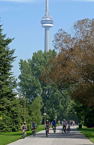
Native trees in Toronto are trees that are naturally growing in Toronto and were not later introduced by humans. The area that presently comprise Toronto is a part of the Carolinian forest, although agricultural and urban developments destroyed significant portions of that life zone. In addition, many of Toronto's native trees have been displaced by non-native plants and trees introduced by settlers from Europe and Asia from the 18th century to the present. Most of the native trees are found in the Toronto ravine system, parks, and along the Toronto waterway system.

The Ecological regions of Quebec are regions with specific types of vegetation and climates as defined by the Quebec Ministry of Forests, Wildlife and Parks. Given the size of this huge province, there is wide variation from the temperate deciduous forests of the southwest to the arctic tundra of the extreme north.
Native trees in Ottawa are trees that are naturally growing in Ottawa, Ontario and were not later introduced by humans. Many of Ottawa's native trees have been displaced by non-native plants and trees introduced by settlers from Europe and Asia from the 18th century to the present. Most of the native trees are found in the Greenbelt, parks, and along the Rideau and Ottawa rivers.
41°24′41.21″N81°55′32.27″W / 41.4114472°N 81.9256306°W