Virunga National Park is a national park in the Albertine Rift Valley in the eastern part of the Democratic Republic of the Congo. It was created in 1925. In elevation, it ranges from 680 m (2,230 ft) in the Semliki River valley to 5,109 m (16,762 ft) in the Rwenzori Mountains. From north to south it extends approximately 300 km (190 mi), largely along the international borders with Uganda and Rwanda in the east. It covers an area of 8,090 km2 (3,120 sq mi).

The Bwindi Impenetrable National Park is a national park in southwestern Uganda. It is part of the Bwindi Impenetrable Forest and is situated along the Democratic Republic of the Congo border next to the Virunga National Park and on the edge of the Albertine Rift. Composed of 321 km2 (124 sq mi) of both lowland and montane forest, it is accessible only on foot. It is a United Nations Educational, Scientific and Cultural Organization-designated World Heritage Site.
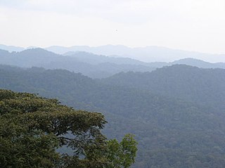
The Albertine Rift montane forests is a tropical moist broadleaf forest ecoregion in east-central Africa. The ecoregion covers the mountains of the northern Albertine Rift, and is home to distinct Afromontane forests with high biodiversity.
Semliki River is a major river, 140 kilometres (87 mi) long, in the Democratic Republic of the Congo (DRC) and Uganda in Central and East Africa. It flows north from Lake Edward in Beni Territory, Nord-Kivu, D.R.C avoiding the Rwenzori Mountains on its Right (East), emptying into Lake Albert in the Albertine Rift, Irumu Territory, Ituri Province, D.R.C overlooking the Blue Mountains to its left in the west. Its mouth is near the Village of Katolingo in Kanara subcounty, Ntoroko district, Uganda. Along its lower reaches, it meanders extensively forming part of the international border between the DRC and the western Ugandan districts of Bundibugyo and Ntoroko, near the Semuliki National Park.

Semuliki National Park is a national park in Bwamba County, a remote part of the Bundibugyo District in the Western Region of Uganda that was established in October 1993. It encompasses 219 km2 (85 sq mi) of East Africa's only lowland tropical rainforest. It is one of the richest areas of floral and faunal biodiversity in Africa, with bird and butterfly species being especially diverse. The park is managed by the Uganda Wildlife Authority.
The Institute of Tropical Forest Conservation (ITFC) is a post-graduate research institute based in the Bwindi Impenetrable Forest, in south-western Uganda. The institute is a semi-autonomous part of Mbarara University of Science and Technology and is focused on research, training, and monitoring for conservation management in the Albertine Rift ecoregion.
The Itombwe Mountains are a range of mountains in the South Kivu province of the Democratic Republic of the Congo (DRC). They run along the west shore of the northern part of Lake Tanganyika. They contain a vast area of contiguous montane forest and are home to a rich diversity of wildlife.
Guramwa Central Forest Reserve is a protected area located in Western Uganda's Kibaale district. It is managed by the National Forestry Authority and was first gazetted in 1932 under the National Forestry and Tree Planting Act, 2003 with an area of 230 ha (0.9 sq mi), and was later re-gazetted in 1968 with an area of 1,550 ha.
Rwensambya Central Forest Reserve is a tropical forest located in Kyegegwa district. It covers an area of 671 hectares.
Rwengiri Central Forest Reserve is a protected tropical forest that is located in Rukungiri district in Western Uganda. It covers an area of 155 km2. It managed by the National Forestry Authority. Its WPDA ID is 40357. It was designated a reserve in 1968.
Rwengeye Central Forest Reserve is a protected tropical high forest in the Kiryanga and Pacwa subcounties in Kibaale District in Western Uganda. It covers an area of 329 hecatres (3.24 km²). It is operated by the National Forestry Authority (NFA). Its WDPA ID is 39999. It was declared a forest reserve in 1932.
Nyabyeya Central Forest Reserve is a forest reserve located in Masindi District, Western Uganda, Bujenje County, Budongo sub-county, and Nyabyeya parish in western Uganda. It is part of the extensive network of Central Forest Reserves managed by the National Forestry Authority (NFA) in Uganda. This forest reserve covers an area of about 358.06 hectares. Nyabyeya Forest Reserve was created to train students in forestry under the Nyabyeya Forestry College.
Nyamakere Central Forest Reserve is a protected area located in the Kiryandongo District of Uganda. It is one of the many Central Forest Reserves managed by the National Forestry Authority (NFA) of Uganda. Nyamakere Central Forest Reserve covers an extensive stretch of over 3.4 kilometers.
Kasyoha-Kitomi Central Forest Reserve is located in Western Uganda, and has an area of 433-square-kilometre (107,000-acre). It is located south of Lake George and the Kazinga channel in the Albertine Rift eco-region, which is known for its abundance of endemic species. The forest reserve lies within the counties of Bunyaruguru, Igara and Buhweju in the administrative districts of Bushenyi, Ibanda and Kamwenge It was officially gazetted in 1932 and is controlled by Uganda's National Forestry Authority (NFA).
Mubuku Central Forest Reserve is a forest located in the Rwenzori Mountains region of Western Uganda, situated near the villages of Nyakalengija and Kilembe. The forest reserve covers a significant area and plays a vital role in the conservation of biodiversity and ecosystem services in the region.
Muhangi Central Forest Reserve is a protected area located in Western Uganda's Kyenjojo district. Muhangi forest is a closed tropical forest that protects the banks of river Muzizi. It spans an area of 2,044 hectares. It is also located in the Ugandan Albertine Rift, Muzizi River Catchment Area since the River Muzizi runs along the northern part of Muhangi Central Forest Reserve.
Kapchorwa Central Forest Reserve is a forest reserve located in Kapchorwa district found in the eastern part of Uganda at the slopes of Mount Elgon. It is bordered by Mbale, Bulambuli, and Sironko in the south-west, Nakapiripit and Moroto in the north, and the republic of Kenya in the east. The area largely comprises the sabiny, pokot and the nandi communities of western Kenya. The 0.06 square kilometer forest reserve is located at an Altitude of 2,100 to 2,400 meters above sea level.
Kasenyi Central Forest Reserve is a protected high forest located in Buwekula county in Mubende District in Central Region of Uganda. It was designated a forest reserve in 1968 and it covers an area of 1.99 km2. Its World Database on Protected Areas (WDPA) ID is 40141. It is under the management of National Forestry Authority.
Kasato Central Forest Reserve is a protected tropical forest that is located in Kiryanga subcounty in Kagadi District in Western Uganda. It covers an area of 26.82 km2(2691 hectares). It managed by the National Forestry Authority. It was designated a reserve in 1965. Its WPDA ID is 39988.
Muhunga Central Forest Reserve is a protected tropical forest that is located in Kyebando sub-county in Kibaale District in Western Uganda. It covers an area of 4.12 km2. It is managed by the National Forestry Authority. It was designated a reserve in 1965. Its WPDA ID is 39992.